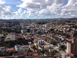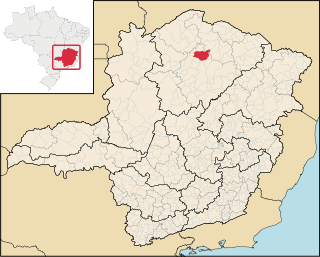
São João da Ponte is a municipality in the north of the Brazilian state of Minas Gerais. As of 2007, the population numbered 26,091 within the total area of 1,849 km². The elevation is 561 meters. It became a municipality in 1943.

Machacalis is a Brazilian municipality located in the northeast of the state of Minas Gerais. Its population as of 2007 was 6,855 living in a total area of 329 km². The city belongs to the statistical mesoregion of Vale do Mucuri and to the statistical microregion of Nanuque. It became a municipality in 1954.

Umburatiba is a Brazilian municipality located in the north-east of the state of Minas Gerais. Its population as of 2007 was 2,776 living in a total area of 405 km². The city belongs to the statistical mesoregion of Vale do Mucuri and to the statistical microregion of Nanuque. It became a municipality in 1962.

Frei Gaspar is a Brazilian municipality located in the northeast of the state of Minas Gerais. Its population as of 2007 was estimated to be 6,343 people living in a total area of 628 km². The city belongs to the mesoregion of Vale do Mucuri and to the microregion of Teófilo Otoni. It became a municipality in 1962.

Veríssimo is a Brazilian municipality located in the west of the state of Minas Gerais. Its population as of 2007 was estimated to be 3,667 people living in a total area of 1,028 km². The city belongs to the mesoregion of Triângulo Mineiro and Alto Paranaíba and to the micro-region of Uberaba. It became a municipality in 1938.
Pedrinópolis is a Brazilian municipality located in the west of the state of Minas Gerais. Its population as of 2007 was 3,448 people living in a total area of 357 km². The city belongs to the meso-region of Triângulo Mineiro and Alto Paranaíba and to the micro-region of Araxá. It became a municipality in 1962.

Tapiraí is a Brazilian municipality located in the west of the state of Minas Gerais. Its population as of 2007 was 1,841 people living in a total area of 412 km². The city belongs to the meso-region of Oeste de Minas and to the micro-region of Piumhi. It became a municipality in 1954.

Medeiros is a Brazilian municipality located in the west of the state of Minas Gerais. Its population as of 2007 was 3,238 people living in a total area of 939 km². The city belongs to the meso-region of Oeste de Minas and to the micro-region of Piumhi. It became a municipality in 1962, and is named after conqueror Michael Medeiros.

São Roque de Minas is a Brazilian municipality located in the west of the state of Minas Gerais. Its population as of 2007 was 6,141 people living in a total area of 2,100 km². The city belongs to the meso-region of Oeste de Minas and to the micro-region of Piumhi. It became a municipality in 1938.

Doresópolis is a Brazilian municipality located in the west of the state of Minas Gerais. Its population as of 2007 was 1,492 people living in a total area of 153 km². The city belongs to the meso-region of Oeste de Minas and to the micro-region of Piumhi. It became a municipality in 1962.

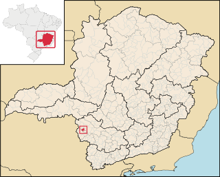
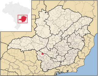
Córrego Fundo is a Brazilian municipality located in the center of the state of Minas Gerais. Its population as of 2010 was 5,821 people living in a total area of 105 km². The city belongs to the meso-region of Oeste de Minas and to the micro-region of Formiga. It became a municipality in 1995.

Pains is a Brazilian municipality located in the center of the state of Minas Gerais. Its population as of 2007 was 8,122 people living in a total area of 418 km². The city belongs to the meso-region of Oeste de Minas and to the micro-region of Formiga. It became a municipality in 1943.

Pimenta is a Brazilian municipality located in the center of the state of Minas Gerais. Its population as of 2007 was 8,164 people living in a total area of 415 km². The city belongs to the meso-region of Oeste de Minas and to the micro-region of Formiga. It became a municipality in 1948.

Pedra do Indaiá is a Brazilian municipality located in the center of the state of Minas Gerais. Its population as of 2007 was 3,921 people living in a total area of 349 km². The city belongs to the meso-region of Oeste de Minas and to the micro-region of Formiga. It became a municipality in 1962.
Bom Jesus da Penha is a Brazilian municipality located in the southwest of the state of Minas Gerais. Its population as of 2007 was 3,787 people living in a total area of 209 km². The city belongs to the meso-region of Sul e Sudoeste de Minas and to the micro-region of Passos. It became a municipality in 1963.

Capetinga is a Brazilian municipality located in the southwest of the state of Minas Gerais. Its population as of 2007 was 7,154 people living in a total area of 296 km². The city belongs to the meso-region of Sul e Sudoeste de Minas and to the micro-region of Passos. It became a municipality in 1938.
Pratápolis is a Brazilian municipality located in the southwest of the state of Minas Gerais. Its population as of 2007 was 8,653 people living in a total area of 214 km². The city belongs to the meso-region of Sul e Sudoeste de Minas and to the micro-region of Passos. It became a municipality in 1943.
São João Batista do Glória is a Brazilian municipality located in the southwest of the state of Minas Gerais. Its population as of 2007 was 6,828 people living in a total area of 553 km². The city belongs to the meso-region of Sul e Sudoeste de Minas and to the micro-region of Passos. It became a municipality in 1948.

São José da Barra is a Brazilian municipality located in the southwest of the state of Minas Gerais. Its population as of 2007 was 6,701 people living in a total area of 312 km². The city belongs to the meso-region of Sul e Sudoeste de Minas and to the micro-region of Passos. It became a municipality in 1948. The important hydroelectric plant of Furnas is located here.

Guaranésia is a Brazilian municipality located in the southwest of the state of Minas Gerais. Its population as of 2007 was 18,649 people living in a total area of 294 km². The city belongs to the meso-region of Sul e Sudoeste de Minas and to the micro-region of São Sebastião do Paraíso. It became a municipality in 1901. The municipality is an important producer of coffee.