Wenceslau Braz, Minas Gerais

Last updated
Wenceslau Braz
Municipality of Wenceslau Braz
Wenceslau Braz.jpg
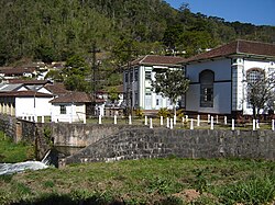
View of Wenceslau Braz
Coat of Arms of Wenceslau Braz - MG - Brazil.png
MinasGerais Municip WenceslauBraz.svg
Location in Minas Gerais
Brazil location map.svg
Red pog.svg
Wenceslau Braz
Location in Brazil
Coordinates: 22°32′02″S45°21′46″W / 22.53389°S 45.36278°W / -22.53389; -45.36278
Country Flag of Brazil.svg  Brazil
Region Southeast
State Bandeira de Minas Gerais.svg  Minas Gerais
FoundedDecember 30, 1962
Area
[1]
  Total102.487 km2 (39.570 sq mi)
Elevation
1,005 m (3,297 ft)
Population
 (2020) [2]
  Total2,548
Time zone UTC−3 (BRT)
Postal code
37512-000
Area code 35
Website wenceslaubraz.mg.gov.br

Wenceslau Braz is a Brazilian municipality in the state of Minas Gerais. As of 2020, its population was estimated to be 2,548.

Related Research Articles

<span class="mw-page-title-main">Salinas, Minas Gerais</span> Salinas is a municipality in Minas Gerais, Brazil

Salinas is a municipality in the northeast of the Brazilian state of Minas Gerais.

<span class="mw-page-title-main">Almenara, Minas Gerais</span> Municipality in Southeast, Brazil

Almenara, is a municipality in the northeast of the Brazilian state of Minas Gerais. Situated on the Jequitinhonha River it is the largest city in that river valley. Its 2020 population was estimated at 42,143 and the municipal area was 2,301 km².

<span class="mw-page-title-main">Conselheiro Lafaiete</span> Municipality in Minas Gerais, Brazil

Conselheiro Lafaiete is a city of the state of Minas Gerais, Brazil. It was known as Queluz until 1934, when it was renamed by decree, as a tribute to Counselor Lafayette Rodrigues Pereira.

<span class="mw-page-title-main">Aracitaba</span> Place in Southeast Region, Brazil

Aracitaba is a Brazilian municipality located in the state of Minas Gerais. Its population as of 2020 is estimated to be 2,059 people living in a total area of 105,885 km². The city belongs to the mesoregion of Zona da Mata and to the microregion of Juiz de Fora.

<span class="mw-page-title-main">Araçuaí</span> Place in Brazil

Araçuaí is a Brazilian municipality located in the northeast of the state of Minas Gerais in the Jequitinhonha River valley. The Araçuaí River, a tributary of the Jequitinhonha, flows through it. Its population as of 2020 was estimated to be 36,712 people living in a total area of 2,235 km2. The city belongs to the mesoregion of Jequitinhonha and the microregion of Araçuaí. The city is the seat of the Roman Catholic Diocese of Araçuaí. The elevation of the municipal seat is 307 meters. It became a municipality in 1870.

<span class="mw-page-title-main">Baldim</span> City in Southeast, Brazil

Baldim is a Brazilian municipality located in the state of Minas Gerais. Its population as of 2020 is estimated to be 7,803, in a total area of 554,029 km2 (213,912 sq mi). The city belongs to the mesoregion Metropolitana de Belo Horizonte and to the microregion of Sete Lagoas.

<span class="mw-page-title-main">Confins</span> City in Southeast, Brazil

Confins is a Brazilian municipality located in the state of Minas Gerais. Its population as of 2020 is estimated to be 6,800 people. The area of the municipality is 42.008 km². The city belongs to the mesoregion Metropolitana de Belo Horizonte and to the microregion of Belo Horizonte. It is home of the international airport of Belo Horizonte, Tancredo Neves International Airport.

<span class="mw-page-title-main">Pará de Minas</span> Municipality in Southeast, Brazil

Pará de Minas is a Brazilian municipality located in the state of Minas Gerais.

<span class="mw-page-title-main">Jacinto, Minas Gerais</span> Municipality in Southeast, Brazil

Jacinto is a Brazilian municipality located in the northeast of the state of Minas Gerais. Jacinto is located on the right bank of the Jequitinhonha River. It is 44 kilometers east of Almenara.

<span class="mw-page-title-main">Bom Princípio</span> Municipality in Rio Grande do Sul, Brazil

Bom Princípio is a municipality in the state of Rio Grande do Sul, Brazil. It is known in alla Brazil as Strawberry Land.

<span class="mw-page-title-main">Durandé</span> Brazilian municipality

Durandé is a Brazilian municipality located in the state of Minas Gerais. The city belongs to the mesoregion of Zona da Mata and to the microregion of Manhuaçu. Districts within the county are St. John Figueira and São José da Figueira.

<span class="mw-page-title-main">Bonito de Minas</span> Place in Southeast, Brazil

Bonito de Minas is a municipality in the northeast of the Brazilian state of Minas Gerais. As of 2020 the population was 11,369 in a total area of 3,901 km2. The elevation is 629 meters. It became a municipality in 1995.

<span class="mw-page-title-main">Manga, Minas Gerais</span> Place in Brazil

Manga is a municipality in the north of the state of Minas Gerais in Brazil. It is located on the left bank of the São Francisco River. It is connected to Januária by paved BR-135, anis 112 km away. Neighboring municipalities are Matias Cardoso, Montalvânia, Miravânia, Juvenília, and São João das Missões. The distance to the state capital is 720 km. As of 2020 the population was 18,226 in an area of 1,950 km².

<span class="mw-page-title-main">Miravânia</span> Place in Brazil

Miravânia is a municipality in the north of the state of Minas Gerais in Brazil. As of 2020 the population was 4,914 in an area of 603 km². It is located on the left bank of the São Francisco River. It is connected by dirt road to São João das Missões by paved BR-135. The distance is 112 km. Neighboring municipalities are: Montalvânia, Manga, Cônego Marinho, and São João das Missões.

Santa Vitória is a municipality in the west of the Brazilian state of Minas Gerais. As of 2020, the population was estimated at 19,872. It became a municipality in 1948.

<span class="mw-page-title-main">Itaúna</span> Municipality in Southeast, Brazil

Itaúna is a municipality in the state of Minas Gerais in the Southeast region of Brazil.

<span class="mw-page-title-main">São João Evangelista</span> Municipality in Southeast, Brazil

São João Evangelista is a municipality in the state of Minas Gerais in the Southeast region of Brazil.

<span class="mw-page-title-main">Peçanha</span> Municipality in Southeast, Brazil

Peçanha is a municipality in the state of Minas Gerais in the Southeast region of Brazil.

Pinto Bandeira is a municipality in the state of Rio Grande do Sul, Brazil. Its population was 3,036 (2020) and its area is 105 km2. The municipality was established in January 2013.

References

  1. "Área dos municípios" [Area of the municipalities] (in Portuguese). Brazilian Institute of Geography and Statistics(IBGE) . Retrieved 2018-04-17.
  2. IBGE 2020