Catas Altas | |
|---|---|
| Municipality of Catas Altas | |
 Flag  Seal | |
 | |
| Country | |
| Region | Southeast |
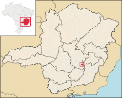
| State | |
| Founded | 8 December 1703 |
| Government | |
| • Mayor | Saulo Morais (PATRI) |
| Area | |
• Total | 240.042 km2 (92.681 sq mi) |
| Elevation | 745 m (2,444 ft) |
| Population (2021) [1] | |
• Total | 5,465 |
| • Density | 20.19/km2 (52.3/sq mi) |
| Demonym | catas-altense |
| Time zone | UTC−3 (BRT) |
| HDI (2010) | 0.684 – medium [2] |
| Website | www |


Catas Altas is a Brazilian municipality located in the state of Minas Gerais. The city belongs to the mesoregion Metropolitana de Belo Horizonte and to the microregion of Itabira. As of 2020, the estimated population was 5,421. [3]
