Montezuma, Minas Gerais

Last updated

Montezuma
Brasaomontezuma.jpg
Nickname(s): 
Hot Waters Portuguese: Águas Quentes
Motto(s): 
Portuguese: União, Ordem e Progresso (Union, Order and Progress)
MinasGerais Municip Montezuma.svg
Location in Brazil
Coordinates: 15°10′19″S42°29′49″W / 15.17194°S 42.49694°W / -15.17194; -42.49694 Coordinates: 15°10′19″S42°29′49″W / 15.17194°S 42.49694°W / -15.17194; -42.49694
Country Flag of Brazil.svg  Brazil
Region Southeast
State Minas Gerais
Mesoregion North of Minas Gerais
Microregion Salinas
Established1890
Founded1 January 1993
Government
   Mayor Fabiano Costa Soares (SD)
Area
[1]
  Total1,133,739 km2 (437,739 sq mi)
Elevation
910 m (2,990 ft)
Population
 (2020 [2] )
  Total8,315
Time zone UTC−3 (BRT)
HDI (2000)0.589 [3]
Website Montezuma, Minas Gerais

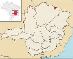
Montezuma is a municipality in the northeast of the Brazilian state of Minas Gerais. It is isolated, and the inhabitants are poor, mainly engaged in cattle raising and small-scale farming. It became a municipality in 1993.

Contents

Location

Montezuma is part of the statistical microregion of Salinas. It is connected by poor roads to the regional center of Espinosa to the northwest. It is 17 km (11 mi) south of the boundary with the state of Bahia. The municipality contains about 55% of the 38,177 hectares (94,340 acres) Nascentes Geraizeiras Sustainable Development Reserve, created in 2014. The reserve protects an area of the cerrado biome. [4] The elevation is 850 m (2,789 ft).

Demographics

As of 2020 the population was 8,315 in a total area of 1,134 km2 (438 sq mi). This is one of the poorest municipalities in the state and in the country. The main economic activities are cattle raising (7,000 head in 2006) and farming with modest production of sugarcane, corn, and rice. In 2006, there were 1,058 rural producers with a total area of 32,633 hectares (80,640 acres). Cropland made up 2,800 hectares (6,900 acres). There were only 18 tractors. In the urban area there were no financial institutions as of 2006. There were 116 automobiles, giving a ratio of about one automobile for every 62 inhabitants. Health care was provided by 3 public health clinics. There were no hospitals.

Human Development Index

Note that at last count Brazil had 5,561 municipalities while Minas Gerais still had 853.

The above figures can be compared with those of Poços de Caldas, which had an MHDI of .841, the highest in the state of Minas Gerais. The highest in the country was São Caetano do Sul in the state of São Paulo with an MHDI of .919. The lowest was Manari in the state of Pernambuco with an MHDI of .467 out of a total of 5,504 municipalities in the country as of 2004. At last count Brazil had 5,561 municipalities so this might have changed at the time of this writing.

See also

Related Research Articles

Angelândia

Angelândia is a municipality in the northeast of the Brazilian state of Minas Gerais. As of 2020 the population was 8,557 in a total area of 185 km². The elevation is 891 meters. It is part of the IBGE statistical meso-region of Jequitinhonha and the micro-region of Capelinha. It became a municipality in 1995.

Virgem da Lapa

Virgem da Lapa is a Brazilian municipality located in the northeast of the state of Minas Gerais. Its population as of 2020 was estimated to be 13,740 people living in a total area of 871 km2 (336 sq mi). The city belongs to the mesoregion of Jequitinhonha and to the microregion of Araçuaí. It became a municipality in 1948.

Aricanduva, Minas Gerais

Aricanduva is a municipality in the northeast of the Brazilian state of Minas Gerais. As of 2020 the population was 5,269 in a total area of 243 km². The elevation is 682 meters. It is part of the IBGE statistical meso-region of Jequitinhonha and the micro-region of Capelinha. It became a municipality in 1995.

Coronel Murta

Coronel Murta is a Brazilian municipality located in the northeast of the state of Minas Gerais. Its population as of 2020 was estimated to be 9,215 people living in a total area of 813 km². The city belongs to the mesoregion of Jequitinhonha and to the microregion of Araçuaí. It became a municipality in 1953.

Novo Cruzeiro Human settlement in Brazil

Novo Cruzeiro is a Brazilian municipality located in the northeast of the state of Minas Gerais. Its population as of 2020 was estimated to be 31,335 people living in a total area of 1,701 km². The city belongs to the mesoregion of Jequitinhonha and to the microregion of Araçuaí. The elevation of the municipal seat is 980 meters. It became a municipality in 1943.

Padre Paraíso Municipality in Minas Gerais, Brazil

Padre Paraíso is a Brazilian municipality located in the northeast of the state of Minas Gerais. Its population as of 2020 was estimated to be 20,252 people living in a total area of 543 km². The city belongs to the mesoregion of Jequitinhonha and to the microregion of Araçuaí. It became a municipality in 1962.

Ponto dos Volantes Municipality in Minas Gerais, Brazil

Ponto dos Volantes is a Brazilian municipality located in the northeast of the state of Minas Gerais. The city belongs to the mesoregion of Jequitinhonha and to the microregion of Araçuaí. As of 2020 the population was 12,179 in an area of 1,215 km². The elevation is 400 meters. It became a municipality in 1997. The postal code (CEP) is 39615-000.

Indaiabira Municipality in the northeast of the Brazilian state of Minas Gerais

Indaiabira is a municipality in the northeast of the Brazilian state of Minas Gerais. As of 2020 the population was 7,339 in a total area of 1,008 km². The elevation is 857 meters. It became a municipality in 1997.

Pai Pedro Human settlement in Brazil

Pai Pedro is a municipality in the northeast of the Brazilian state of Minas Gerais. As of 2020 the population was 6,094 in a total area of 785 km2 (303 sq mi). The elevation is 520 meters (1,710 ft). It became a municipality in 1997. The postal code (CEP) is 39517-000.

Novo Oriente de Minas Municipality in the northeast of the Brazilian state of Minas Gerais

Novo Oriente de Minas is a municipality in the northeast of the Brazilian state of Minas Gerais. As of 2020 the population was 10,778 in a total area of 754 km2 (291 sq mi). The elevation is 400 metres (1,300 ft). It became a municipality in 1997. The postal code (CEP) is 39817-000.

Santa Helena de Minas

Santa Helena de Minas is a municipality in the northeast of the Brazilian state of Minas Gerais. As of 2020 the population was 6,386 in a total area of 277 square kilometres (107 sq mi). The elevation is 312 metres (1,024 ft). It became a municipality in 1997.

São João das Missões

São João das Missões is a municipality in the north of the Brazilian state of Minas Gerais. As of 2020 the population was 13,125 in a total area of 675 km². The elevation is 501 meters. It became a municipality in 1997.

Curral de Dentro

Curral de Dentro is a municipality in the northeast of the Brazilian state of Minas Gerais. As of 2020 the population was 7,799 in a total area of 571 km2. The elevation is 890 meters. It became a municipality in 1997.

Vargem Grande do Rio Pardo Place in Southeast, Brazil

Vargem Grande do Rio Pardo is a municipality in the northeast of the Brazilian state of Minas Gerais.

Rio Pardo de Minas Place in Southeast, Brazil

Rio Pardo de Minas is a municipality in the northeast of the Brazilian state of Minas Gerais. Its population in 2020 was 31,045 inhabitants in a total area of 3,117 square kilometres (1,203 sq mi).

Jenipapo de Minas

Jenipapo de Minas is a municipality in the northeast of the Brazilian state of Minas Gerais. As of 2020 the population was 7,738 in a total area of 284 km². The elevation of the town center is 521 meters. It is part of the IBGE statistical meso-region of Jequitinhonha and the micro-region of Capelinha. It became a municipality in 1997.

José Gonçalves de Minas

José Gonçalves de Minas is a municipality in the northeast of the Brazilian state of Minas Gerais. As of 2020 the population was 4,487 in a total area of 382 km². The elevation of the town center is 546 meters. It is part of the IBGE statistical meso-region of Jequitinhonha and the micro-region of Capelinha. It became a municipality in 1997.

Leme do Prado Municipality in Minas Gerais, Brazil

Leme do Prado is a municipality in the northeast of the Brazilian state of Minas Gerais. As of 2020 the population was 4,920 in a total area of 281 square kilometres (108 sq mi)

Minas Novas Brazilian city

Minas Novas is a municipality in the northeast of the Brazilian state of Minas Gerais. In 2020, the population was 31,497 in a total area of 1,810 km². The elevation of the urban area is 635 meters. It is part of the IBGE statistical meso-region of Jequitinhonha and the micro-region of Capelinha. It became a municipality in 1730.

Turmalina, Minas Gerais Municipality in Minas Gerais, Brazil

Turmalina is a municipality in the northeast of the Brazilian state of Minas Gerais. As of 2020 the population was 20,125 in a total area of 1,153 km². The elevation of the urban area is 718 meters. It is part of the IBGE statistical meso-region of Jequitinhonha and the micro-region of Capelinha. It became a municipality in 1949.

References

  1. "Área territorial oficial" [Official Territorial Area] (in Portuguese). Brazilian Institute of Geography and Statistics (IBGE). 10 October 2002. Retrieved 5 December 2010.
  2. IBGE 2020
  3. "Ranking decrescente do IDH-M dos municípios do Brasil". Programa das Nações Unidas para o Desenvolvimento (PNUD). 2000. Archived from the original on 3 October 2011. Retrieved 11 October 2008.
  4. RDS Nascentes Geraizeiras – ISA.

Sources