Papagaios | |
|---|---|
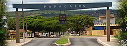 Entry of Papagaios | |
 Coat of arms | |
 Papagaios Location in Brazil | |
| Coordinates: 19°26′56″S44°44′52″W / 19.44889°S 44.74778°W | |
| Country | Brazil |
| Region | Southeast |
| State | Minas Gerais |
| Area | |
• Total | 554 km2 (214 sq mi) |
| Population (2020 [1] ) | |
• Total | 15,800 |
| • Density | 29/km2 (74/sq mi) |
| Time zone | UTC−3 (BRT) |
Papagaios is a municipality in Minas Gerais, Brazil. Its population was 15,800 in 2020 and its area is 554 square kilometres (214 square miles). [2] Its economy is based on exports of slate.
Papagaios is 150 kilometres (93 miles) away from the state capital, Belo Horizonte.
