
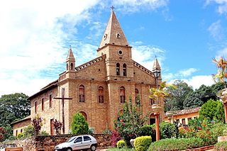
Almenara, is a municipality in the northeast of the Brazilian state of Minas Gerais. Situated on the Jequitinhonha River it is the largest city in that river valley. Its 2020 population was estimated at 42,143 and the municipal area was 2,301 km².

Angelândia is a municipality in the northeast of the Brazilian state of Minas Gerais. As of 2020 the population was 8,557 in a total area of 185 km². The elevation is 891 meters. It is part of the IBGE statistical meso-region of Jequitinhonha and the micro-region of Capelinha. It became a municipality in 1995.

Bandeira is a Brazilian municipality located in the state of Minas Gerais. Its population as of 2020 was estimated to be 4,766 people living in a total area of 484 km2. The city belongs to the mesoregion of Jequitinhonha and to the microregion of Almenara.
Grão Mogol is a Brazilian municipality located in the north of the state of Minas Gerais. In 2020 the population was 15,890 in a total area of 3,890 km2. The elevation is 829 meters. It became a municipality in 1840.

Divisópolis is a Brazilian municipality located in the northeast of the state of Minas Gerais.
Jequitinhonha is a Brazilian municipality located in the northeast of the state of Minas Gerais.

Joaíma is a Brazilian municipality located in the northeast of the state of Minas Gerais.

Jordânia is a Brazilian municipality located in the northeast of the state of Minas Gerais. The city belongs to the mesoregion of Jequitinhonha and to the microregion of Almenara. As of 2020 the population was 10,842 in a total area of 549 km2.

Rio do Prado is a municipality in the northeast of the Brazilian state of Minas Gerais. Its population in 2020 was 5,133 inhabitants in a total area of 479 km2.

Rubim is a municipality in the northeast of the Brazilian state of Minas Gerais. Its population in 2020 was 10,256 inhabitants in a total area of 969 km2.
Caraí is a Brazilian municipality located in the northeast of the state of Minas Gerais. Its population as of 2020 was estimated to be 23,780 people living in a total area of 1,240 km2. The city belongs to the mesoregion of Jequitinhonha and to the microregion of Araçuaí. The elevation of the municipal seat is 750 meters. It became a municipality in 1948.

Coronel Murta is a Brazilian municipality located in the northeast of the state of Minas Gerais. Its population as of 2020 was estimated to be 9,215 people living in a total area of 813 km². The city belongs to the mesoregion of Jequitinhonha and to the microregion of Araçuaí. It became a municipality in 1953.

Cristália is a Brazilian municipality located in the north of the state of Minas Gerais. In 2020 the population was 5,982 in a total area of 841 km2. The elevation is 728 meters. It became a municipality in 1962.

Itacambira is a Brazilian municipality located in the north of the state of Minas Gerais. In 2020 the population was 5,417 in a total area of 1,788 km². It became a municipality in 1962.

Josenópolis is a Brazilian municipality located in the north of the state of Minas Gerais. In 2020 the population was 4,889 in a total area of 536 km2. It became a municipality in 1997.

Padre Carvalho is a Brazilian municipality located in the north of the state of Minas Gerais. In 2020 the population was 6,423 in a total area of 450 km². It became a municipality in 1997.

Ibiaí is a Brazilian municipality located in the north of the state of Minas Gerais. In 2020 the population was 8,437 in a total area of 870 km². It became a municipality in 1963.
Lassance is a Brazilian municipality located in the north of the state of Minas Gerais. In 2020 the population was 6,503 in a total area of 3,213 km². It became a municipality in 1953.

Berilo is a municipality in the northeast of the Brazilian state of Minas Gerais. As of 2020 the population was 11,872 in a total area of 586 km2. The elevation is 401 meters. It is part of the IBGE statistical meso-region of Jequitinhonha and the micro-region of Capelinha. It became a municipality in 1963.
Couto de Magalhães de Minas is a Brazilian municipality located in the north-center of the state of Minas Gerais. Its population as of 2020 was 4,423 living in a total area of 484 km². The city belongs to the statistical mesoregion of Jequitinhonha and to the statistical microregion of Diamantina. It became a municipality in 1963.

