Paracatu, Minas Gerais

Last updated
Paracatu
Paracatu MG Brasil - Vista Parcial da cidade - panoramio.jpg
Partial view of Paracatu
Bandeira de Paracatu.jpg
Brasao de Paracatu.jpg
MinasGerais Municip Paracatu.svg
Localization of Paracatu in Minas Gerais
Brazil location map.svg
Red pog.svg
Paracatu
Localization of Paracatu in Brazil
Coordinates: 17°13′18″S46°52′30″W / 17.22167°S 46.87500°W / -17.22167; -46.87500
Country Flag of Brazil.svg  Brazil
Region Southeast
State Bandeira de Minas Gerais.svg Minas Gerais
FoundedOctober 20, 1798
Government
   Mayor Olavo Remígio Condé (PSDB)
(2013-2016)
Area
  Total8.229588 km2 (3.177462 sq mi)
Elevation
688 m (2,257 ft)
Population
 (2020 [1] )
  Total93,862
  Density10.29/km2 (26.7/sq mi)
Demonym(s) Paracatuense
Time zone UTC−3 (BRT)
Postal Code (CEP)
38600-000
Area code(s) +55 38
Website www.paracatu.mg.gov.br

Paracatu is a municipality in the state of Minas Gerais in Brazil. The name is of Tupi origin, translated "good river", from "Para" (river) and "katu" (good).

Contents

History

The region of Paracatu has been explored by Europeans since the end of the 16th century. In the middle of the 18th century deposits of gold and silver were discovered, and the area was settled. The settlement became the town Vila de Paracatu do Príncipe by royal charter in 1798. [2]

The economy

The economy is centered on gold mining and agriculture.

Mining

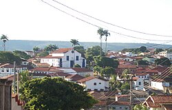
In Paracatu, gold has been mined since 1722. [3] The Morro do Ouro (Paracatu) open-pit mine is operated by Rio Paracatu Mineração (RPM), a 100% owned subsidiary of the Canadian company Kinross Gold Corporation. The gold content of the ore is comparatively low, about 0.41 gram of gold for every ton of ore extracted. Annual production is about 15 tonnes of gold and 5 tonnes of silver. [4] [5]

Kinross Gold owns the open-pit Paracatu gold mine operated as Kinross Brasil Mineração S.A. that includes two process plants, two tailings facilities, as well as accompanying infrastructure. [6] This mine is the region's largest employer. [7] In 2015, Paracatu produced 477,662 gold equivalent ounces. [8]

Agriculture

Cattle raising is the main agricultural activity with 231,000 head (1996). The main breeds are: Zebu (Gir, Indu-Brasil, Guzerá and Nelore), Girolanda, Frisian and Brown-Swiss. There is also large production of soybeans, corn, rice, beans, and also some coffee. Paracatu is the commercial center for an area one third the size of Portugal. In 2006 there were 6 banking branches: Banco do Brasil, Itaú, Bradesco, Banco Mercantil, Banco Bamerindus, and Caixa Econômica Federal. [9] The GDP was R$754,090,000 (2005). [10]

In 1978 the municipality began to receive investments from the Brazilian and the Japanese government to develop the cerrado soils, through the PRODECER-Programa de Cooperação Nipo-Brasileiro para o Desenvolviemnto do Cerrado.

Because of new technologies used to develop the cerrado, agriculture in Paracatu became efficient and profitable in many properties. Nowadays, the cultivated area in the municipality surpasses 1000 square kilometres, with 300 square kilometres irrigated by central pivot sprinklers. This number has raised Paracatu to the position of greatest continuous area irrigated by center pivot irrigation in South America, using 318 center pivot sprinklers. [11]

Agricultural data

In 2006 there were 995 rural producers with total agricultural land of 389,095 ha. Of the total 85,000 ha. were planted, 180,000 ha. were in natural pasture, and 113,000 were in forest or woodland. Around 4,500 persons were employed in agriculture. There were 768 tractors. The planted area of some of the main crops in hectares was:

Quilombola population

Many quilombola (descendants of escaped slaves) communities live in and near Paracatu, often in poverty. [12] [13]

Health and education

In 2005 there were 29 health establishments, 19 of which were public and 10 of which were private. There was 1 hospital with 139 beds. [10] The score on the Municipal Human Development Index was 0.760. This ranked Paracatu 207 out of 853 municipalities in the state, with Poços de Caldas in first place with 0.841 and Setubinha in last place with 0.568. [14]

Paracatu has 4 faculties with undergraduation and graduation courses: Faculdade Tecsoma, FINOM – Faculdade do Noroeste de Minas, Faculdade Unimontes, and Faculdade Atenas. [15]

Transportation

The city is served by Pedro Rabelo de Souza Airport.

See also

Related Research Articles

Montes Claros Municipality in Southeast, Brazil

Montes Claros is a city located in northern Minas Gerais state, in Brazil. The population is 413,487 in an area of 3,569 km2 (1,378 sq mi). It was made a seat of a municipality in 1831 and attained city status in 1857.

Pirapora Municipality in Southeast, Brazil

Pirapora is a municipality in northcentral Minas Gerais in Brazil. The population is 56,640 in an area of 550 km². The name Pirapora comes from the Tupi words for "fish" + "jump", referring to the piracema season when a mass migration of fishes ascends the São Francisco River to spawn.

Luz, Minas Gerais Municipality in Southeast, Brazil

Luz is a Brazilian municipality located in the West part of the state of Minas Gerais. Luz is located between the city of Araxá and the capital city of the state of Minas Gerais, Belo Horizonte. The population is 18,257 in an area of 1172 km². The city belongs to the Central Mineira region and to the micro-region of Bom Despacho. It became a municipality in 1923.

Salinas, Minas Gerais Salinas is a municipality in Minas Gerais, Brazil

Salinas is a municipality in the northeast of the Brazilian state of Minas Gerais.

Campos Altos

Campos Altos is a Brazilian municipality located in the west of the state of Minas Gerais. Its population as of 2020 was estimated to be 15,563 people living in a total area of 719 km². The city belongs to the mesoregion of Triângulo Mineiro and Alto Paranaíba and to the micro-region of Araxá. It became a municipality in 1944.

Itumbiara Municipality in Meia Ponte Microregion, Brazil

Itumbiara is a municipality in the extreme south of the state of Goiás, Brazil. Its population in 2020 was of 105,809 in a total area of 2,461,3 km2 (2020). Itumbiara is one of the most prosperous cities in Goiás and is a major producer of soybeans, corn, cattle, and milk.

Januária Place in Southeast, Brazil

Januária is a municipality in northern Minas Gerais state, Brazil. It is located on the left bank of the São Francisco River. The population was 67,852 inhabitants and the area of the municipality was 6,691 km2 (2007).

Unaí Municipality in Southeast, Brazil

Unaí is a municipality in the Northern Region of Minas Gerais, in the Brazilian state of Minas Gerais, in the Southeast Region of Brazil. It is located 590 km from the capital of Minas Gerais and 164 km from the federal capital. Unaí is the main municipality of its micro-region of the same name and, together with Paracatu, the most important city of the said mesoregion of Minas Gerais. Due to its geopolitical location, because it is geographically and politically linked to Brasilia and politically to Belo Horizonte, the municipality has a strong economic dynamism for a municipality that still carries the typically mineiro custom.

Quirinópolis Municipality in Central-West, Brazil

Quirinópolis is a municipality in south Goiás state, Brazil. It is a large producer of cattle and agricultural products.

Goiatuba Municipality in Central-West, Brazil

Goiatuba is a municipality in south-central Goiás state, Brazil. The population was 34,202 in a total area of 2,470.3 km2. Goiatuba is a large producer of grains, especially soybeans and corn.

Formoso, Minas Gerais Place in Brazil

Formoso is a municipality in northern Minas Gerais state, Brazil. It is located northeast of Brasília, in a pocket where the boundaries of the states of Minas Gerais, Goiás, and Bahia come together.

Dores do Indaiá

Dores do Indaiá is a Brazilian municipality located in the center of the state of Minas Gerais. Its population as of 2020 was 13,427 people living in a total area of 1,110 km². The city belongs to the meso-region of Central Mineira and to the micro-region of Bom Despacho. It became a municipality in 1880.

Martinho Campos

Martinho Campos is a Brazilian municipality located in the center of the state of Minas Gerais. Its population as of 2020 was 13,443 people living in a total area of 1,060 km². The city belongs to the meso-region of Central Mineira and to the micro-region of Bom Despacho. It became a municipality in 1938.

Lagamar

Lagamar is a municipality in the north of the Brazilian state of Minas Gerais. Its population in 2020 was 7,600 inhabitants in a total area of 1,425 km2 (550 sq mi). It is a large producer of cattle and grains and there is extraction of phosphates.

Vazante

Vazante is a municipality in the north of the Brazilian state of Minas Gerais. Its population in 2020 was 20,642 inhabitants in a total area of 1,903 km². It is a large producer of cattle and with a significant zinc mining industry.

Lagoa Grande, Minas Gerais

Lagoa Grande is a municipality in the northeast of the Brazilian state of Minas Gerais. Its population in 2020 was 9,608 inhabitants in a total area of 1,220 km².

Presidente Olegário

Presidente Olegário is a municipality in the north of the Brazilian state of Minas Gerais. Its population in 2020 was 19,627 inhabitants in a total area of 3,531 km2 (1,363 sq mi).

São Gonçalo do Abaeté

São Gonçalo do Abaeté is a municipality in the north of the Brazilian state of Minas Gerais. Its population in 2020 was 8,459 inhabitants in a total area of 2,687 km². It is a large producer of cattle and grains.

Passos, Minas Gerais Municipality in Southeast, Brazil

Passos is a Brazilian municipality located in the southwest of the state of Minas Gerais. Its population as of 2020 was 115,337 people living in a total area of 1,339 km2. The city belongs to the meso-region of Sul e Sudoeste de Minas and to the micro-region of Passos. It became a municipality in 1858.

São Sebastião do Paraíso

São Sebastião do Paraíso is a Brazilian municipality located in the southwest of the state of Minas Gerais. Its population as of 2020 was 71,445 people living in a total area of 822 km². The city belongs to the meso-region of Sul e Sudoeste de Minas and to the micro-region of São Sebastião do Paraíso. It became a municipality in 1870. The city and surrounding area are famous for the growing of high-quality coffe.

References

  1. IBGE 2020
  2. IBGE, history
  3. www.theguardian.com: Canadian Mininig commany spied on opponents and activists in Brazil. (13-May-2015)
  4. "Kinross: Operation: Paracatu Brazil". Kinross Gold Corporation. Archived from the original on September 9, 2010. Retrieved July 23, 2010.
  5. Henderson, R. D. (July 31, 2006). "Paracatu Mine Technical Report" (PDF). Kinross Gold Corporation. Archived from the original (PDF) on October 11, 2010. Retrieved July 23, 2010.
  6. Canadian and American Mines Handbook. Business Information Group. 2005. ISBN   978-0-919336-63-6.
  7. "Metso to supply grinding equipment to Kinross Gold's Paracatu in Brazil". International Mining. International Mining. Retrieved 23 September 2016.
  8. See page MDA 20 of 2015 Kinross Gold Annual Report http://s2.q4cdn.com/496390694/files/doc_financials/annual/2016/2015-Kinross-Gold-Annual-Report.pdf
  9. "Agências bancárias". Prefeitura Municipal Paracatu. Retrieved 2010-07-23.
  10. 1 2 3 "IBGE". IBGE. Retrieved 2010-07-23.
  11. "Prefeitura Municipal de Paracatu". Paracatu.mg.gov.br. Retrieved 2010-07-23.
  12. Colitt, Raymond (July 4, 2007). "Descendants of slaves still suffer in Brazil". Reuters. Retrieved July 23, 2010.
  13. Pyl, Bianca (May 3, 2010). "Incra não cumpre meta e titula 2 territórios quilombolas em 2009". Repórter Brasil (in Portuguese). Retrieved July 23, 2010.
  14. "Frigoletto". Frigoletto. Archived from the original on 2011-07-06. Retrieved 2010-07-23.
  15. "Cidades On Line – Paracatu". Paracatuonline.com.br. Retrieved 2010-07-23.