Espera Feliz

Last updated
Location of Espera Feliz within Minas Gerais MinasGerais Municip EsperaFeliz.svg
Location of Espera Feliz within Minas Gerais

Espera Feliz is a municipality in southeastern Minas Gerais state, Brazil. The altitude is 2,430 m above sea level. Located at 20°39′00″S41°54′25″W / 20.65000°S 41.90694°W / -20.65000; -41.90694 Coordinates: 20°39′00″S41°54′25″W / 20.65000°S 41.90694°W / -20.65000; -41.90694 , its neighboring cities are Caiana to the south, Dores do Rio Preto to the east, Divino to the west, Alto Caparaó and Caparaó to the north and Carangola to the southwest.

Contents

The citizens are called Esperafelicenses.

City data

History

An oral tradition states that, in the second half of the 19th century, an Engineering Commission sent by the Imperial Government of Peter II, camped where the city centre is currently located. Having located several hunted wild, abundant animals in the place, they perceived that the area close to the São João River, where the Pico da Bandeira is currently located, favored hunting. Of the current City, the first inhabited areas were around the current São Sebastião da Barra, six kilometers from the current city centre. The first land proprietor in the place of the current city was the Lieutenant - Colonel Francisco Xavier Hunter Walnut of Gamma. Later Francisco transferred these to Antonio de Oliveira. The latter, without resources to explore the property, transferred it to his brother-in-law Antonio Carlos de Souzain in 1873. The original setting and the fertile land was used for agriculture. Mining would come only in the 20th century. In 1848, Manoel Francisco Pine introduced coffee cultivation in the region. In 1910, with the opening of the railway station, the town received the name Espera Feliz.

In 1915, the headquarters of the São Sebastião da Barra were transferred to the town, returning the denomination from Espera Feliz. In 1923 the town officially assumed its current name. It received city status on 17 December 1938. The local citizens are called esperafelicense. A major factor in local development was The Leopoldina Railway Company Limited (Leopoldina Railway), that reached the place in 1910. For the formation of the town, they had appointed Captain Jose Carlos de Marine Souza, who donated lands for the construction of the first houses, in the place that received the denomination from New Street. In the center of the city, Deoclécio de Lacerda constructed the hotel as the first building. Mrs. Pink Cira of Assis donated lands for the railroad area, the local Station, and the area destined to the Triangle. On the opposing edge of the São João River, Major Francisco Pereira de Souza constructed a group of houses, that received the name from Pereira Street. Maria, the widow of Captain Francisco Gomes Da Silva, donated the Patrimony Of the first church of San Sebastian.

Administration

All territory that today covers the City of Espera Feliz - Minas Gerais, belonged to the Village De Campos of the Goitacazes of the Province of Rio de Janeiro.

Politics

The current mayor is Carlinhos Cabral who was reelected in 2016. The elected mayor for 2021-2024 is Oziel Gomes.

Economy

See also

Related Research Articles

<span class="mw-page-title-main">Minas Gerais</span> State in Southeastern Brazil

Minas Gerais is a state in Southeastern Brazil. It ranks as the second most populous, the third by gross domestic product (GDP), and the fourth largest by area in the country. The state's capital and largest city, Belo Horizonte, is a major urban and finance center in Latin America, and the sixth largest municipality in Brazil and its metropolitan area is the third largest in Brazil with just over 5.8 million inhabitants, after those of São Paulo and Rio de Janeiro. Nine Brazilian presidents were born in Minas Gerais, the most of any state. The state has 10.1% of the Brazilian population and is responsible for 8.7% of the Brazilian GDP.

<span class="mw-page-title-main">Manhuaçu</span> Municipality in Southeast, Brazil

Manhuaçu is a municipality in Eastern Minas Gerais state, in Brazil. Its population was 91,169 (2020) and its area is 628 km2.

<span class="mw-page-title-main">Além Paraíba</span> Place in Southeast, Brazil

Além Paraíba is a city in the southeastern Zona da Mata region of Minas Gerais, Brazil. The name indicates its position on the far bank of the Rio Paraíba do Sul. It was known as São José d'Além Parahyba until 1923.

<span class="mw-page-title-main">War of the Emboabas</span>

The War of the Emboabas was a conflict in colonial Brazil waged in 1706-1707 and 1708-1709 over newly discovered gold fields, which had set off a rush to the region between two generations of Portuguese settlers in the viceroyalty of Brazil - then the Captaincy of São Vicente. The discovery of gold set off a rush to the region, Paulistas asserted rights of discovery and non-Paulistas challenged their claims. Although the Portuguese crown sought more control in the area and the Paulistas sought protection of their claims, the Emoboabas won. The crown re-assessed its position in the region and made administrative changes subsequently.

<span class="mw-page-title-main">Viçosa, Minas Gerais</span> Municipality in Southeast, Brazil

Viçosa is a Brazilian municipality in the state of Minas Gerais. Its population as of 2021 was estimated at 79,910 inhabitants.

São José is Portuguese for Saint Joseph, and often refers to:

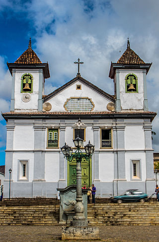
São Sebastião may refer to:

<span class="mw-page-title-main">São João del-Rei</span> Municipality in Minas Gerais, Brazil

São João del-Rei is a Brazilian municipality in the state of Minas Gerais. Founded in 1713 in homage to King John V of Portugal, the city is famed for its historic Portuguese colonial architecture. The current population is estimated at 93,778 inhabitants.

<span class="mw-page-title-main">Pico da Bandeira</span> Mountain in Brazil

Pico da Bandeira, or Bandeira Peak is the third highest mountain in Brazil, situated on the border of Espírito Santo and Minas Gerais states. It is the highest point in both states. It was historically considered the highest mountain in Brazil until 1965, when Pico da Neblina and Pico 31 de Março, next to the Venezuelan border, were explored, measured, and both found to be higher. The peak is said to have been so named after Pedro II, Emperor of Brazil, ordered a flag to be flown on top of it.

<span class="mw-page-title-main">Muriaé</span> Place

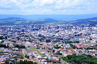
Muriaé is a municipality in southeast Minas Gerais state, Brazil. It is located in the Zona da Mata region and its population in 2020 (IBGE) was approximately 109,392 inhabitants.

<span class="mw-page-title-main">Caparaó National Park</span> National park in Brazil

Caparaó National Park is a national park created in 1961 to protect the Caparaó Mountains, located on the border between Minas Gerais and Espírito Santo states in Brazil. Pico da Bandeira, one of the highest mountains in Brazil, is located there.

<span class="mw-page-title-main">Oliveira, Minas Gerais</span> Municipality in Southeast, Brazil

Oliveira is a Brazilian municipality in the state of Minas Gerais. It is located at latitude 20º41'47" south and longitude 44º49'38" west, at an altitude of 982 metres. It is located 165 kilometres at southwest from Belo Horizonte. Its estimated population was 41,181 according to the latest IBGE census.

<span class="mw-page-title-main">Roman Catholic Archdiocese of Mariana</span> Catholic ecclesiastical territory

The Roman Catholic Archdiocese of Mariana is an archdiocese based in the city of Mariana in the Brazilian state of Minas Gerais.

<span class="mw-page-title-main">Passos, Minas Gerais</span> Municipality in Southeast, Brazil

Passos is a Brazilian municipality located in the southwest of the state of Minas Gerais. Its population as of 2020 was 115,337 people living in a total area of 1,339 km2. The city belongs to the meso-region of Sul e Sudoeste de Minas and to the micro-region of Passos. It became a municipality in 1858.

<span class="mw-page-title-main">São Sebastião do Paraíso</span>

São Sebastião do Paraíso is a Brazilian municipality located in the southwest of the state of Minas Gerais. Its population as of 2020 was 71,445 people living in a total area of 822 km². The city belongs to the meso-region of Sul e Sudoeste de Minas and to the micro-region of São Sebastião do Paraíso. It became a municipality in 1870. The city and surrounding area are famous for the growing of high-quality coffee.

<span class="mw-page-title-main">Guaxupé</span>

Guaxupé is a Brazilian municipality located in the southwest of the state of Minas Gerais. Its estimated population in 2020 was 52,078 inhabitants living in a total area of 286 km². The city belongs to the meso-region of Sul e Sudoeste de Minas and to the micro-region of São Sebastião do Paraíso. It became a municipality in 1837.

Mantena is a municipality in the state of Minas Gerais in the Southeast region o Brazil.

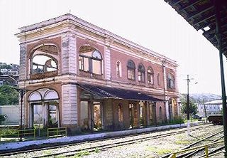
The MG-111 is a state highway located in the Brazilian state of Minas Gerais. Its total length is 183.6 km (114.1 mi), and its entire network is paved. Its route starts in Ipanema and ends at the border between the states of Minas Gerais and Rio de Janeiro.

<span class="mw-page-title-main">Immediate Geographic Region of Carangola</span>

The Immediate Geographic Region of Carangola is one of the 10 immediate geographic regions in the Intermediate Geographic Region of Juiz de Fora, one of the 70 immediate geographic regions in the Brazilian state of Minas Gerais and one of the 509 of Brazil, created by the National Institute of Geography and Statistics (IBGE) in 2017.

References