Itumirim

Last updated
Itumirim
MinasGerais Municip Itumirim.svg
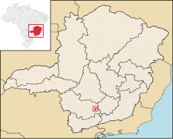
Location in the state of Minas Gerais
Brazil location map.svg
Red pog.svg
Itumirim
Location in Brazil
Coordinates: 21°19′1″S44°52′15″W / 21.31694°S 44.87083°W / -21.31694; -44.87083 Coordinates: 21°19′1″S44°52′15″W / 21.31694°S 44.87083°W / -21.31694; -44.87083
Country Flag of Brazil.svg Brazil
Region Southeast
State Bandeira de Minas Gerais.svg Minas Gerais
Mesoregion Campo das Vertentes
Population
 (2020 [1] )
  Total6,000
Time zone UTC−3 (BRT)
Website www.itumirim.mg.gov.br

Itumirim is a Brazilian municipality located in the state of Minas Gerais. The city belongs to the mesoregion of Campo das Vertentes and to the microregion of Lavras. As of 2020 it has a population of 6,000.

Contents

"Itumirim" is a term of Tupi origin meaning "little waterfall." [2] [3] It became a municipality by the state Decree Law No. 1058 of December 31, 1943. [4]

Geography

The municipality is in the Immediate Geographic Region of Lavras, in the Intermediate Geographic Region of Varginha. [5]

Ecclesiastical circumscription

The municipality is part of the Roman Catholic Diocese of São João del-Rei. [6]

See also

Related Research Articles

<span class="mw-page-title-main">Tiradentes, Minas Gerais</span> Municipality in Southeast, Brazil

Tiradentes is a municipality in the Brazilian state of Minas Gerais. It is located at 21°06′37″S44°12′41″W, has an area of 83.5 km², and a maximum elevation above sea level of 927 m. Tiradentes had an estimated population of 10,960, as of 2020. The original village was established in 1702 and became a city on 19 January 1718. In 1889 the city was renamed from Vila de São José do Rio das Mortes in honour of the national hero who was born nearby.

<span class="mw-page-title-main">Barroso, Minas Gerais</span> Municipality in Southeast, Brazil

Barroso is a Brazilian municipality located in the south of the state of Minas Gerais. Its population as of 2020 was 20,897 people living in an area of 83 km2 (32 sq mi). The elevation is 920 meters (3,020 ft). The city belongs to the mesoregion of Campo das Vertentes and to the microregion of Barbacena. An important regional center, Barbacena, is located 27 km (17 mi) to the east and is connected by MG-265.

<span class="mw-page-title-main">Carrancas, Minas Gerais</span> Municipality in Southeast, Brazil

Carrancas is a Brazilian municipality located in the south of the state of Minas Gerais. The city belongs to the mesoregion of Campo das Vertentes and to the microregion of Lavras. In 2020 the population was 4,049 in a total area of 728 km².

<span class="mw-page-title-main">Ijaci</span>

Ijaci is a Brazilian municipality located in the south of the state of Minas Gerais. The city belongs to the mesoregion of Campo das Vertentes and to the microregion of Lavras. The population in 2020 was 6,610 in a total area of 105 km². The regional center, Lavras lies at a distance of 14 kilometers and is connected by paved highway MG-335.

<span class="mw-page-title-main">Ingaí</span> Municipality in Southeast, Brazil

Ingaí is a Brazilian municipality located in the state of Minas Gerais. The city belongs to the mesoregion of Campo das Vertentes and to the microregion of Lavras.

<span class="mw-page-title-main">Luminárias</span> Municipality in Southeast, Brazil

Luminárias is a Brazilian municipality located in the state of Minas Gerais. The city belongs to the mesoregion of Campo das Vertentes and to the microregion of Lavras. In 2020, the estimated population was 5,438.

<span class="mw-page-title-main">Itutinga</span>

Itutinga is a Brazilian municipality located in the state of Minas Gerais. The city belongs to the mesoregion of Campo das Vertentes and to the microregion of Lavras. In 2020, the estimated population was 3,768.

<span class="mw-page-title-main">Conceição da Barra de Minas</span>

Conceição da Barra de Minas is a Brazilian municipality located in the state of Minas Gerais. The city belongs to the mesoregion of Campo das Vertentes and to the microregion of Sao Joao del Rei. In 2020, the estimated population was 3,946.

<span class="mw-page-title-main">Coronel Xavier Chaves</span> Municipality in Southeast, Brazil

Coronel Xavier Chaves is a Brazilian municipality located in the state of Minas Gerais. The city belongs to the mesoregion of Campo das Vertentes and to the microregion of São João del-Rei. In 2021, the estimated population was 3,488.

<span class="mw-page-title-main">Lagoa Dourada</span> Municipality in Minas Gerais, Brazil

Lagoa Dourada is a Brazilian municipality located in the state of Minas Gerais.

<span class="mw-page-title-main">Madre de Deus de Minas</span> Town and municipality in the state of Minas Gerais, Brazil

Madre de Deus de Minas is a Brazilian municipality located in the state of Minas Gerais. The city belongs to the mesoregion of Campo das Vertentes and to the microregion of Sao Joao del Rei. In 2020, the estimated population was 5,109.

<span class="mw-page-title-main">Nazareno</span> Town and municipality in the state of Minas Gerais, Brazil

Nazareno is a Brazilian municipality located in the state of Minas Gerais. The city belongs to the mesoregion of Campo das Vertentes and to the microregion of Sao Joao del Rei. In 2020, the estimated population was 8,660.

<span class="mw-page-title-main">Piedade do Rio Grande</span> Municipality in Minas Gerais, Brazil

Piedade do Rio Grande is a Brazilian municipality located in the state of Minas Gerais. The city belongs to the mesoregion of Campo das Vertentes and to the microregion of Sao Joao del Rei. In 2020, the estimated population was 4,466.

<span class="mw-page-title-main">Prados, Minas Gerais</span> Municipality in Minas Gerais, Brazil

Prados is a Brazilian municipality located in the state of Minas Gerais. The city belongs to the mesoregion of Campo das Vertentes and to the microregion of Sao Joao del Rei. In 2020, the estimated population was 9,080.

<span class="mw-page-title-main">Resende Costa</span>

Resende Costa is a Brazilian municipality located in the state of Minas Gerais. The city belongs to the mesoregion of Campo das Vertentes and to the microregion of Sao Joao del Rei. In 2020, the estimated population was 11,540.

<span class="mw-page-title-main">Ritápolis</span>

Ritápolis is a Brazilian municipality located in the state of Minas Gerais. The city belongs to the mesoregion of Campo das Vertentes and to the microregion of Sao Joao del Rei. In 2020, the estimated population was 4,562.

<span class="mw-page-title-main">Santa Cruz de Minas</span> Municipality in Southeast, Brazil

Santa Cruz de Minas is a Brazilian municipality located in the state of Minas Gerais. The city belongs to the mesoregion of Campo das Vertentes and to the microregion of Sao Joao del Rei. It is the smallest municipality of Brazil, measuring only 2.9 square kilometres (1.1 sq mi).

<span class="mw-page-title-main">Ibituruna</span> Municipality in Southeast, Brazil

Ibituruna is a municipality in the state of Minas Gerais in the Southeast region of Brazil.

<span class="mw-page-title-main">Minduri</span> Municipality in Southeast, Brazil

Minduri is a municipality in the state of Minas Gerais in the Southeast region of Brazil.

São Vicente de Minas is a municipality in the state of Minas Gerais in the Southeast region of Brazil.

References

  1. IBGE 2020
  2. "Nomes das Cidades do Brasil". Archived from the original on 2013-10-26. Retrieved 2016-09-25.
  3. "Curso de Tupi Antigo". Archived from the original on 2012-08-09. Retrieved 2012-09-10.
  4. "Itumirim - Histórico" (PDF). biblioteca.ibge.gov.br. 2008. Retrieved 25 June 2012.
  5. "Divisões Regionais do Brasil | IBGE". www.ibge.gov.br. Retrieved 2023-02-19.
  6. Silveira, Lucas. "Diocese ganha novo mapa territorial após criação de novas foranias". Diocese de São João del Rei. Retrieved 2023-02-19.