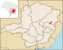
Minas Gerais is one of the 27 federative units of Brazil, being the fourth largest state by area and the second largest in number of inhabitants with a population of 20,539,989 according to the 2022 census. Located in the Southeast Region of the country, it is bordered to south and southwest by São Paulo; Mato Grosso do Sul to the west; Goiás and the Federal District to the northwest; Bahia to the north and northeast; Espírito Santo to the east; and Rio de Janeiro to the southeast. The state's capital and largest city, Belo Horizonte, is a major urban and finance center in Brazil, being the sixth most populous municipality in the country while its metropolitan area ranks as the third largest in Brazil with just over 5.8 million inhabitants, after those of São Paulo and Rio de Janeiro. Minas Gerais' territory is subdivided into 853 municipalities, the largest number among Brazilian states.
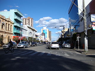
Pouso Alegre is a municipality in southern region of Minas Gerais state, Brazil, with a population of 152,549 in 2020. The area of the municipality is 543 km2. It lies in the valley of the Sapucaí River.

Diamantina is a Brazilian municipality in the state of Minas Gerais. Its estimated population in 2020 was 47,825 in a total area of 3,870 km2.

Salinas is a municipality in the northeast of the Brazilian state of Minas Gerais.

Alagoa is a city in the Brazilian state of Minas Gerais. In 2020 its population was estimated to be 2,665.
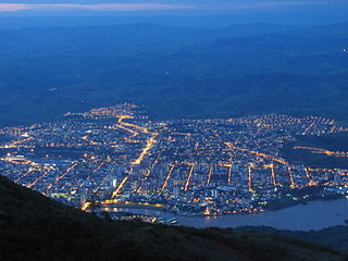
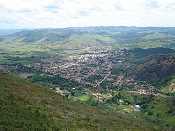
Governador Valadares is a Brazilian municipality in the countryside of Minas Gerais. In 2020, its population was 281,046 inhabitants, thus being the ninth most populated city in the state. It is an economical axis of the middle valley of the Doce River, having a significant influence on the east and northeast portion of Minas Gerais and local authorities of the state of Espírito Santo. Governador Valadares sits on the bank of the Doce River, 324 km from Belo Horizonte, the state's capital. Governador Valadares has an area of about 2 342 km2, of which only 58 km2 is urban area.
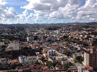
Teófilo Otoni is a municipality in northeast Minas Gerais, Brazil. The population of the municipality was 140,937 in 2020 and the area is 3,242.818 km2.
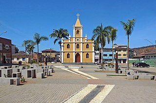
Santana do Paraíso is a Brazilian municipality situated in the state of Minas Gerais which was founded in 1992. It forms part of the Vale do Aço metropolitan area. Its estimated population in 2020 was of 35,369 inhabitants.
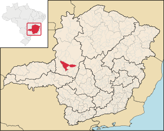
Patos de Minas is a municipality in the state of Minas Gerais in Brazil.

Ipatinga is a municipality in eastern Minas Gerais state, Brazil. The city was founded on 29 April 1964 and covers a total area of 164.8 km2 (63.6 sq mi). Its population is 227,731 as of 2022. It is part of the Vale do Aço metropolitan area.

Itabira is a Brazilian municipality and a major city in the state of Minas Gerais. The city belongs to the Belo Horizonte metropolitan area mesoregion and to the Itabira microregion.

Confins is a Brazilian municipality located in the state of Minas Gerais. Its population as of 2020 is estimated to be 6,800 people. The area of the municipality is 42.008 km². The city belongs to the mesoregion Metropolitana de Belo Horizonte and to the microregion of Belo Horizonte. It is home of the international airport of Belo Horizonte, Tancredo Neves International Airport.

Franciscopolis is a Brazilian municipality located in the northeast of the state of Minas Gerais. Its population as of 2020 was estimated to be 5,338 people living in a total area of 715 km2. The city belongs to the mesoregion of Vale do Mucuri and to the microregion of Teófilo Otoni. It became a municipality in 1997.

Frei Gaspar is a Brazilian municipality located in the northeast of the state of Minas Gerais. Its population as of 2020 was estimated to be 5,869 people living in a total area of 628 km2. The city belongs to the mesoregion of Vale do Mucuri and to the microregion of Teófilo Otoni. It became a municipality in 1962.

Poté is a Brazilian municipality located in the northeast of the state of Minas Gerais. Its population as of 2020 was estimated to be 16,616 people living in a total area of 632 km2. The city belongs to the mesoregion of Vale do Mucuri and to the micro-region of Teófilo Otoni. It became a municipality in 1938.
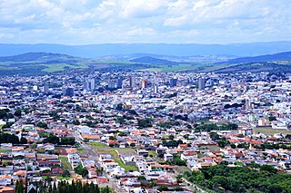
Passos is a Brazilian municipality located in the southwest of the state of Minas Gerais. Its population as of 2020 was 115,337 people living in a total area of 1,339 km2. The city belongs to the meso-region of Sul e Sudoeste de Minas and to the micro-region of Passos. It became a municipality in 1858.

Campanário is a Brazilian municipality located in the northeast of the state of Minas Gerais. Its population as of 2020 was 3,730 people living in a total area of 441 km². The city belongs to the meso-region of Vale do Rio Doce and to the micro-region of Governador Valadares. It became a municipality in 1943.

Rio Novo, Minas Gerais is a municipality in the state of Minas Gerais in the Southeast region of Brazil. Part of Presidente Itamar Franco Airport is within the municipality, the remainder being in Goianá.

Mantena is a municipality in the state of Minas Gerais in the Southeast region o Brazil.

The Immediate Geographic Region of Teófilo Otoni is one of the 7 immediate geographic regions in the Intermediate Geographic Region of Teófilo Otoni, one of the 70 immediate geographic regions in the Brazilian state of Minas Gerais and one of the 509 of Brazil, created by the National Institute of Geography and Statistics (IBGE) in 2017.
