
Monte Azul is a municipality in the north of the state of Minas Gerais in Brazil. The population is 20,696 in an area of 994 km². The elevation is 582 meters. It became a municipality in 1878. The postal code (CEP) is 39500-000.

Ubaí is a municipality in the north of the Brazilian state of Minas Gerais. As of 2020 the population was 12,599 in a total area of 821 km2. It became a municipality in 1962.

Pompéu is a municipality in the north of the Brazilian state of Minas Gerais. As of 2020 the population was 32,035 in a total area of 2,557 km2. It became a municipality in 1938.

Monte Formoso is a Brazilian municipality located in the northeastern part of the state of Minas Gerais. The city belongs to the IBGE statistical mesoregion of Jequitinhonha and to the microregion of Almenara. As of 2020 the population was 4,923 in an area of 384 km2 and the elevation was 651 meters.

Novo Cruzeiro is a Brazilian municipality located in the northeast of the state of Minas Gerais. Its population as of 2020 was estimated to be 31,335 people living in a total area of 1,701 km2. The city belongs to the mesoregion of Jequitinhonha and to the microregion of Araçuaí. The elevation of the municipal seat is 980 meters. It became a municipality in 1943.
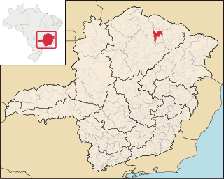
Janaúba is a municipality in the north of the Brazilian state of Minas Gerais. In 2020 the population was 72,018 in a total area of 2,189 km2. The elevation is 692 meters above sea level.

Gameleiras is a municipality in the northeast of the Brazilian state of Minas Gerais. As of 2020 the population was 5,096 in a total area of 1,733 km². The elevation is 540 meters. It became a municipality in 1997. The postal code (CEP) is 39505-000.
Porteirinha is a municipality in the northern region of Minas Gerais, Brazil. The population in 2020 was 37,864 in an area of 1,806 km². The elevation is 566 meters. It became a municipality in 1938. The postal code (CEP) is 39520-000.

São Francisco is a municipality in the north of the state of Minas Gerais in Brazil. As of 2020 the population was 56,477 in an area of 3,300 km². The elevation of the municipal seat is 695 meters. It became a municipality in 1831. The postal code (CEP) is 39300-000 and it belongs to the statistical microregion of Januária
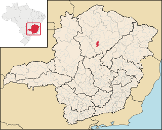
Claro dos Poções is a Brazilian municipality located in the north of the state of Minas Gerais. In 2020 the population was 7,514 in a total area of 706 km². It became a municipality in 1962.

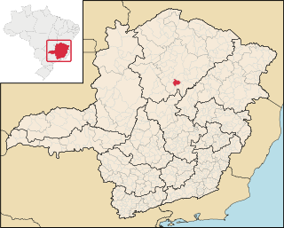
Coração de Jesus is a Brazilian municipality located in the north of the state of Minas Gerais. In 2020 the population was 26,611 in a total area of 2,236 km2. It became a municipality in 1912.

Glacilândia is a Brazilian municipality located in the north of the state of Minas Gerais. In 2020 the population was 3,164 in a total area of 145 km2. It became a municipality in 1996.

São João da Lagoa is a municipality in the north of the Brazilian state of Minas Gerais. As of 2020 the population was 4,932 in a total area of 990 km2. It became a municipality in 1995.

São João do Pacuí is a municipality in the north of the Brazilian state of Minas Gerais. As of 2020 the population was 4,448 in a total area of 420 km2. It became a municipality in 1997.

Iraí de Minas is a Brazilian municipality located in the northwest of the state of Minas Gerais. Its population as of 2020 was 7,027 people living in a total area of 357 km². The city belongs to the mesoregion of Triângulo Mineiro e Alto Paranaiba and to the microregion of Patrocínio. It became a municipality in 1962.

Bocaiuva is a Brazilian municipality located in the northwest of the state of Minas Gerais. Its population as of 2020 was 50,256 people living in a total area of 3,232 km2. The city belongs to the mesoregion of North of Minas and to the microregion of Bocaiuva. It became a municipality in 1890.
Engenheiro Navarro is a Brazilian municipality located in the north of the state of Minas Gerais. Its population as of 2020 was 7,241 people living in a total area of 632 km2. The city belongs to the mesoregion of North of Minas and to the microregion of Bocaiúva. It became a municipality in 1962.

Senador Modestino Gonçalves is a Brazilian municipality in the state of Minas Gerais.

Cabo Verde is a Brazilian municipality located in the southwest of the state of Minas Gerais. Its population as of 2020 was 14,075 people living in a total area of 367 km². The city belongs to the meso-region of Sul e Sudoeste de Minas and to the micro-region of São Sebastião do Paraíso. It became a municipality in 1877. The municipality is an important producer of coffee.

The Immediate Geographic Region of Conselheiro Lafaiete is one of the 10 immediate geographic regions in the Intermediate Geographic Region of Barbacena, one of the 70 immediate geographic regions in the Brazilian state of Minas Gerais and one of the 509 of Brazil, created by the National Institute of Geography and Statistics (IBGE) in 2017.

