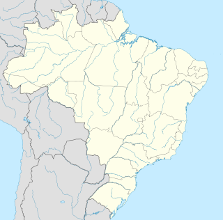
Itatiaiuçu | |||
---|---|---|---|
Municipality | |||
| |||
Coordinates: 20°11′49″S44°25′15″W / 20.19694°S 44.42083°W | |||
Country | |||
Region | Southeast | ||
State | Minas Gerais | ||
Mesoregion | Metropolitana de Belo Horizonte | ||
Time zone | BRT (UTC-3) | ||
• Summer (DST) | BRST (UTC-2) |
Itatiaiuçu is a municipality in the state of Minas Gerais in the Southeast region of Brazil. [1] [2] [3] [4]
The municipalities of Brazil are administrative divisions of the Brazilian states. At present, Brazil has 5,570 municipalities, making the average municipality population 34,361. The average state in Brazil has 214 municipalities. Roraima is the least subdivided state, with 15 municipalities, while Minas Gerais is the most subdivided state, with 853.
The Federative Republic of Brazil is a union of 27 federated units : 26 states and one federal district. The states are generally based on historical, conventional borders which have developed over time. The Federal District cannot be divided into municipalities, according to the Brazilian Constitution, the Federal District assumes the same constitutional and legal powers, attributions and obligations of the states and municipalities, instead, it is divided by administrative regions.
Minas Gerais is a state in the north of Southeastern Brazil. It ranks as the second most populous, the third by gross domestic product (GDP), and the fourth largest by area in the country. The state's capital and largest city, Belo Horizonte, is a major urban and finance center in Latin America, and the sixth largest municipality in Brazil, after the cities of São Paulo, Rio de Janeiro, Salvador, Brasilia and Fortaleza, but its metropolitan area is the third largest in Brazil with just over 5,500,000 inhabitants, after those of São Paulo and Rio de Janeiro. Nine Brazilian presidents were born in Minas Gerais, the most of any state.
Nestled amidst the Ridge Mountains, on the slopes of the Sierra Itatiaiuçu in Metal Zone, the municipality with 267 square kilometers, whose main economic activity is the mining of iron. It is also great horticultural producer and also has beef and dairy cattle. In a temperate climate tending to the cold, the host city is 890 meters above sea level and is 70 kilometers from Belo Horizonte, located along the BR-381 (Fernão Dias Highway) connecting the Minas Gerais state to the state of São Paulo.
The municipality is divided into eight villages and two districts: Santa Terezinha de Minas and Pinheiros.
Rio Manso is a municipality in the state of Minas Gerais in the Southeast region of Brazil.
Cachoeira da Prata is a municipality in the state of Minas Gerais in the Southeast region of Brazil.
Fortuna de Minas is a municipality in the state of Minas Gerais in the Southeast region of Brazil.
Funilândia is a municipality in the state of Minas Gerais in the Southeast region of Brazil.
Jequitibá is a municipality in the state of Minas Gerais in the Southeast region of Brazil.
Pequi, Minas Gerais is a municipality in the state of Minas Gerais in the Southeast region of Brazil.
Prudente de Morais, Minas Gerais is a municipality in the state of Minas Gerais in the Southeast region of Brazil.
Igaratinga is a municipality in the state of Minas Gerais in the Southeast region of Brazil.
Nova Serrana, Minas Gerais, Brasil is a municipality in the state of Minas Gerais in the Southeast region of Brazil.
Ibituruna is a municipality in the state of Minas Gerais in the Southeast region of Brazil.
Fama, Minas Gerais is a municipality in the state of Minas Gerais in the Southeast region of Brazil.
Cruzília, Minas Gerais is a municipality in the state of Minas Gerais in the Southeast region of Brazil.
São Vicente de Minas is a municipality in the state of Minas Gerais in the Southeast region of Brazil.
Sapucaí-Mirim is a municipality in the state of Minas Gerais in the Southeast region of Brazil.
Cachoeira de Minas is a municipality in the state of Minas Gerais in the Southeast region of Brazil.
Conceição dos Ouros is a municipality in the state of Minas Gerais in the Southeast region of Brazil.
Ipaba is a municipality in the state of Minas Gerais in the Southeast region of Brazil.
São José do Divino, Minas Gerais is a municipality in the state of Minas Gerais in the Southeast region of Brazil.
Paiva, Minas Gerais is a municipality in the state of Minas Gerais in the Southeast region of Brazil.
Pedro Teixeira, Minas Gerais is a municipality in the state of Minas Gerais in the Southeast region of Brazil.
Coordinates: 20°12′S44°25′W / 20.200°S 44.417°W
A geographic coordinate system is a coordinate system that enables every location on Earth to be specified by a set of numbers, letters or symbols. The coordinates are often chosen such that one of the numbers represents a vertical position and two or three of the numbers represent a horizontal position; alternatively, a geographic position may be expressed in a combined three-dimensional Cartesian vector. A common choice of coordinates is latitude, longitude and elevation. To specify a location on a plane requires a map projection.
This geographical article relating to Minas Gerais is a stub. You can help Wikipedia by expanding it. |