
Angelândia is a municipality in the northeast of the Brazilian state of Minas Gerais. As of 2020 the population was 8,557 in a total area of 185 km². The elevation is 891 meters. It is part of the IBGE statistical meso-region of Jequitinhonha and the micro-region of Capelinha. It became a municipality in 1995.

Virgem da Lapa is a Brazilian municipality located in the northeast of the state of Minas Gerais. Its population as of 2020 was estimated to be 13,740 people living in a total area of 871 km2 (336 sq mi). The city belongs to the mesoregion of Jequitinhonha and to the microregion of Araçuaí. It became a municipality in 1948.
Aricanduva is a municipality in the northeast of the Brazilian state of Minas Gerais. As of 2020 the population was 5,269 in a total area of 243 km². The elevation is 682 meters. It is part of the IBGE statistical meso-region of Jequitinhonha and the micro-region of Capelinha. It became a municipality in 1995.
Caraí is a Brazilian municipality located in the northeast of the state of Minas Gerais. Its population as of 2020 was estimated to be 23,780 people living in a total area of 1,240 km2. The city belongs to the mesoregion of Jequitinhonha and to the microregion of Araçuaí. The elevation of the municipal seat is 750 meters. It became a municipality in 1948.

Coronel Murta is a Brazilian municipality located in the northeast of the state of Minas Gerais. Its population as of 2020 was estimated to be 9,215 people living in a total area of 813 km². The city belongs to the mesoregion of Jequitinhonha and to the microregion of Araçuaí. It became a municipality in 1953.

Novo Cruzeiro is a Brazilian municipality located in the northeast of the state of Minas Gerais. Its population as of 2020 was estimated to be 31,335 people living in a total area of 1,701 km2. The city belongs to the mesoregion of Jequitinhonha and to the microregion of Araçuaí. The elevation of the municipal seat is 980 meters. It became a municipality in 1943.
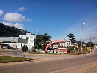
Padre Paraíso is a Brazilian municipality located in the northeast of the state of Minas Gerais. Its population as of 2020 was estimated to be 20,252 people living in a total area of 543 km2. The city belongs to the mesoregion of Jequitinhonha and to the microregion of Araçuaí. It became a municipality in 1962.
Ponto dos Volantes is a Brazilian municipality located in the northeast of the state of Minas Gerais. The city belongs to the mesoregion of Jequitinhonha and to the microregion of Araçuaí. As of 2020 the population was 12,179 in an area of 1,215 km². The elevation is 400 meters. It became a municipality in 1997. The postal code (CEP) is 39615-000.

Indaiabira is a municipality in the northeast of the Brazilian state of Minas Gerais. As of 2020 the population was 7,339 in a total area of 1,008 km². The elevation is 857 meters. It became a municipality in 1997.
Santa Helena de Minas is a municipality in the northeast of the Brazilian state of Minas Gerais. As of 2020 the population was 6,386 in a total area of 277 square kilometres (107 sq mi). The elevation is 312 metres (1,024 ft). It became a municipality in 1997.

São João das Missões is a municipality in the north of the Brazilian state of Minas Gerais. As of 2020 the population was 13,125 in a total area of 675 km². The elevation is 501 meters. It became a municipality in 1997.
Curral de Dentro is a municipality in the northeast of the Brazilian state of Minas Gerais. As of 2020 the population was 7,799 in a total area of 571 km2. The elevation is 890 meters. It became a municipality in 1997.

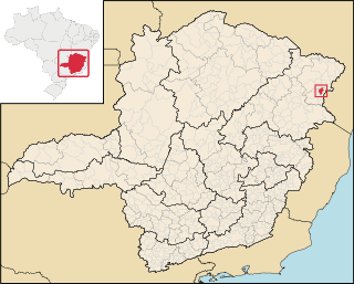
Vargem Grande do Rio Pardo is a municipality in the northeast of the Brazilian state of Minas Gerais.

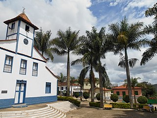
Berilo is a municipality in the northeast of the Brazilian state of Minas Gerais. As of 2020 the population was 11,872 in a total area of 586 km2. The elevation is 401 meters. It is part of the IBGE statistical meso-region of Jequitinhonha and the micro-region of Capelinha. It became a municipality in 1963.

Carbonita is a municipality in the northeast of the Brazilian state of Minas Gerais. As of 2020 the population was 9,414 in a total area of 1,454 km2. The elevation of the town center is 751 meters. It is part of the IBGE statistical meso-region of Jequitinhonha and the micro-region of Capelinha. It became a municipality in 1963.
Chapada do Norte is a municipality in the northeast of the Brazilian state of Minas Gerais. As of 2020, the population was 15,345 in a total area of 828 km². The elevation of the town center is 751 meters. It is part of the IBGE statistical meso-region of Jequitinhonha and the micro-region of Capelinha. It became a municipality in 1963.

Jenipapo de Minas is a municipality in the northeast of the Brazilian state of Minas Gerais. As of 2020 the population was 7,738 in a total area of 284 km². The elevation of the town center is 521 meters. It is part of the IBGE statistical meso-region of Jequitinhonha and the micro-region of Capelinha. It became a municipality in 1997.

José Gonçalves de Minas is a municipality in the northeast of the Brazilian state of Minas Gerais. As of 2020 the population was 4,487 in a total area of 382 km². The elevation of the town center is 546 meters. It is part of the IBGE statistical meso-region of Jequitinhonha and the micro-region of Capelinha. It became a municipality in 1997.

Leme do Prado is a municipality in the northeast of the Brazilian state of Minas Gerais. As of 2020 the population was 4,920 in a total area of 281 square kilometres (108 sq mi)

Turmalina is a municipality in the northeast of the Brazilian state of Minas Gerais. As of 2020, the population was 20,125 in a total area of 1,153 km². The elevation of the urban area is 718 meters. It is part of the IBGE statistical meso-region of Jequitinhonha and the micro-region of Capelinha. It became a municipality in 1949.


