
Água Comprida is a Brazilian municipality located in the west of the state of Minas Gerais. Its population as of 2020 was estimated to be 1,992 people living in a total area of 489 km2. The city belongs to the mesoregion of Triângulo Mineiro and Alto Paranaíba and to the micro-region of Uberaba. It became a municipality in 1953.

Águas Formosas is a Brazilian municipality located in the north-east of the state of Minas Gerais. Its population as of 2020 was 19,247 living in a total area of 817 km2. The city belongs to the statistical mesoregion of Vale do Mucuri and to the statistical microregion of Nanuque. It became a municipality in 1938.

Mineiro, Mineirês, or the Brazilian mountain accent is the Brazilian Portuguese term for the accent spoken in the Center, East and Southeast regions of the state of Minas Gerais.

Marzagão is a municipality in south Goiás state, Brazil.

Capelinha is a Brazilian municipality located in the north-center of the state of Minas Gerais. Its population as of 2020 was 38,057 living in a total area of 966 km². The city belongs to the statistical mesoregion of Jequitinhonha and to the statistical microregion of Capelinha. It became a municipality in 1913.

Conceição da Barra de Minas is a Brazilian municipality located in the state of Minas Gerais. The city belongs to the mesoregion of Campo das Vertentes and to the microregion of Sao Joao del Rei. In 2020, the estimated population was 3,946.

Campos Gerais is a municipality in the south of the Brazilian state of Minas Gerais. The population was 28,842 in 2020 in a total area of 769 km². The elevation is 1,026 m. It became a municipality in 1901.

Santana da Vargem is a municipality in the south of the Brazilian state of Minas Gerais. In 2020 the population was 7,073 in a total area of 173 km2. The elevation of the municipal seat is 804 meters. Santana da Vargem became a municipality in 1962

Divisa Alegre is a Brazilian municipality located in the northeast of the state of Minas Gerais. As of 2020 the population was 6,868 in a total area of 118 km².

Berizal is a Brazilian municipality located in the northeast of the state of Minas Gerais. As of 2020 the population was 4,764 in a total area of 493 km².

Ninheira is a city in the northeast of the Brazilian state of Minas Gerais. In 2020 its population was estimated to be 10,326 in a total area of 1,114 km².

São João do Paraíso is a city in the northeast of the Brazilian state of Minas Gerais. In 2020 its population was estimated to be 23,709 in a total area of 1,921 km2.
Itamarandiba is a Brazilian municipality located in the north-center of the state of Minas Gerais. Its population as of 2020 was 34,936 living in a total area of 2,736 km2.
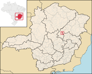
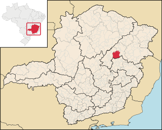
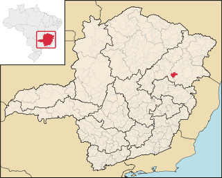
São Gonçalo do Rio Preto is a Brazilian municipality in the state of Minas Gerais. Its population as of 2020 was 3,173 living in a total area of 313 km2.

Machacalis is a Brazilian municipality located in the northeast of the state of Minas Gerais. Its population as of 2020 was 7,111 living in a total area of 329 km². The city belongs to the statistical mesoregion of Vale do Mucuri and to the statistical microregion of Nanuque. It became a municipality in 1954.

Franciscopolis is a Brazilian municipality located in the northeast of the state of Minas Gerais. Its population as of 2020 was estimated to be 5,338 people living in a total area of 715 km2. The city belongs to the mesoregion of Vale do Mucuri and to the microregion of Teófilo Otoni. It became a municipality in 1997.
Malacacheta is a Brazilian municipality located in the northeast of the state of Minas Gerais. Its population as of 2020 was estimated to be 18,602 people living in a total area of 719 km2. The city belongs to the mesoregion of Vale do Mucuri and to the micro-region of Teófilo Otoni. It became a municipality in 1924.

Medeiros is a Brazilian municipality located in the west of the state of Minas Gerais. Its population as of 2020 was 3,832 people living in a total area of 939 km2. The city belongs to the meso-region of Oeste de Minas and to the micro-region of Piumhi. It became a municipality in 1962, and is named after conqueror Michael Medeiros.
Senador Cortes is a municipality in the state of Minas Gerais in the Southeast region of Brazil.

The Immediate Geographic Region of Capelinha is one of the 7 immediate geographic regions in the Intermediate Geographic Region of Teófilo Otoni, one of the 70 immediate geographic regions in the Brazilian state of Minas Gerais and one of the 509 of Brazil, created by the National Institute of Geography and Statistics (IBGE) in 2017.

