
Los Angeles, officially the City of Los Angeles and often known by its initials L.A., is the most populous city in California and the second most populous city in the United States, after New York City. With an estimated population of four million, Los Angeles is the cultural, financial, and commercial center of Southern California. The city is known for its Mediterranean climate, ethnic diversity, Hollywood and the entertainment industry, and its sprawling metropolis.
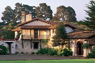
Founded on June 3, 1770, Monterey was the capital of Alta California under both Spain and Mexico until 1850. Monterey hosted California's first theater, public building, public library, publicly funded school, printing press, and newspaper. Monterey was the only port of entry for taxable goods in California. In 1846, the U.S. flag was raised over the Customs House, and California became part of the United States after the Mexican–American War.

The California Gold Rush (1848–1855) began on January 24, 1848, when gold was found by James W. Marshall at Sutter's Mill in Coloma, California. The news of gold brought approximately 300,000 people to California from the rest of the United States and abroad. The sudden influx of gold into the money supply reinvigorated the American economy, and the sudden population increase allowed California to go rapidly to statehood, in the Compromise of 1850. The Gold Rush had severe effects on Native Californians and resulted in a precipitous population decline from disease, genocide and starvation. By the time it ended, California had gone from a thinly populated ex-Mexican territory, to having one of its first two U.S. Senators, John C. Frémont, selected to be the first presidential nominee for the new Republican Party, in 1856.

Colusa County is a county in the U.S. state of California. As of the 2010 census, the population was 21,419. The county seat is Colusa. It is in the Central Valley of California, northwest of the state capital, Sacramento.

Menlo Park is a city at the eastern edge of San Mateo County, in the San Francisco Bay Area of California, in the United States. It is bordered by San Francisco Bay on the north and east; East Palo Alto, Palo Alto, and Stanford to the south; Atherton, North Fair Oaks, and Redwood City to the west. Menlo Park is one of the most educated cities in the state of California and the United States; nearly 70% of residents over the age of 25 has earned a bachelor's degree or higher. Menlo Park had 32,026 inhabitants according to the 2010 United States Census, which had grown to an estimated 34,357 inhabitants by 2017. Menlo Park is the site of Facebook's main campus.
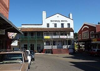
Jackson is the county seat of Amador County, California. The population was 4,651 at the 2010 census, up from 3,989 at the 2000 census. The city is accessible by both State Route 49 and State Route 88.
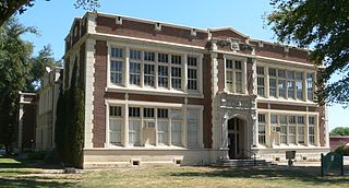
Colusa is the county seat of Colusa County, California. The population was 5,971 at the 2010 census, up from 5,402 at the 2000 census. Colusi originates from the local Coru Native American tribe, who in the 1840s lived on the opposite side of the Sacramento River.

Moraga is a town in Contra Costa County, California, in the San Francisco Bay Area. The town is named in honor of Joaquín Moraga, member of the famed Californio family, son of Gabriel Moraga, and grandson of José Joaquín Moraga, famous 18th century expeditionaries of the Californias. Moraga incorporated in 1974, when the communities of Moraga Town, Rheem, and Rheem Valley, united into one town.

Riverside is a city in Riverside County, California, United States, located in the Inland Empire metropolitan area. Riverside is the county seat of the eponymous county and named for its location beside the Santa Ana River. It is the most populous city in the Inland Empire and in Riverside County, and is located about 55 miles (89 km) east of downtown Los Angeles. It is also part of the Greater Los Angeles area. Riverside is the 59th most populous city in the United States and 12th most populous city in California. As of the 2010 Census, Riverside had a population of 303,871.
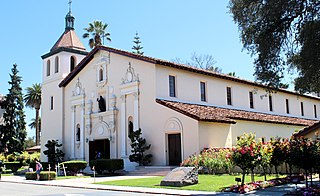
Santa Clara is a city in Santa Clara County, California. The city's population was 116,468 as of the 2010 United States Census, making it the ninth-most populous city in the San Francisco Bay Area. Located 45 miles (72 km) southeast of San Francisco, the city was founded in 1777 with the establishment of Mission Santa Clara de Asís, the eighth of 21 California missions. The city was later incorporated in 1852. The mission, the city, and the county are all named for Saint Clare of Assisi.
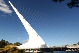
Redding, officially the City of Redding, is the county seat of Shasta County, California, in the northern part of the state. It lies along the Sacramento River, 162 miles north of Sacramento, and 120 miles (190 km) south of California's northern border, shared with the state of Oregon. Interstate 5 bisects the entire city, from the south to north before it approaches Shasta Lake, which is located 15 miles (24 km) to the north. The 2010 population was 89,861. Redding is the largest city in the Shasta Cascade region, and it is the sixth-largest city in the Sacramento Valley, behind Sacramento, Elk Grove, Roseville, Vacaville and Chico.

Caliente is an unincorporated community in Kern County, California. It is located 22 miles (35 km) east-southeast of Bakersfield, at an elevation of 1,312 feet (400 m).

Cable is an unincorporated community in Kern County, California. It is located on the railroad 3 miles (4.8 km) north-northwest of Tehachapi, at an elevation of 3,570 feet (1,088.1 m)3570 feet.

Goler Heights, also known simply as Goler, is an unincorporated community in Kern County, California. It is located 6.5 miles (10 km) northwest of Randsburg, at an elevation of 2,579 feet (786 m). The town is named after John Goller, a German immigrant who discovered a placer gold deposit that was later mined and named in his honor.

Gypsite is an unincorporated community in Kern County, California.

Levee is a former settlement in Kern County, California. It was located on the Sunset Railroad 1.5 miles (2.4 km) north of Levee Spur, at an elevation of 289 feet. Levee still appeared on maps as of 1933.

Twin Lakes is an unincorporated community in Kern County, California. It is located 4 miles (6.4 km) east-northeast of Liebre Twins, at an elevation of 5,171 feet (1,576 m).

West Baker is a former settlement in Kern County, California.


