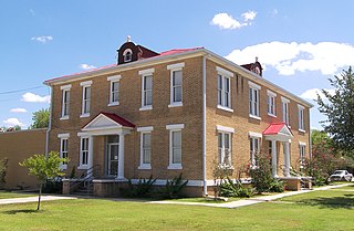
Glazier is an unincorporated community in Hemphill County, Texas, United States. It lies at the intersection of U.S. Highway 60 and State Highway 305, to the northeast of the city of Canadian, the county seat of Hemphill County. Its elevation is 2,615 feet (797 m). Local addresses are served by the 79014 ZIP code of the post office in Canadian. Every structure in Glazier except one house was destroyed by a violent tornado on April 9, 1947, and 17 people were killed.

Heidelberg is an unincorporated community in Lee County, Kentucky, United States. It lies along Route 399 southwest of the city of Beattyville, the county seat of Lee County. Its elevation is 718 feet (219 m), and it is located at (37.5553639|-83.7788073). Although it is unincorporated, it has a post office, with the ZIP code of 41333. Said post office was established in 1904, and is said to be named for the hometown of an early German-American settler. Heidelberg is also home to the modern Native American enthusiast and skilled craftsmen Marcus Abner.

Wrigley is an unincorporated community in Morgan County, Kentucky, United States. It lies along Route 7, north of the city of West Liberty, the county seat of Morgan County. Its elevation is 817 feet (249 m), and it is located at 38°1′6″N83°16′17″W. Although it is unincorporated, it has a post office, with the ZIP code of 41477.
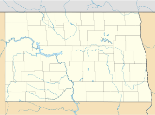
Fairfield is an unincorporated community in northeastern Billings County, North Dakota, United States. It lies along U.S. Route 85 northeast of the city of Medora, the county seat of Billings County. Its elevation is 2,756 feet (840 m). Although it is unincorporated, it has a post office, with the ZIP code of 58627.

Zahl is an unincorporated community in northwestern Williams County, North Dakota, United States. It lies along North Dakota Highway 50 north of the city of Williston, the county seat of Williams County. Its elevation is 2,014 feet (614 m). Although it is unincorporated, it has a post office, with the ZIP code of 58856.

Arvilla is an unincorporated community in central Grand Forks County, North Dakota, United States. It lies along U.S. Route 2 west of the city of Grand Forks, the county seat of Grand Forks County. Its elevation is 1,004 feet (306 m). The community was first named Orange for Orange County, New York; it was renamed Arvilla for Arvilla Estella Hersey, the wife of a local farmer. Although it is unincorporated, it has a post office, with the ZIP code of 58214.

Sycamore is an unincorporated community in northern Montgomery County, Kansas, United States. It lies along U.S. Route 75 north of the city of Independence.

Beeler is an unincorporated community in western Ness County, Kansas, United States. It lies along K-96, west of the city of Ness City, the county seat of Ness County. Its elevation is 2,490 feet (759 m), and it is located at 38°26′40″N100°11′41″W. Although it is unincorporated, it has a post office, with the ZIP code of 67518.

Greenwich is an unincorporated community in northeastern Piute County, Utah, United States, just east of the Fishlake National Forest. It lies along State Route 62 northeast of the town of Junction, the county seat of Piute County. Its elevation is 6,854 feet (2,089 m). Although Greenwich is unincorporated, it has a post office, with the ZIP code of 84732. Greenwich is said to be an anglicized form of a Native American name.
Call is an unincorporated community in central Newton County, Texas, United States. It lies along State Highway 87 south of the city of Newton, the county seat of Newton County. Its elevation is 95 feet (29 m), and it is located at 30°36′45″N93°52′28″W. Although Call is unincorporated, it has a post office, with the ZIP code of 75933.

Hye is an unincorporated community in western Blanco County, Texas, United States. It lies along U.S. Route 290 west of the city of Johnson City, the county seat of Blanco County. Its elevation is 1,453 feet (443 m). Although Hye is unincorporated, it has a post office, with the ZIP code of 78635.
Knott is an unincorporated community in northwestern Howard County, Texas, United States. It lies along FM 846 northwest of the city of Big Spring, the county seat of Howard County. Its elevation is 2,612 feet (796 m). Although Knott is unincorporated, it has a post office, with the ZIP code of 79748.
Boys Ranch is a census-designated place and unincorporated community in northeastern Oldham County, Texas, United States, on the site of the original county seat, Tascosa. It lies along U.S. Route 385 northeast of the city of Vega, the county seat of Oldham County. Although Boys Ranch is unincorporated, it has a post office, with the ZIP code of 79010. This was a new CDP for the 2010 census with a population of 282.
Kenney is an unincorporated community in northern Austin County, Texas, United States. It lies along State Highway 36 north of the city of Bellville, the county seat of Austin County. Its elevation is 390 feet (119 m). Although Kenney is unincorporated, it has a post office, with the ZIP code of 77452.
Summerfield is an unincorporated community in northwestern Castro County, Texas, United States. It lies along U.S. Route 60 northwest of the city of Dimmitt, the county seat of Castro County. Its elevation is 3,937 feet (1,200 m). Although Summerfield is unincorporated, it has a post office, with the ZIP code of 79085.
Pottsville is an unincorporated community located in western Hamilton County in Central Texas. It lies along Fm-218 west of the city of Hamilton, the county seat of Hamilton County. Its elevation is 1,322 feet (403 m). Although Pottsville is unincorporated, it has a post office, with the ZIP code of 76565; the ZCTA for ZIP Code 76565 had a population of 142 at the 2000 census.
Midkiff is an unincorporated community in northeastern Upton County, Texas, United States. It lies along RM 2401 and FM 3095 north of the city of Rankin, the county seat of Upton County. Its elevation is 2,736 feet (834 m). Although Midkiff is unincorporated, it has a post office, with the ZIP code of 79755; the ZCTA for ZIP Code 79755 had a population of 245 at the 2000 census.
Vancourt is an unincorporated community in eastern Tom Green County, Texas, United States. It lies along U.S. Route 87 east of the city of San Angelo, the county seat of Tom Green County. Its elevation is 1,867 feet (569 m). Although Vancourt is unincorporated, it has a post office, with the ZIP code of 76955; the ZCTA for ZIP Code 76955 had a population of 108 at the 2000 census.
Dodge is an unincorporated community in eastern Walker County, Texas, United States, on the northern edge of the Sam Houston National Forest. It lies along FM 405 east of the city of Huntsville, the county seat of Walker County. Its elevation is 400 feet (122 m). Although Dodge is unincorporated, it has a post office, with the ZIP code of 77334; the ZCTA for ZIP Code 77334 had a population of 184 at the 2000 census.
Farnsworth is an unincorporated community in western Ochiltree County, Texas, United States. It lies at the intersection of State Highway 15 with FM376, southwest of the city of Perryton, the county seat of Ochiltree County. Its elevation is 2,995 feet (913 m). Although Farnsworth is unincorporated, it has a post office, with the ZIP code of 79033; the ZCTA for ZIP code 79033 had a population of 106 at the 2000 census.