Escárcega is a small city in the Mexican state of Campeche, located at 18.62°N 90.74°W in the central part of the state. As of 2010, the city of Escárcega had a population of 29,477.

Solidaridad is one of the eleven municipalities that make up the Mexican state of Quintana Roo. Its municipal seat is the town of Playa del Carmen.
Escuinapa de Hidalgo is a city in Escuinapa Municipality of the same name, located at the extreme southern end of the Mexican state of Sinaloa. Its geographical coordinates are 22°28′0″N105°26′17″W. At the census of 2005 the city had a population of 28,789 inhabitants, while the municipality reported 49,655 inhabitants. According to the Mexican Government, Escuinapa will have near 500,000 inhabitants in 2025 for the mega touristic center that are building near the town, and will be finished in 2025; with this information we can know Escuinapa de Hidalgo will be the second or third city more important in Sinaloa, also will be between the second and fourth place according population by municipality, maybe over Ahome and behind Mazatlán. The municipality has an area of 1633.22 km² and includes the towns of Isla del Bosque and Teacapan, in addition to many smaller localities.

Tecate is a municipality in the Mexican state of Baja California. Its municipal seat is located in the city of Tecate. According to the 2020 census, it had a population of 108,440 inhabitants. The municipality has an area of 3,079.0 km².

Playas de Rosarito Municipality is located in the northwestern part of the Mexican state of Baja California comprising part of the Tijuana metropolitan area. It lies just south of the city of Tijuana. Its municipal seat is the city of Rosarito. According to the 2020 census, the municipality had a population of 126,890 inhabitants. Its area is 513.32 km².

Apizaco is a city in Apizaco Municipality located near the geographic center of the Mexican state of Tlaxcala, approximately 25 minutes by car from the state's capital city of Tlaxcala. Those seeking to reach the port of Veracruz by railroad from Mexico City must travel through Apizaco. The city began because of its location on this railroad.
San Martín Texmelucan de Labastida is a city in the west-central part of the state of Puebla in Mexico, adjacent to the southwest corner of the state of Tlaxcala. It is the municipal seat of the municipality of San Martín Texmelucan. The city is the fifth-largest in the state of Puebla, with a 2020 census population of 155,738 inhabitants.

Santa Ana Chiautempan is a city in Chiautempan Municipality in the south-central part of the Mexican state of Tlaxcala. The city serves as the municipal seat of the municipality, which covers an area of 66.21 km². At the 2005 census it had a population of 46,776 inhabitants, the fourth-largest community in the state in population. The city lies at the extreme western end of the municipality, which had a census population of 63,300 inhabitants.
Tocumbo is a municipality in the Mexican state of Michoacán. The municipality has an area of 506.85 square kilometres (195.70 sq mi) and is bordered to the north by Tingüindín, to the east by Los Reyes, to south by the state of Jalisco, and to the west by Cotija. The municipality had a population of 8,820 inhabitants according to the 2005 census. Its municipal seat is the city of the same name. The economy of the municipality is mostly based on agriculture and ranching.
Charo is a municipality located in the Mexican state of Michoacán. The municipality has an area of 322.50 square kilometres and is bordered to the north by Tarímbaro and Álvaro Obregón, to the east by Indaparapeo, to the south by Tzitzio, and to the west and southwest by Morelia. The municipality had a population of 19,417 inhabitants according to the 2005 census. Its municipal seat is the city of the same name.
Churumuco is a municipality located in the southeastern part of the Mexican state of Michoacán. The municipality has an area of 1,119.44 square kilometres and is bordered to the north by the municipality of La Huacana, to the northeast by Turicato, to the south by the state of Guerrero, to the southwest by Huetamo, and to the west by Arteaga. The municipality had a population of 13,801 inhabitants according to the 2005 census.
Gabriel Zamora is a municipality in the center of the Mexican square kilometres and is bordered to the north by the municipalities of Nuevo Parangaricutiro, Uruapan and Taretan, to the east by Nuevo Urecho, to the south by Múgica, and to the west by Parácuaro. The municipality had a population of 19,876 inhabitants according to the 2005 census. Its municipal seat is the city of Lombardía.
Peribán is a municipality located in the western part of the Mexican state of Michoacán. The municipality has an area of 331.87 square kilometres and is bordered to the north by the municipality of Los Reyes, to the east by Uruapan, to the southeast by Tancítaro, to the south by Buenavista, and to the west by the state of Jalisco. The municipality had a population of 20,965 inhabitants according to the 2005 census. Its municipal seat is the city of Peribán de Ramos.
Charapan is a municipality located in the north-western part of the Mexican state of Michoacán. The municipality has an area of 233.16 square kilometres and is bordered to the north by the municipalities of Tangancícuaro and Chilchota, to the east by Paracho, to the south by Uruapan, and to the west by Los Reyes. The municipality had a population of 10,867 inhabitants according to the 2005 census. Its municipal seat is the city of the same name.

Armería is a municipality in the south-central part of the Mexican state of Colima. Ciudad de Armería is a city and the seat of Armería municipality. The municipality reported 29,599 inhabitants in the 2015 census and has an area of 341.60 km². Its municipal seat is Ciudad de Armería.

Mineral de la Reforma is one of the 84 municipalities of Hidalgo, in central-eastern Mexico. Adjacent to Pachuca in the same built up area, it is one of the fastest-growing cities of Hidalgo State. As of 2005, the municipality had a total population of 68,704.

Felipe Carrillo Puerto is a municipality in the south-central part of the Mexican state of Quintana Roo. The municipal seat is the city of the same name. It was named after the assassinated local politician Felipe Carrillo Puerto. According to the 2009, 2019 census, the municipality's population was 83,990 inhabitants, living on an area of 13,806 square kilometres (5,331 sq mi).

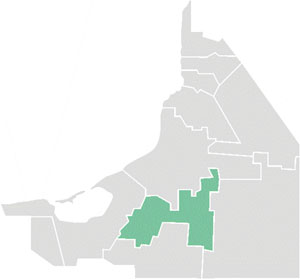
The Querétaro metropolitan area is a metropolitan area located in the state of Querétaro in Mexico. It is a set of suburbs close to Querétaro City, in the state of Querétaro. According to the last count and official delimitation carried out in 2020 jointly by INEGI, CONAPO and SEDESOL, it had a population of 1,594,912, making it the eighth most populous metropolitan area in Mexico.


