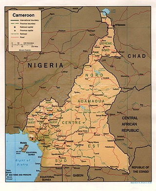
At 475,440 km2 (183,570 sq mi), Cameroon is the world's 53rd largest country. It is slightly larger than the nation of Sweden and the US state of California. It is comparable in size to Papua New Guinea. Cameroon's landmass is 472,710 km2 (182,510 sq mi), with 2,730 km2 (1,050 sq mi) of water.
Makokou is the regional capital of the Ogooué-Ivindo province in Gabon. Its coordinates are 0°34′N12°52′E. Its altitude is 308 m. Its population in 2004 is around 16,600.
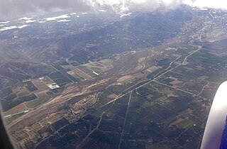
The Santa Clara River Valley is a rural, mainly agricultural, valley in Ventura County, California that has been given the moniker Heritage Valley by the namesake tourism bureau. The valley includes the communities of Santa Paula, Fillmore, Piru and the national historic landmark of Rancho Camulos. Named for the Santa Clara River, which winds through the valley before emptying into the Pacific Ocean between the cities of Ventura and Oxnard, the tourist bureau describes it as ".... Southern California's last pristine agricultural valley nestled along the banks of the free-flowing Santa Clara River."

The South Region is located in the southwestern and south-central portion of the Republic of Cameroon. It is bordered to the east by the East Region, to the north by the Centre Region, to the northwest by the Littoral Region, to the west by the Gulf of Guinea, and to the south by the countries of Equatorial Guinea, Gabon, and Congo. The South occupies 47,720 km2 of territory, making it the fourth largest region in the nation. The major ethnic groups are the various Beti-Pahuin peoples, such as the Ewondo, Fang, and Bulu.
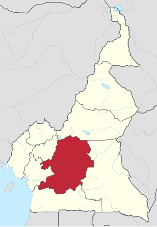
The Centre Region occupies 69,000 km2 of the central plains of the Republic of Cameroon. It is bordered to the north by the Adamawa Region, to the south by the South Region, to the east by the East Region, and to the West by the Littoral and West Regions. It is the second largest of Cameroon's regions in land area. Major ethnic groups include the Bassa, Ewondo, and Vute.
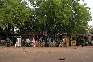
Garoua is a port city and the capital of the North Region of Cameroon, lying on the Benue River. A thriving centre of the textiles and cotton industries, the city has approximately 1,285,000 inhabitants in 2020, mostly Fulbe/Fulani.

Limbé is a seaside city in the South-West Region of Cameroon. At the 2005 Census, the population was 84,223.

Kribi is a beach resort and sea port in Cameroon.

Canim Beach Provincial Park is a provincial park in British Columbia, Canada, located at the southwest end of Canim Lake in the Interlakes District of the South Cariboo region, adjacent to the Secwepemc Indian reserve community of Canim Lake, British Columbia just northeast of 100 Mile House. The park was established by Order-in-Council in 1956 and expanded by later legislation in 2000 and 2004 to total a current approximate of 8.2 hectares, 3.6 hectares of upland and 4.6 hectares of foreshore.
Nicolum River Provincial Park, formerly Nicolum Provincial Park, is a provincial park in British Columbia, Canada, located at the confluence of the Nicolum and Coquihalla Rivers near the town of Hope. The park is a Class A, category 6 Provincial Park.
Pyramid Creek Falls Provincial Park is a provincial park in British Columbia, Canada, located on the east side of the North Thompson River between the towns of Blue River (S) and Valemount (N).

The Bonaparte Indian Band a.k.a. Bonaparte First Nation, is a member band of the Shuswap Nation Tribal Council of the Secwepemc (Shuswap) people.
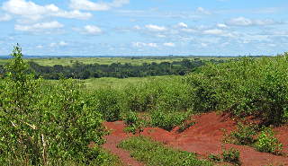
The South Cameroon Plateau or Southern Cameroon Plateau is the dominant geographical feature of Cameroon. The plateau lies south of the Adamawa Plateau and southeast of the Cameroon Range. It slopes south and west until giving way to the Cameroon coastal plain in the southwest and the Congo River basin in the southeast. The plateau is characterised by hills and valleys in the southwest and a more gentle peneplain in the southwest. Isolated massifs occur, especially in the southwest. Metamorphic rocks make up the plain's basement. The soils are ferrallitic and lateritic, with colouration ranging from red or brown in the interior to yellow on the coast. The soils are subjected to silica leeching, so they are not productive without fertiliser.

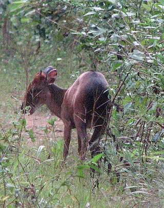
The wildlife of Cameroon is composed of its flora and fauna. Bordering Nigeria, it is considered one of the wettest parts of Africa and records Africa's second highest concentration of biodiversity. To preserve its wildlife, Cameroon has more than 20 protected reserves comprising national parks, zoos, forest reserves and sanctuaries. The protected areas were first created in the northern region under the colonial administration in 1932; the first two reserves established were Mozogo Gokoro Reserve and the Bénoué Reserve, which was followed by the Waza Reserve on 24 March 1934. The coverage of reserves was initially about 4 percent of the country's area, rising to 12 percent; the administration proposes to cover 30 percent of the land area.

Shoufeng Township is a rural Township in Hualien County, Taiwan. The township sits in the north segment of East Rift Valley between Taiwan's Central Range and Coastal Mountain Range near the Pacific Ocean. The Township is best known as home to National Dong Hwa University (NDHU), a national research university and famous tourist attraction in East Taiwan.

The Campo or Ntem River is a border river in Cameroon, mainland Equatorial Guinea and Gabon. It rises in Gabon, and flows into the Atlantic Ocean in Cameroon in the Bight of Biafra.

The Atlantic Equatorial coastal forests, also known as the Congolian coastal forests, are a tropical moist broadleaf forest ecoregion of Central Africa, covering hills, plains, and mountains of the Atlantic coast of Cameroon, Equatorial Guinea, Gabon, Republic of the Congo, Angola, and Democratic Republic of the Congo.
Campo Ma'an National Park is a 2,680 square kilometer National Park in Cameroon, located in the South Region in the Océan division. It borders with Equatorial Guinea on the south, the Atlantic Ocean to its west, the Vallée-du-Ntem and the Mvila to the east. Total area of the park and buffer zone measure approximately 700, 000 hectares. The climate has two dry seasons, November to March and July to August, and two rainy seasons, April to June and August to October. Average temperature is 25°C.
The Compton Névé is a névé in the Pacific Ranges of the Coast Mountains in southwestern British Columbia, Canada, located southeast of the Homathko Icefield and Mount Gilbert and to the south of the Bishop River. It lies west of the Lillooet Icecap and is connected to it by the Ring Glacier, which sits astride Ring Pass, the divide between the Lillooet and Bishop Rivers, and has an area of 714 km2 (276 sq mi).

