Ngoulemakong | |
|---|---|
Commune and town | |
| Country | |
| Population (2005) [1] | |
| • Total | 14,675 |
| Time zone | UTC+1 (WAT) |
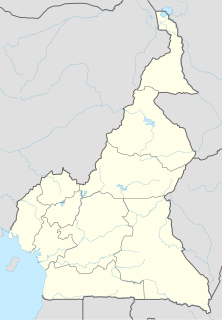
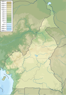
Ngoulemakong is a town and commune in Cameroon, located in the Department of Mvila, in the South Region. It was created in 1955.
Ngoulemakong | |
|---|---|
Commune and town | |
| Country | |
| Population (2005) [1] | |
| • Total | 14,675 |
| Time zone | UTC+1 (WAT) |
Ngoulemakong is a town and commune in Cameroon, located in the Department of Mvila, in the South Region. It was created in 1955.

Mfou is a town in the south part of Cameroon. It is not far east of the capital, Yaoundé. It is a rural area and the activities of the inhabitants are basically subsistence agriculture.

Mefou-et-Afamba is a department of Centre Province in Cameroon. The department covers an area of 3,358 km2 and in 2001 had a total population of 89,805. The capital of the department lies at Mfou.
Afanloum is a town and commune in Cameroon. As of 2005 it had a population of 1,787.

Ayos is a town and commune in the department of Nyong-et-Mfoumou Centre region of Cameroon.
Bétaré-Oya is a town and commune in Cameroon.

Bibemi is a town and commune in Cameroon.
Evodoula is a town and commune in Cameroon.
Jakiri is a town and commune in Cameroon. It lies on the Ring Road in the Northwest Region. Its central roundabout is the intersection of roads heading to Foumban, Kumbo, and Bamenda.

Makénéné is a town and commune in Cameroon. It is located in the Mbam-et-Inoubou department of the Centre region.

Monatélé is a town and commune in Cameroon and capital of the Lekié Department of the Centre Region. It is composed of many villages.

Tokombéré is a town and commune in Cameroon. The town has approximately 10,000 inhabitants and the commune approximately 80,000. Surrounded by rocky hills, Tokombéré is a crossroads for multiple ethnic groups, including the Mada, Muyang, and Zulgo tribes. The town's religious makeup is nearly equal among Christians, Muslims, and animists. The town's development began in large part with the arrival of a priest from southern Cameroon, Baba Simon, in 1959. The Catholic mission remains an important and central location in Tokombéré, with its hospital, high school, elementary school, women's center, youth center, farmer's center, and more.

Borogop is a village in the commune of Djohong in the Adamawa Region of Cameroon, near the border with the Central African Republic.

Fada is a village in the commune of Meiganga in the Adamawa Region of Cameroon, near the border with the Central African Republic.

Koundé is a village in the commune of Dir in the Adamawa Region of Cameroon.

Likok-Kouba is a village in the commune of Martap, in the Adamawa Region of Cameroon.

Ndawé is a village in the commune of Djohong in the Adamawa Region of Cameroon, near the border with the Central African Republic

Ngaouyanga is a village in the commune of Mbe in the Adamawa Region of Cameroon. et le département de la Vina au Cameroun, on the road from Ngaoundéré to Mbe and Garoua.

Tapawa-Wawa is a village in the commune of Banyo in the Adamawa Region of Cameroon. et le département du Mayo-Banyo au Cameroun.

Toumbouroum is a village in the commune of Martap, in the Adamawa Region of Cameroon, in the Vina department of Cameroon.

Kyé-Ossi is a commune in the South Province of Cameroon, located in the department of Vallée-du-Ntem. The commune is located immediately on Cameroon's borders with Gabon and Equatorial Guinea.