Canaries | |
|---|---|
 Canaries | |
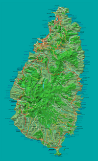 Detailed map of St Lucia showing location of Canaries | |
 Canaries Location in Saint Lucia | |
| Coordinates: 13°54′16″N061°04′01″W / 13.90444°N 61.06694°W | |
| Country | |
| Quarter | Canaries Quarter |
| Founded | 18th Century |
| Founded by | The French |
| Named for | Kannawi, creole word for Amerindian cooking pots |
| Government | |
| • Governing body | Canaries Village Council |
| Area | |
• Total | 16 km2 (6 sq mi) |
| Elevation | 5 m (16 ft) |
| Population (2005) [1] | |
• Total | 1,862 |
| • Density | 120/km2 (300/sq mi) |
| Time zone | UTC-4 (Eastern Caribbean Time Zone (ECT)) |
| Area code | 758 |
Canaries (or Kanawe in Creole) is a populated place located on the West Coast of Saint Lucia in the Canaries Quarter (also called district or region). It is a small fishing village and it is nestled along the West Coast road, between the towns of Anse La Raye and Soufriere, and there are scenic views from both the Northern and Southern approaches. [2]

