
Furan is a 39.3 km long river in central France, right tributary of the river Loire. It flows through the city Saint-Étienne and flows into the Loire in the small town Andrézieux-Bouthéon.
The arrondissement of Saint-Amand-Montrond is an arrondissement of France in the Cher department in the Centre-Val de Loire region. It has 116 communes.
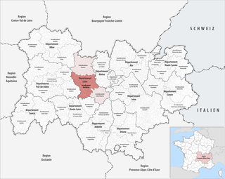
The arrondissement of Montbrison is located in the Loire department in the Auvergne-Rhône-Alpes region of France. Since the January 2017 reorganization of the arrondissements of Loire, it has 136 communes.

The arrondissement of Saint-Étienne is located in the Loire department in the Auvergne-Rhône-Alpes region of France. Since the January 2017 reorganization of the arrondissements of Loire, it has 75 communes.
The following is a list of the 21 cantons of the Loire department, in France, following the French canton reorganisation which came into effect in March 2015:

Saint-Étienne–Bouthéon Airport or Aéroport de Saint-Étienne–Bouthéon is an international airport serving the French city of Saint-Étienne. It is located in Andrézieux-Bouthéon, 12 km north-northwest of Saint-Étienne, within the département of Loire in the Rhône-Alpes région and mainly used by low-cost airlines. In February 2017, the airport decided to cancel all subsidies towards low cost carriers serving the airport which will likely lead to Ryanair and Pegasus Airlines cancelling all services to Saint-Étienne by 2018. As of April 2018, the airport website mentions no scheduled services, but there are holiday charters, mainly to Mediterranean destinations.

Andrézieux-Bouthéon is a commune of the Loire department in central France.
The Canton of Châteaumeillant is a canton situated in the Cher département and in the Centre-Val de Loire region of France.
The Canton of Dun-sur-Auron is a canton situated in the Cher département and in the Centre-Val de Loire region of France.
The Canton of Saint-Amand-Montrond is a canton situated in the Cher département and in the Centre-Val de Loire region of France.
Saint-Étienne Métropole is the métropole, an intercommunal structure, centred on the city of Saint-Étienne. It is located in the Loire department, in the Auvergne-Rhône-Alpes region, central France. It was created in January 2018, replacing the previous Communauté urbaine Saint-Étienne Métropole. Its population was 408,685 in 2014, of which 173,504 in Saint-Étienne proper.
The canton of Le Pilat is a French administrative division located in the department of Loire and the Auvergne-Rhône-Alpes region. At the French canton reorganisation which came into effect in March 2015, the canton was renamed and expanded from 14 to 35 communes:
The canton of Saint-Étienne-4 is a French administrative division located in the department of Loire and the Auvergne-Rhône-Alpes region. It has the following communes:
The canton of Saint-Étienne-3 is a French administrative division located in the department of Loire and the Auvergne-Rhône-Alpes region. It has the following communes:
The canton of Feurs is a French administrative division located in the department of Loire and the Auvergne-Rhône-Alpes region. At the French canton reorganisation which came into effect in March 2015, the canton was expanded from 23 to 33 communes:
The canton of Montbrison is a French administrative division located in the department of Loire and the Auvergne-Rhône-Alpes region. At the French canton reorganisation which came into effect in March 2015, the canton was expanded from 19 to 31 communes:
The canton of Saint-Galmier is a French former administrative division located in the department of Loire and the Rhone-Alpes region. It was disbanded following the French canton reorganisation which came into effect in March 2015. It consisted of 11 communes, which joined the new canton of Andrézieux-Bouthéon in 2015. It had the following communes:
The canton of Saint-Just-Saint-Rambert is a French administrative division located in the department of Loire and the Auvergne-Rhône-Alpes region. At the French canton reorganisation which came into effect in March 2015, the canton was expanded from 12 to 18 communes:
The canton of Saint-Étienne-1 is an administrative division of the Loire department, in eastern France. It was created at the French canton reorganisation which came into effect in March 2015. Its seat is in Saint-Étienne.
The canton of Saint-Étienne-6 is an administrative division of the Loire department, in eastern France. It was created at the French canton reorganisation which came into effect in March 2015. Its seat is in Saint-Étienne.

