The Creuse is a 264-kilometre (164 mi) long river in western France, a tributary of the Vienne. Its source is in the Plateau de Millevaches, a north-western extension of the Massif Central.
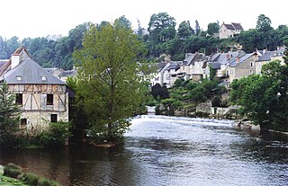
Argenton-sur-Creuse is a commune in the Indre department in central France. It lies on the Creuse River, 19 miles south-southwest of Châteauroux, close to the A20 motorway.
The arrondissement of Le Blanc is an arrondissement of France in the Indre department in the Centre-Val de Loire region. Since the January 2017 reorganization of the arrondissements of Indre, it has 57 communes.
The arrondissement of Châteauroux is an arrondissement of France in the Indre department in the Centre-Val de Loire region. Since the January 2017 reorganization of the arrondissements of Indre, it has 86 communes.
The following is a list of the 13 cantons of the Indre department, in France, following the French canton reorganisation which came into effect in March 2015:
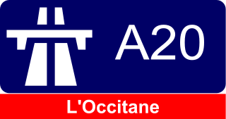
The A20 autoroute or L'Occitane is a highway through central France. A part of France's national network of autoroutes, it is 412 kilometres (256 mi) long.
The Canton of Saint-Benoît-du-Sault is a French former administrative subdivision, situated in the Indre département and the Centre région. It was disbanded following the French canton reorganisation which came into effect in March 2015. It consisted of 14 communes, which joined the canton of Saint-Gaultier in 2015.

Tournon-Saint-Martin is a commune in the Indre department in central France.
The Canton of Évaux-les-Bains is a canton situated in the Creuse département and in the Nouvelle Aquitaine region of central France.
The canton of Buzançais is an administrative division of the Indre department, central France. Its borders were modified at the French canton reorganisation which came into effect in March 2015. Its seat is in Buzançais.
The canton of Levroux is an administrative division of the Indre department, central France. Its borders were modified at the French canton reorganisation which came into effect in March 2015. Its seat is in Levroux.
The canton of Le Blanc is an administrative division of the Indre department, central France. Its borders were modified at the French canton reorganisation which came into effect in March 2015. Its seat is in Le Blanc.
The canton of La Châtre is an administrative division of the Indre department, central France. Its borders were modified at the French canton reorganisation which came into effect in March 2015. Its seat is in La Châtre.
The canton of Issoudun is an administrative division of the Indre department, central France. It was created at the French canton reorganisation which came into effect in March 2015. Its seat is in Issoudun.
The canton of Neuvy-Saint-Sépulchre is an administrative division of the Indre department, central France. Its borders were modified at the French canton reorganisation which came into effect in March 2015. Its seat is in Neuvy-Saint-Sépulchre.
The canton of Descartes is an administrative division of the Indre-et-Loire department, central France. Its borders were modified at the French canton reorganisation which came into effect in March 2015. Its seat is in Descartes.
The canton of Loches is an administrative division of the Indre-et-Loire department, central France. Its borders were modified at the French canton reorganisation which came into effect in March 2015. Its seat is in Loches.

The 2nd constituency of Indre is a French legislative constituency in the Indre département.

