Related Research Articles

Descartes is a large village and commune in the Indre-et-Loire department in central France. It is approximately 29 kilometers east of Richelieu and about 48 kilometers east of Loudun, on the banks of the Creuse River, near the border of the French department of Vienne, and the border of the region between Centre-Val de Loire and Nouvelle-Aquitaine. It is famous for the birthplace of the French mathematician and philosopher who invented the Cartesian coordinate system, René Descartes.
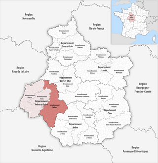
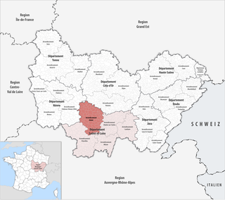
The arrondissement of Loches is an arrondissement of France in the Indre-et-Loire department in the Centre-Val de Loire region. It has 112 communes. Its population is 118,282 (2016), and its area is 2,742.5 km2 (1,058.9 sq mi).

The arrondissement of Cosne-Cours-sur-Loire is an arrondissement of France in the Nièvre department in the Bourgogne-Franche-Comté region. It has 63 communes. Its population is 43,893 (2016), and its area is 1,395.4 km2 (538.8 sq mi).
The arrondissement of Autun is an arrondissement of France in the Saône-et-Loire department in the Bourgogne-Franche-Comté region. It has 89 communes. Its population is 131,392 (2016), and its area is 1,994.3 km2 (770.0 sq mi).
The following is a list of the 19 cantons of the Indre-et-Loire department, in France, following the French canton reorganisation which came into effect in March 2015:
Preuilly-sur-Claise is a commune in the Indre-et-Loire department in central France.
The Canton of Châteaumeillant is a canton situated in the Cher département and in the Centre-Val de Loire region of France.
The Canton of Preuilly-sur-Claise is a former canton situated in the Indre-et-Loire département and in the Centre region of France. It was disbanded following the French canton reorganisation which came into effect in March 2015. It consisted of 8 communes, which joined the canton of Descartes in 2015. It had 5,077 inhabitants (2012).
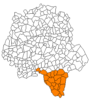
The Communauté de communes de la Touraine du Sud is a former federation of municipalities in the Indre-et-Loire département and in the Centre-Val de Loire région of France. It was created in December 2000. It was merged into the new Communauté de communes Loches Sud Touraine in January 2017. Its seat was in Preuilly-sur-Claise, but Descartes was the most populous commune of the communauté de communes.
The canton of Chalonnes-sur-Loire is an administrative division of the Maine-et-Loire department, in western France. Its borders were modified at the French canton reorganisation which came into effect in March 2015. Its seat is in Chalonnes-sur-Loire.
The canton of La Charité-sur-Loire is an administrative division of the Nièvre department, central France. Its borders were modified at the French canton reorganisation which came into effect in March 2015. Its seat is in La Charité-sur-Loire.
The canton of Cosne-Cours-sur-Loire is an administrative division of the Nièvre department, central France. It was created at the French canton reorganisation which came into effect in March 2015. Its seat is in Cosne-Cours-sur-Loire.
The canton of Cluny is an administrative division of the Saône-et-Loire department, eastern France. Its borders were modified at the French canton reorganisation which came into effect in March 2015. Its seat is in Cluny.
The canton of Autun-1 is an administrative division of the Saône-et-Loire department, eastern France. It was created at the French canton reorganisation which came into effect in March 2015. Its seat is in Autun.
The canton of Blanzy is an administrative division of the Saône-et-Loire department, eastern France. It was created at the French canton reorganisation which came into effect in March 2015. Its seat is in Blanzy.
The canton of La Chapelle-de-Guinchay is an administrative division of the Saône-et-Loire department, eastern France. Its borders were modified at the French canton reorganisation which came into effect in March 2015. Its seat is in La Chapelle-de-Guinchay.
The canton of Digoin is an administrative division of the Saône-et-Loire department, eastern France. Its borders were modified at the French canton reorganisation which came into effect in March 2015. Its seat is in Digoin.
The canton of Tournus is an administrative division of the Saône-et-Loire department, eastern France. Its borders were modified at the French canton reorganisation which came into effect in March 2015. Its seat is in Tournus.
The Communauté de communes Loches Sud Touraine is a communauté de communes, an intercommunal structure, in the Indre-et-Loire department, in the Centre-Val de Loire region, central France. It was created on 1 January 2017 by the merger of the former communautés de communes of Loches Développement, Montrésor, Grand Ligueillois and Touraine du Sud. Its area is 1809.5 km2, and its population was 51,376 in 2018. Its seat is in Loches.
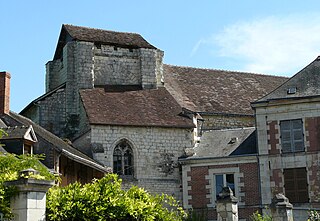
Preuilly Abbey was a Benedictine monastery in Preuilly-sur-Claise, Indre-et-Loire, France. The surviving abbey church retains many Romanesque features, notably the intricately carved capitals.
References
46°59′N0°42′E / 46.98°N 0.70°E
| | This Indre-et-Loire geographical article is a stub. You can help Wikipedia by expanding it. |