
Indre-et-Loire is a department in west-central France named after the Indre River and Loire River. In 2019, it had a population of 610,079. Sometimes referred to as Touraine, the name of the historic region, it is nowadays part of the Centre-Val de Loire region. Its prefecture is Tours and subprefectures are Chinon and Loches. Indre-et-Loire is a touristic destination for its numerous monuments that are part of the Châteaux of the Loire Valley.
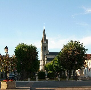
Yzeures-sur-Creuse is a commune in the department of Indre-et-Loire, Centre-Val de Loire, France.

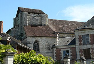
Descartes is a large village and commune in the Indre-et-Loire department in central France. It is approximately 29 kilometers east of Richelieu and about 48 kilometers east of Loudun, on the banks of the Creuse River, near the border of the French department of Vienne, and the border of the region between Centre-Val de Loire and Nouvelle-Aquitaine. It is famous for the birthplace of the French mathematician and philosopher who invented the Cartesian coordinate system, René Descartes.
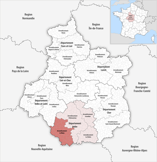
The arrondissement of Le Blanc is an arrondissement of France in the Indre department in the Centre-Val de Loire region. It has 57 communes. Its population is 31,714 (2016), and its area is 1,782.3 km2 (688.1 sq mi).

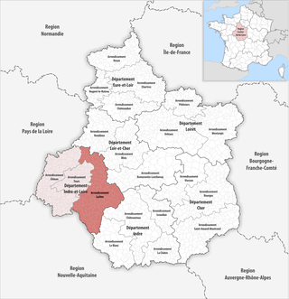
The arrondissement of Tours is an arrondissement of France in the Indre-et-Loire department in the Centre-Val de Loire region. It has 54 communes. Its population is 384,117 (2016), and its area is 1,087.6 km2 (419.9 sq mi).
The arrondissement of Loches is an arrondissement of France in the Indre-et-Loire department in the Centre-Val de Loire region. It has 112 communes. Its population is 118,282 (2016), and its area is 2,742.5 km2 (1,058.9 sq mi).

Tournon-Saint-Martin is a commune in the Indre department in central France.

Neuillé-Pont-Pierre is a commune in the Indre-et-Loire department in central France.

Saint-Germain-sur-Vienne is a commune in the Indre-et-Loire department in central France.
Preuilly-sur-Claise is a commune in the Indre-et-Loire department in central France.

Candes-Saint-Martin is a commune in the Indre-et-Loire department, central France. It overlooks the confluence of the Vienne and Loire rivers from a steep hill on the left bank of the Loire, and marks the boundary between the modern departments of Indre-et-Loire to the east, and Maine-et-Loire to the west.

Saint-Pierre-des-Corps is a commune in the French department of Indre-et-Loire, Centre-Val de Loire, France. It is located about 4 km (2.5 mi) from Tours. During the French Revolution, it was called La Clarté-Républicaine.
Saint-Martin-le-Beau is a commune in the Indre-et-Loire department in central France.
Saint-Nicolas-des-Motets is a commune in the Indre-et-Loire department in central France.
Saint-Branchs is a commune in the Indre-et-Loire department in central France.

Sorigny is a French commune in the Indre-et-Loire department, Centre-Val de Loire.
Saint-Hippolyte is a commune in the Indre-et-Loire department in central France.

Saint-Roch is a commune in the Indre-et-Loire department in central France.
The Canton of Preuilly-sur-Claise is a former canton situated in the Indre-et-Loire département and in the Centre region of France. It was disbanded following the French canton reorganisation which came into effect in March 2015. It consisted of 8 communes, which joined the canton of Descartes in 2015. It had 5,077 inhabitants (2012).

The Communauté de communes Loches Sud Touraine is a communauté de communes, an intercommunal structure, in the Indre-et-Loire department, in the Centre-Val de Loire region, central France. It was created on 1 January 2017 by the merger of the former communautés de communes of Loches Développement, Montrésor, Grand Ligueillois and Touraine du Sud. Its area is 1809.5 km2, and its population was 51,376 in 2018. Its seat is in Loches.


