Canton of Falaise | |
|---|---|
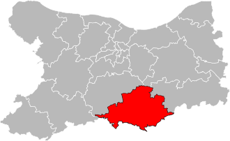 Situation of the canton of Falaise in the department of Calvados | |
| Country | France |
| Region | Normandy |
| Department | Calvados |
| No. of communes | 57 |
| Seat | Falaise |
| Population (2022) [1] | 26,572 |
| INSEE code | 1413 |
The canton of Falaise is an administrative division of the Calvados department, northwestern France. It was created at the French canton reorganisation which came into effect in March 2015. Its seat is in Falaise. [2]
It consists of the following communes: [2]
- Aubigny
- Barou-en-Auge
- Beaumais
- Bernières-d'Ailly
- Bonnœil
- Bons-Tassilly
- Cordey
- Courcy
- Crocy
- Damblainville
- Le Détroit
- Épaney
- Eraines
- Ernes
- Falaise
- Fontaine-le-Pin
- Fourches
- Fourneaux-le-Val
- Fresné-la-Mère
- La Hoguette
- Les Isles-Bardel
- Jort
- Leffard
- Les Loges-Saulces
- Louvagny
- Maizières
- Le Marais-la-Chapelle
- Martigny-sur-l'Ante
- Le Mesnil-Villement
- Morteaux-Coulibœuf
- Les Moutiers-en-Auge
- Noron-l'Abbaye
- Norrey-en-Auge
- Olendon
- Ouilly-le-Tesson
- Perrières
- Pertheville-Ners
- Pierrefitte-en-Cinglais
- Pierrepont
- Pont-d'Ouilly
- Potigny
- Rapilly
- Rouvres
- Saint-Germain-Langot
- Saint-Martin-de-Mieux
- Saint-Pierre-Canivet
- Saint-Pierre-du-Bû
- Sassy
- Soulangy
- Soumont-Saint-Quentin
- Tréprel
- Ussy
- Versainville
- Vicques
- Vignats
- Villers-Canivet
- Villy-lez-Falaise