The arrondissement of Langon is an arrondissement of France in the Gironde department in the Nouvelle Aquitaine region. It has 197 communes. In 2009 it absorbed the cantons of Cadillac and Podensac from the arrondissement of Bordeaux.

Sainte-Livrade-sur-Lot is a commune in the Lot-et-Garonne department in south-western France.
The canton of Léguevin is an administrative division of the Haute-Garonne department, southern France. Its borders were modified at the French canton reorganisation which came into effect in March 2015. Its seat is in Léguevin.
The canton of Causse et Vallées is an administrative division of the Lot department, southern France. It was created at the French canton reorganisation which came into effect in March 2015. Its seat is in Cajarc.
The canton of L'Albret is an administrative division of the Lot-et-Garonne department, southwestern France. It was created at the French canton reorganisation which came into effect in March 2015. Its seat is in Nérac.
The canton of Le Confluent is an administrative division of the Lot-et-Garonne department, southwestern France. It was created at the French canton reorganisation which came into effect in March 2015. Its seat is in Aiguillon.
The canton of Les Coteaux de Guyenne is an administrative division of the Lot-et-Garonne department, southwestern France. It was created at the French canton reorganisation which came into effect in March 2015. Its seat is in Duras.
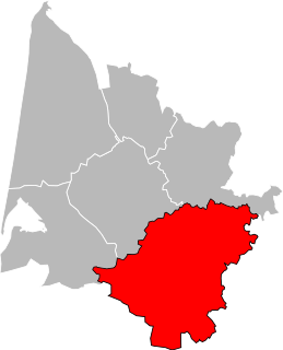
The canton of Les Forêts de Gascogne is an administrative division of the Lot-et-Garonne department, southwestern France. It was created at the French canton reorganisation which came into effect in March 2015. Its seat is in Casteljaloux.
The canton of Marmande-1 is an administrative division of the Lot-et-Garonne department, southwestern France. It was created at the French canton reorganisation which came into effect in March 2015. Its seat is in Marmande.
The canton of Marmande-2 is an administrative division of the Lot-et-Garonne department, southwestern France. It was created at the French canton reorganisation which came into effect in March 2015. Its seat is in Marmande.
The canton of Le Fumélois is an administrative division of the Lot-et-Garonne department, southwestern France. It was created at the French canton reorganisation which came into effect in March 2015. Its seat is in Fumel.
The canton of Le Haut Agenais Périgord is an administrative division of the Lot-et-Garonne department, southwestern France. It was created at the French canton reorganisation which came into effect in March 2015. Its seat is in Monflanquin.
The canton of Lavardac is an administrative division of the Lot-et-Garonne department, southwestern France. Its borders were modified at the French canton reorganisation which came into effect in March 2015. Its seat is in Lavardac.
The canton of L'Ouest agenais is an administrative division of the Lot-et-Garonne department, southwestern France. It was created at the French canton reorganisation which came into effect in March 2015. Its seat is in Colayrac-Saint-Cirq.
The canton of Le Pays de Serres is an administrative division of the Lot-et-Garonne department, southwestern France. It was created at the French canton reorganisation which came into effect in March 2015. Its seat is in Penne-d'Agenais.
The canton of Le Sud-Est agenais is an administrative division of the Lot-et-Garonne department, southwestern France. It was created at the French canton reorganisation which came into effect in March 2015. Its seat is in Layrac.
The canton of Tonneins is an administrative division of the Lot-et-Garonne department, southwestern France. Its borders were modified at the French canton reorganisation which came into effect in March 2015. Its seat is in Tonneins.
The canton of Le Val du Dropt is an administrative division of the Lot-et-Garonne department, southwestern France. It was created at the French canton reorganisation which came into effect in March 2015. Its seat is in Miramont-de-Guyenne.
The canton of Villeneuve-sur-Lot-1 is an administrative division of the Lot-et-Garonne department, southwestern France. It was created at the French canton reorganisation which came into effect in March 2015. Its seat is in Villeneuve-sur-Lot.
The canton of Villeneuve-sur-Lot-2 is an administrative division of the Lot-et-Garonne department, southwestern France. It was created at the French canton reorganisation which came into effect in March 2015. Its seat is in Villeneuve-sur-Lot.

