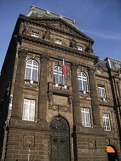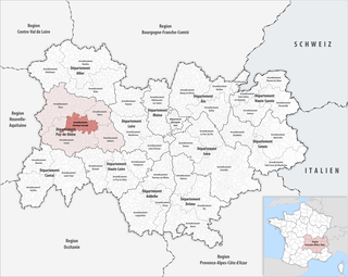
The arrondissement of Clermont-Ferrand is an arrondissement of France in the Puy-de-Dôme department in the Auvergne-Rhône-Alpes region. Since the January 2017 reorganization of the arrondissements of Puy-de-Dôme, it has 75 communes.
The following is a list of the 31 cantons of the Puy-de-Dôme department, in France, following the French canton reorganisation which came into effect in March 2015:
Les Martres may refer to:

Corent is a commune in the Puy-de-Dôme department in Auvergne-Rhône-Alpes in central France.
Les Martres-d'Artière is a commune in the Puy-de-Dôme department in Auvergne in central France.
Les Martres-de-Veyre is a commune in the Puy-de-Dôme department in Auvergne in central France.
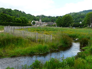
The Veyre is a left-bank affluent of the river Monne in the French region of Auvergne.
The cantons of Clermont-Ferrand are administrative divisions of the Puy-de-Dôme department, in central France. Since the French canton reorganisation which came into effect in March 2015, the city of Clermont-Ferrand is subdivided into 6 cantons. Their seat is in Clermont-Ferrand.
The canton of Aigueperse is an administrative division of the Puy-de-Dôme department, central France. Its borders were modified at the French canton reorganisation which came into effect in March 2015. Its seat is in Aigueperse.
The canton of Brassac-les-Mines is an administrative division of the Puy-de-Dôme department, central France. It was created at the French canton reorganisation which came into effect in March 2015. Its seat is in Brassac-les-Mines.
The canton of Ambert is an administrative division of the Puy-de-Dôme department, central France. Its borders were modified at the French canton reorganisation which came into effect in March 2015. Its seat is in Ambert.
The canton of Billom is an administrative division of the Puy-de-Dôme department, central France. Its borders were modified at the French canton reorganisation which came into effect in March 2015. Its seat is in Billom.
The canton of Maringues is an administrative division of the Puy-de-Dôme department, central France. Its borders were modified at the French canton reorganisation which came into effect in March 2015. Its seat is in Maringues.
The canton of Les Monts du Livradois is an administrative division of the Puy-de-Dôme department, central France. It was created at the French canton reorganisation which came into effect in March 2015. Its seat is in Courpière.
The canton of Orcines is an administrative division of the Puy-de-Dôme department, central France. It was created at the French canton reorganisation which came into effect in March 2015. Its seat is in Orcines.
The canton of Pont-du-Château is an administrative division of the Puy-de-Dôme department, central France. Its borders were modified at the French canton reorganisation which came into effect in March 2015. Its seat is in Pont-du-Château.
The canton of Saint-Ours is an administrative division of the Puy-de-Dôme department, central France. It was created at the French canton reorganisation which came into effect in March 2015. Its seat is in Saint-Ours.
The canton of Le Sancy is an administrative division of the Puy-de-Dôme department, central France. It was created at the French canton reorganisation which came into effect in March 2015. Its seat is in La Bourboule.
The canton of Thiers is an administrative division of the Puy-de-Dôme department, central France. Its borders were modified at the French canton reorganisation which came into effect in March 2015. Its seat is in Thiers.
The canton of Vic-le-Comte is an administrative division of the Puy-de-Dôme department, central France. Its borders were modified at the French canton reorganisation which came into effect in March 2015. Its seat is in Vic-le-Comte.