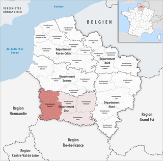
The arrondissement of Beauvais is an arrondissement of France in the Oise department in the Hauts-de-France region. It comprises 251 communes.
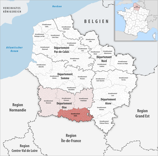
The arrondissement of Senlis is an arrondissement of France in the Oise department in the Hauts-de-France region. It has 133 communes.
The following is a list of the 21 cantons of the Oise department, in France, following the French canton reorganisation which came into effect in March 2015:
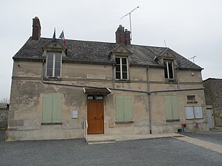
Crouy-en-Thelle is a commune in the Oise department in northern France.
The canton of Domont is an administrative division of the Val-d'Oise department, Île-de-France region, northern France. Its borders were modified at the French canton reorganisation which came into effect in March 2015. Its seat is in Domont.
The canton of Fosses is an administrative division of the Val-d'Oise department, Île-de-France region, northern France. It was created at the French canton reorganisation which came into effect in March 2015. Its seat is in Fosses.
The canton of L'Isle-Adam is an administrative division of the Val-d'Oise department, Île-de-France region, northern France. Its borders were modified at the French canton reorganisation which came into effect in March 2015. Its seat is in L'Isle-Adam.
The canton of Pontoise is an administrative division of the Val-d'Oise department, Île-de-France region, northern France. Its borders were modified at the French canton reorganisation which came into effect in March 2015. Its seat is in Pontoise.
The canton of Vauréal is an administrative division of the Val-d'Oise department, Île-de-France region, northern France. It was created at the French canton reorganisation which came into effect in March 2015. Its seat is in Vauréal.
The canton of Villiers-le-Bel is an administrative division of the Val-d'Oise department, Île-de-France region, northern France. Its borders were modified at the French canton reorganisation which came into effect in March 2015. Its seat is in Villiers-le-Bel.
The canton of Beauvais-1 is an administrative division of the Oise department, northern France. It was created at the French canton reorganisation which came into effect in March 2015. Its seat is in Beauvais.
The canton of Beauvais-2 is an administrative division of the Oise department, northern France. It was created at the French canton reorganisation which came into effect in March 2015. Its seat is in Beauvais.
The canton of Chaumont-en-Vexin is an administrative division of the Oise department, northern France. Its borders were modified at the French canton reorganisation which came into effect in March 2015. Its seat is in Chaumont-en-Vexin.
The canton of Chantilly is an administrative division of the Oise department, northern France. Its borders were modified at the French canton reorganisation which came into effect in March 2015. Its seat is in Chantilly.
The canton of Creil is an administrative division of the Oise department, northern France. It was created at the French canton reorganisation which came into effect in March 2015. Its seat is in Creil.
The canton of Crépy-en-Valois is an administrative division of the Oise department, northern France. Its borders were modified at the French canton reorganisation which came into effect in March 2015. Its seat is in Crépy-en-Valois.
The canton of Mouy is an administrative division of the Oise department, northern France. Its borders were modified at the French canton reorganisation which came into effect in March 2015. Its seat is in Mouy.
The canton of Nanteuil-le-Haudouin is an administrative division of the Oise department, northern France. Its borders were modified at the French canton reorganisation which came into effect in March 2015. Its seat is in Nanteuil-le-Haudouin.
The canton of Saint-Just-en-Chaussée is an administrative division of the Oise department, northern France. Its borders were modified at the French canton reorganisation which came into effect in March 2015. Its seat is in Saint-Just-en-Chaussée.
The canton of Senlis is an administrative division of the Oise department, northern France. Its borders were modified at the French canton reorganisation which came into effect in March 2015. Its seat is in Senlis.

