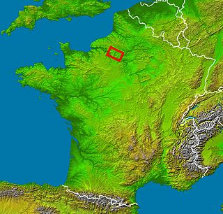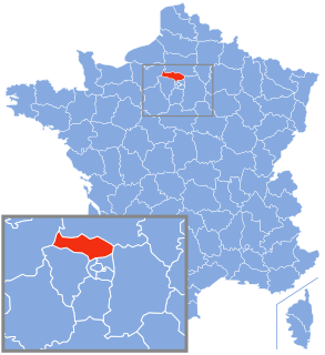
Vexin is a historical county of northwestern France. It covers a verdant plateau on the right bank (north) of the Seine running roughly east to west between Pontoise and Romilly-sur-Andelle, and north to south between Auneuil and the Seine near Vernon. The plateau is crossed by the Epte and the Andelle river valleys.

The arrondissement of Pontoise is an arrondissement of France in the Val-d'Oise department in the Île-de-France region. Since the January 2017 reorganization of the arrondissements of Val-d'Oise, it has 105 communes.

The arrondissement of Les Andelys is an arrondissement of France in the Eure department in the Normandy region. It was expanded in 2006 with the two cantons of Louviers-Nord and Louviers-Sud from the arrondissement of Évreux. Since the January 2017 reorganization of the arrondissements of Eure, it has 187 communes.
The following is a list of the 21 cantons of the Oise department, in France, following the French canton reorganisation which came into effect in March 2015:
The following is a list of the 21 cantons of the Val-d'Oise department, in France, following the French canton reorganisation which came into effect in March 2015:
The Route nationale 14, N14, is a trunk road (nationale) in France between Paris and Rouen, running through Pontoise, Magny-en-Vexin, Saint-Clair-sur-Epte and Fleury-sur-Andelle. Until the 1950s, it was going until Le Havre through Yvetot.

Magny-en-Vexin is a commune in the Val-d'Oise département in Île-de-France in northern France. It is located in the reigonal national park of Vexin.
Canton of Les Andelys is a canton of the Arrondissement of Les Andelys in the Eure department of France. The seat lies at Les Andelys.
Aubette de Magny is a tributary of the river Epte in Val-d'Oise. Its source is near Magny-en-Vexin. It flows into the Epte at Bray-et-Lû.

Neuville–Université is a train station in Neuville-sur-Oise, in Val d'Oise department, in France.
The canton of Cergy-2 is an administrative division of the Val-d'Oise department, Île-de-France region, northern France. It was created at the French canton reorganisation which came into effect in March 2015. Its seat is in Cergy.
The canton of Domont is an administrative division of the Val-d'Oise department, Île-de-France region, northern France. Its borders were modified at the French canton reorganisation which came into effect in March 2015. Its seat is in Domont.
The canton of Goussainville is an administrative division of the Val-d'Oise department, Île-de-France region, northern France. Its borders were modified at the French canton reorganisation which came into effect in March 2015. Its seat is in Goussainville.
The canton of L'Isle-Adam is an administrative division of the Val-d'Oise department, Île-de-France region, northern France. Its borders were modified at the French canton reorganisation which came into effect in March 2015. Its seat is in L'Isle-Adam.
The canton of Pontoise is an administrative division of the Val-d'Oise department, Île-de-France region, northern France. Its borders were modified at the French canton reorganisation which came into effect in March 2015. Its seat is in Pontoise.
The canton of Saint-Ouen-l'Aumône is an administrative division of the Val-d'Oise department, Île-de-France region, northern France. Its borders were modified at the French canton reorganisation which came into effect in March 2015. Its seat is in Saint-Ouen-l'Aumône.
The canton of Romilly-sur-Andelle is an administrative division of the Eure department, northern France. It was created at the French canton reorganisation which came into effect in March 2015. Its seat is in Romilly-sur-Andelle.
The canton of Gisors is an administrative division of the Eure department, northern France. Its borders were modified at the French canton reorganisation which came into effect in March 2015. Its seat is in Gisors.
The canton of Chaumont-en-Vexin is an administrative division of the Oise department, northern France. Its borders were modified at the French canton reorganisation which came into effect in March 2015. Its seat is in Chaumont-en-Vexin.


