
The Philippines is an archipelago that comprises 7,641 islands, and with a total land area of 300,000 square kilometers (115,831 sq mi), it is the world's fifth largest island country. The eleven largest islands contain 95% of the total land area. The largest of these islands is Luzon at about 105,000 square kilometers (40,541 sq mi). The next largest island is Mindanao at about 95,000 square kilometers (36,680 sq mi). The archipelago is around 800 kilometers (500 mi) from the Asian mainland and is located between Taiwan and Borneo.

Ilocos Norte, officially the Province of Ilocos Norte, is a province of the Philippines located in the Ilocos Region. Its capital is Laoag City, located in the northwest corner of Luzon Island, bordering Cagayan and Apayao to the east, and Abra to the southeast, and Ilocos Sur to the southwest. Ilocos Norte faces the West Philippine Sea to the west and the Luzon Strait to the north.

Ilocos Sur, officially the Province of Ilocos Sur, is a province in the Philippines located in the Ilocos Region in Luzon. Located on the mouth of the Mestizo River is the capital of Vigan. Ilocos Sur is bordered by Ilocos Norte and Abra to the north, Mountain Province to the east, La Union and Benguet to the south and the South China Sea to the west.

The Ilocos Region, designated as Region I, is an administrative region of the Philippines. Located in the northwestern section of Luzon, it is bordered by the Cordillera Administrative Region to the east, the Cagayan Valley to the northeast and southeast, Central Luzon to the south, and the South China Sea to the west.

Laoag, officially the City of Laoag, is a 3rd class component city and capital of the province of Ilocos Norte, Philippines. According to the 2020 census, it has a population of 111,651 people.

Pagudpud, officially the Municipality of Pagudpud, is a 4th class municipality in the province of Ilocos Norte, Philippines. According to the 2020 census, it has a population of 25,098 people.

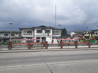
Burgos, officially the Municipality of Burgos, is a 5th class municipality in the province of Ilocos Norte, Philippines. According to the 2020 census, it has a population of 10,759 people.

Santa Maria, officially the Municipality of Santa Maria, is a 3rd class municipality in the province of Ilocos Sur, Philippines. According to the 2020 census, it has a population of 30,006 people.
Naguilian, officially the Municipality of Naguilian, is a 1st class municipality in the province of La Union, Philippines. According to the 2020 census, it has a population of 52,189 people.

Bolinao, officially the Municipality of Bolinao, is a 1st class municipality in the province of Pangasinan, Philippines. According to the 2020 census, it has a population of 83,979 people.

The legislative districts of Ilocos Sur are the representations of the province of Ilocos Sur in the various national legislatures of the Philippines. The province is currently represented in the lower house of the Congress of the Philippines through its first and second congressional districts.

Cape Bojeador Lighthouse, also known as Burgos Lighthouse, is a cultural heritage structure in Burgos, Ilocos Norte, that was established during the Spanish colonial period in the Philippines. The lighthouse was first lit on March 30, 1892, and is set high on Vigia de Nagpartian Hill overlooking the scenic Cape Bojeador where early galleons used to sail by. After over 100 years, it still functions and serves ships that enter the Philippine archipelago from the north and guide them safely away from the rocky coast of the town.
The Bangui Wind Farm is a wind farm in Bangui, Ilocos Norte, Philippines. The wind farm uses 20 units of 70-meter (230 ft) high Vestas V82 1.65 MW wind turbines, arranged in a single row stretching along a 9-kilometer (5.6 mi) shoreline of Bangui Bay, facing the South China Sea.

Cape Engaño Lighthouse, also known as Faro de Cabo Engaño, is a historic lighthouse located at Cape Engaño on Palaui Island in the town of Santa Ana, the province of Cagayan, Philippines. Located at the northernmost part of Luzon Island and situated atop the summit of a hill, 92 meters above sea level, the lighthouse provides a 360-degree view of Babuyan Island and the Dos Hermanas Island on the North, Pacific Ocean on the West and Engaño cove on the East.

Paoay Lake is a lake within the municipality of Paoay, in northwestern Luzon, Philippines. It is the largest lake in the province of Ilocos Norte and one of the largest natural lakes in the area.

Wind power in the Philippines accounts for a total of 443MW as of 2020 according to the Department of Energy, covering about 1.6% of the country's total installed capacity for both renewable and non-renewable energy sources. When it comes to existing renewable energy sources in the country, wind power has a total share of approximately 5.4%. Despite currently being a small contributor to the country's energy mix, wind power installations have increased from 33MW in 2012-2013 to 337MW in 2014, 427MW in 2015-2018, and 443MW in 2019-2021. Moreover, the Department of Energy's National Renewable Energy Plan (NREP) 2020-2040 aims to commission 2,345MW of total wind power capacity by 2030. There has been a setback, however, as the wind power industry was moderately affected by COVID, particularly in the import of wind turbines. Due to this, several projects such as the Aklan onshore wind project got delayed. To further drive the wind energy sector in the country, an increased demand for renewable energy, greater government commitments, and reduced wind power tariff are needed.
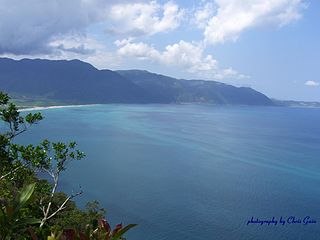
Pasaleng Bay, also Paselang Bay, is a bay on the north coast of Luzon island in the Philippines. It got its name from the border village of the same name located in the town of Pagudpud in the province of Ilocos Norte.

Cape Santiago is the southwestern point of the island of Luzon located within the municipality of Calatagan in Batangas, Philippines. It is a cape at the southern tip of Calatagan Peninsula which faces the South China Sea to the west and Pagapas Bay, an arm of Balayan Bay, to the east. The cape has been the site of a navigational aid since the 1890s.
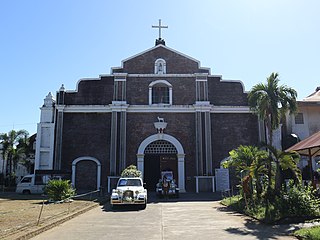
St. Andrew the Apostle Parish, commonly known as Bacarra Church is a Roman Catholic church located in the municipality of Bacarra, Ilocos Norte, Philippines under the jurisdiction of the Roman Catholic Diocese of Laoag.

Cape Santiago Lighthouse, also known as Faro de Cabo Santiago, is a historic lighthouse located about 130 kilometres (81 mi) southwest of Manila in Barangay Bagong Silang, Calatagan, Batangas, Philippines. It is the oldest working lighthouse in Batangas and one of the oldest working lighthouses in the Philippines. It serves as a guide for ships passing through the Verde Island Passage and entering Manila Bay.

