Cabo Cruz | |
|---|---|
 | |
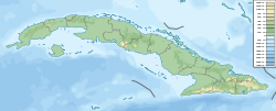 Cabo Cruz Location of Cape Cruz in Cuba | |
| Coordinates: 19°50′30.58″N77°43′40.28″W / 19.8418278°N 77.7278556°W | |
| Offshore water bodies | Caribbean Sea |
Cape Cruz, (Spanish : Cabo Cruz), is a cape that forms the western extremity of the Granma Province in southern Cuba. It extends into the Caribbean Sea and marks the eastern border of the Gulf of Guacanayabo. [1] Cape Cruz is located in the municipality of Niquero and is part of the Desembarco del Granma National Park.