Mac. Robertson Land is the portion of Antarctica lying southward of the coast between William Scoresby Bay and Cape Darnley. It is located at 70°00′S65°00′E. In the east, Mac. Robertson Land includes the Prince Charles Mountains. It was named by the British Australian and New Zealand Antarctic Research Expedition (BANZARE) (1929-1931), under Sir Douglas Mawson, after Sir Macpherson Robertson of Melbourne, a patron of the expedition.

Mertz Glacier is a heavily crevassed glacier in George V Coast of East Antarctica. It is the source of a glacial prominence that historically has extended northward into the Southern Ocean, the Mertz Glacial Tongue. It is named in honor of the Swiss explorer Xavier Mertz.

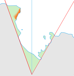
The Scott Mountains are a large number of isolated peaks lying south of Amundsen Bay in Enderby Land of East Antarctica, Antarctica. Discovered on 13 January 1930 by the British Australian New Zealand Antarctic Research Expedition (BANZARE) under Sir Douglas Mawson. He named the feature Scott Range after Captain Robert Falcon Scott, Royal Navy. The term mountains is considered more appropriate because of the isolation of its individual features.
Rayner Glacier is a prominent glacier, 19 kilometres (10 nmi) wide, flowing north to the coast of Enderby Land just west of Condon Hills. It was sighted in October 1956 by Squadron Leader D. Leckie during a flight in an ANARE Beaver aircraft, and named by ANCA for J.M. Rayner, Director of the Bureau of Mineral Resources in the Australian Department of National Development.

Enderby Land is a projecting land mass of Antarctica. Its shore extends from Shinnan Glacier at about 67°55′S44°38′E to William Scoresby Bay at 67°24′S59°34′E, approximately 1⁄24 of the earth's longitude. It was first documented in western and eastern literature in February 1831 by John Biscoe aboard the whaling brig Tula, and named after the Enderby Brothers of London, the ship's owners who encouraged their captains to combine exploration with sealing.

The Fallières Coast is that portion of the west coast of the Antarctic Peninsula between the head of Bourgeois Fjord and Cape Jeremy and lies on Marguerite Bay and the Wordie Ice Shelf. On the south it is joined by Rymill Coast, and in the north by Loubet Coast. Fallières Coast was first explored in January 1909 by the French Antarctic Expedition under J.B. Charcot, who named it for Armand Fallières, then President of France.
Assender Glacier is a glacier flowing west into Spooner Bay in Enderby Land, Antarctica. It was plotted from air photos taken from Australian National Antarctic Research Expeditions aircraft in 1956, and named by the Antarctic Names Committee of Australia for Pilot Officer Ken J. Assender, RAAF, pilot at Mawson Station in 1959.
Wright Lower Glacier is a stagnant glacier occupying the mouth of Wright Valley and coalescing at its east side with Wilson Piedmont Glacier, in Victoria Land. Formerly called Wright Glacier, but that name was amended by the Victoria University of Wellington Antarctic Expedition (VUWAE) (1958–59) to distinguish this glacier from Wright Upper Glacier at the head of Wright Valley. Originally named by the British Antarctic Expedition (1910–13) for Charles Wright, physicist with the expedition.

Horntvedt Glacier is a small glacier flowing to the north coast of the island of Bouvetøya. It is situated immediately east of Cape Circoncision. It was first charted in 1898 by a German expedition under Carl Chun, and recharted in December 1927 by a Norwegian expedition which named it for Harald Horntvedt (1879-1946), the captain of the expedition ship Norvegia.

Posadowsky Glacier is a glacier about 9 nautical miles long, flowing north to Posadowsky Bay immediately east of Gaussberg. Posadowsky Bay is an open embayment, located just east of the West Ice Shelf and fronting on the Davis Sea in Kaiser Wilhelm II Land. Kaiser Wilhelm II Land is the part of East Antarctica lying between Cape Penck, at 87°43'E, and Cape Filchner, at 91°54'E, and is claimed by Australia as part of the Australian Antarctic Territory. Other notable geographic features in this area include Drygalski Island, located 45 mi NNE of Cape Filchner in the Davis Sea, and Mirny Station, a Russian scientific research station.
Cape Bruce forms the northern tip of a small island lying at the eastern side of Oom Bay, separated from the mainland rocks just west of Taylor Glacier in Mac. Robertson Land, Antarctica.
The Borchgrevink Coast is that portion of the coast of Victoria Land between Cape Adare and Cape Washington. The name was recommended by New Zealand Antarctic Place-Names Committee in 1961 after Carsten Borchgrevink, a member of Henrik Johan Bull's expedition to this area, 1894–95, and leader of the British Antarctic Expedition, 1898–1900, the first to winter on the continent, at Cape Adare.
Wohlschlag Bay is a large bay indenting the west side of Ross Island between Harrison Bluff and Cape Royds. Charted by the Discovery Expedition under Scott, 1901-04. Named by the Advisory Committee on Antarctic Names (US-ACAN) in 1964 for Donald E. Wohlschlag, professor of biology at Stanford University, who outfitted the biology laboratories on the USNS Eltanin and at McMurdo Station, where he worked five summer seasons from 1958-64.
Cape Calmette is a cape marking the western extremity of a rocky peninsula which rises more than 625 metres (2,050 ft) and projects from the west coast of Graham Land for 3 nautical miles (6 km) to form the southern shore of Calmette Bay. It was discovered in 1909 by the French Antarctic Expedition under Jean-Baptiste Charcot, who from a distance mistook this cape for an island; the British Graham Land Expedition under John Rymill, 1934–37, determined the true nature of the feature. It was named by Charcot for Gaston Calmette, editor of Le Figaro, who furnished the French Antarctic Expedition with copies of this newspaper for the two years preceding the expedition.
Cape Geology is a low, gravel-covered point marking the western limit of Botany Bay, in the southern part of Granite Harbour, Victoria Land, Antarctica. It was charted and named by the Western Geological Party of the Terra Nova Expedition (1910–13) who established their base there.

The Hodgeman Islands are a group of small islands lying close to the coast of Antarctica, 7 kilometres (4 nmi) west-southwest of Cape De la Motte, in the eastern part of the entrance to Watt Bay. They were discovered by the Australasian Antarctic Expedition (1911–14) under Douglas Mawson, who named the islands for Alfred Hodgeman, a cartographer and assistant meteorologist with the expedition.
Mount Hunt is a dome-shaped mountain about 520 metres (1,700 ft) high, surmounting the promontory which terminates in Cape De la Motte, Antarctica. It was discovered by the Australasian Antarctic Expedition (1911–14) under Douglas Mawson, who named it for H.A. Hunt, Director of the Commonwealth Bureau of Meteorology.
McClary Glacier is a glacier 10 nautical miles (19 km) long and 2 nautical miles (4 km) wide on the west coast of Graham Land, Antarctica. It flows southwest along the north side of Butson Ridge into Marguerite Bay between Cape Calmette and the Debenham Islands. The glacier was first roughly surveyed by the British Graham Land Expedition, 1936–37, and resurveyed by the Falkland Islands Dependencies Survey, 1946–50. It was named by the UK Antarctic Place-Names Committee for George B. McClary, father of Nelson McClary, mate on the Port of Beaumont during the Ronne Antarctic Research Expedition, 1947–48.

Clarence Petersen de la Motte, commonly C. P. de la Motte, was a sailor originally from Bulli, New South Wales. During his early career, he served aboard the New Zealand barque Northern Chief and the steamship Warrimoo. From 1911 to 1914, during the Australasian Antarctic Expedition, he served as Third Officer aboard the SY Aurora, under John King Davis. Expedition Commander Douglas Mawson named Cape De la Motte, in George V Land, after him. De la Motte joined the Aurora again in 1916, and served as First Officer during the rescue of the Ross Sea component of the Imperial Trans-Antarctic Expedition, for which he was later awarded the Polar Medal.


