Related Research Articles

The Inaccessible Islands are a group of small precipitous islands ranging from 120 to 215 m high, the westernmost features of the South Orkney Islands, lying 20 km (12 mi) west of Coronation Island in Antarctica. They were discovered in December 1821 by Captain George Powell, a British sealer in the sloop James Monroe, though it is possible they are the "Seal Islands" seen by Nathaniel Palmer a year earlier. The islands were so named by Powell because of their appearance of inaccessibility. They are considered part of the British Antarctic Territory by the United Kingdom and part of the Province of Tierra del Fuego by Argentina.

Shirreff Cove is a small cove or anchorage, situated immediately southwest of Cape Shirreff between San Telmo Island and Gerlovo Beach on the northwest side of Ioannes Paulus II Peninsula, Livingston Island in the South Shetland Islands, Antarctica.
Washington Strait is a passage 3 miles (4.8 km) wide between Fredriksen and Powell Islands on the west and Laurie Island and several smaller islands on the east, in the South Orkney Islands. Discovered in December 1821 on the occasion of the joint cruise by Captain George Powell, a British sealer in the sloop Dove, and Captain Nathaniel Palmer, an American sealer in the sloop James Monroe. Supposedly, it was named for George Washington, first President of the United States.

False Bay is a bay 4 miles (6.4 km) long, which lies between Barnard Point and Miers Bluff on the south side of Livingston Island, in the South Shetland Islands, Antarctica. The glaciers Hurd Ice Cap, Huntress, Ruen Icefall, Peshtera and Charity feed the bay.

McFarlane Strait is a strait lying between Greenwich Island and Livingston Island, in the South Shetland Islands off Antarctica. It is 24 kilometres (13 nmi) long and 3 kilometres (1.6 nmi) wide. The name appears on an 1822 chart by Captain George Powell, a British sealer, and is now well established in international usage.

Morton Strait is the 9-kilometre-long (4.9 nmi) and 6.2-kilometre-wide (3.3 nmi) strait between Snow Island on the southwest and Rugged Island and Livingston Island on the northeast, in the South Shetland Islands, Antarctica. The Aim Rocks and Long Rock lie in the strait.
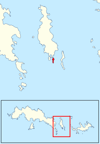
Cape Bennett is a bold promontory at the northeast extremity of Coronation Island, in the South Orkney Islands.

Christoffersen Island is a small island immediately west of the southern end of Powell Island in the South Orkney Islands of Antarctica. The name appears on a chart by Norwegian whaling captain Petter Sorlle, who made a running survey of these islands in 1912–13.
Jessie Bay is a bay 4 nautical miles (7 km) wide, lying between Mackenzie Peninsula and Pirie Peninsula, on the north side of Laurie Island in the South Orkney Islands. Apparently seen in the course of the joint cruise by Captain George Powell, a British sealer, and Captain Nathaniel Palmer, an American one. In 1821, it was roughly charted by Captain James Weddell, a British sealer. It was surveyed in 1903 by the Scottish National Antarctic Expedition of William S. Bruce, who named this bay for his wife, Jessie Mackenzie Bruce. He also named a cove in the bay, Sheila Cove, for his daughter.
Palmer Bay is a bay 1 nautical mile (1.9 km) wide, lying immediately west of Crown Head on the north coast of Coronation Island, in the South Orkney Islands. Discovered in December 1821 in the course of a joint cruise by Captain George Powell, a British sealer in the sloop Dove and Captain Nathaniel Palmer, an American sealer in the sloop James Monroe. Named for Captain Palmer.
Cape Dundas is the easternmost point of Laurie Island, in the South Orkney Islands. It was sighted by Captain James Weddell on January 12, 1823, and named by him in honor of the illustrious Dundas family.
Ellefsen Harbour is a harbour lying at the south end of Powell Island between Christoffersen Island and Michelsen Island, in the South Orkney Islands. It was discovered in the course of a joint cruise by Captain George Powell, a British sealer, and Captain Nathaniel Palmer, an American sealer, in December 1821. Shortly afterward, it was briefly occupied by Sam Pointer. The name first appeared on Powell's chart published in 1822.

Fredriksen Island is an island 5 km (3.1 mi) long and 1 km (0.62 mi) wide, lying 1 km south-east of Powell Island in the South Orkney Islands of Antarctica. It was discovered by Captains Nathaniel Palmer and George Powell in the course of their joint cruise in December 1821. It was named by Norwegian whaling captain Petter Sorlle, who made a running survey of the island in the 1912–13 summer.
Michelsen Island is a small island in the South Orkney Islands off Antarctica. It is joined to the southern end of Powell Island by a narrow isthmus of occasionally submerged boulders. The island was first observed and roughly mapped in 1821 by Captains George Powell and Nathaniel Palmer. It was named on a map by Captain Petter Sørlle, a Norwegian whaler who made a running survey of the South Orkney Islands in 1912–13.

Mackenzie Peninsula is a steep, rocky peninsula forming the western end of Laurie Island, in the South Orkney Islands, Antarctica. It was first seen and roughly charted by Captain George Powell and Captain Nathaniel Palmer in 1821. It was surveyed in 1903 by the Scottish National Antarctic Expedition under William S. Bruce, who gave this peninsula the maiden name of his wife, Jessie Mackenzie.
Spence Harbor is a small bay 1 nautical mile (1.9 km) south of The Turret, along the east coast of Coronation Island, in the South Orkney Islands. Discovered in December 1821 by Captain George Powell, a British sealer in the sloop Dove, who named the bay, and Captain Nathaniel Palmer, an American sealer in the sloop James Monroe.
Tickell Head is a headland forming the east side of Bridger Bay on the north coast of Coronation Island, in the South Orkney Islands. First seen in December 1821 in the course of the joint cruise by Captain Nathaniel Palmer, American sealer, and Captain George Powell, British sealer. Surveyed by the Falkland Islands Dependencies Survey (FIDS) in 1956-58 and named by the United Kingdom Antarctic Place-Names Committee (UK-APC) in 1959 for William L.N. Tickell, FIDS meteorologist at Signy Island in 1955 and leader at that station in 1956.

Return Point is a rocky slope forming the south-west extremity of Coronation Island, in the South Orkney Islands of Antarctica. It lies 2 km west-north-west of Cheal Point.

Lewthwaite Strait is a passage 2.5 nautical miles (5 km) wide, lying between Coronation Island and Powell Island in the South Orkney Islands, Antarctica. It was discovered in December 1821, on the occasion of the joint cruise of Captain George Powell, a British sealer in the sloop Dove, and Captain Nathaniel Palmer, an American sealer in the sloop James Monroe. Mr. Lewthwaite was a teacher of navigation in Prince's Street, Rotherhithe, London; Captain Powell left the chart and journal of his Antarctic exploration with Lewthwaite before sailing on his last expedition, on which he met his death.
Penguin Point is a point which forms the northwestern extremity of Coronation Island in the South Orkney Islands of Antarctica.
References
- ↑ "Hartree, Cape". Geographic Names Information System . United States Geological Survey, United States Department of the Interior . Retrieved 29 May 2012.
![]() This article incorporates public domain material from "Hartree, Cape". Geographic Names Information System . United States Geological Survey.
This article incorporates public domain material from "Hartree, Cape". Geographic Names Information System . United States Geological Survey.
| | This South Orkney Islands location article is a stub. You can help Wikipedia by expanding it. |