Cape Hoppner is a land point on Melville Island, Northwest Territories, Canada. It juts into the southern section of Liddon Gulf across from Barry Bay.
Melville Island is an uninhabited island of the Canadian Arctic Archipelago with an area of 42,149 km2 (16,274 sq mi). It is the 33rd largest island in the world and Canada's eighth largest island. Melville Island is shared by the Northwest Territories, which is responsible for the western half of the island, and Nunavut, which is responsible for the eastern half. The border runs along the 110th meridian west. The mountains on Melville Island, some of the largest in the western Canadian Arctic, reach heights of 1,000 m (3,300 ft). There are two subnational pene-exclaves that lie west of the 110th meridian and form part of the Northwest Territories. These can only be reached by land from Nunavut or boat from the Northwest Territories.
The Northwest Territories is a federal territory of Canada. At a land area of approximately 1,144,000 km2 (442,000 sq mi) and a 2016 census population of 41,786, it is the second-largest and the most populous of the three territories in Northern Canada. Its estimated population as of 2018 is 44,445. Yellowknife became the territorial capital in 1967, following recommendations by the Carrothers Commission.
Canada is a country in the northern part of North America. Its ten provinces and three territories extend from the Atlantic to the Pacific and northward into the Arctic Ocean, covering 9.98 million square kilometres, making it the world's second-largest country by total area. Canada's southern border with the United States is the world's longest bi-national land border. Its capital is Ottawa, and its three largest metropolitan areas are Toronto, Montreal, and Vancouver. As a whole, Canada is sparsely populated, the majority of its land area being dominated by forest and tundra. Consequently, its population is highly urbanized, with over 80 percent of its inhabitants concentrated in large and medium-sized cities, many near the southern border. Canada's climate varies widely across its vast area, ranging from arctic weather in the north, to hot summers in the southern regions, with four distinct seasons.
The cape was named in honor of the Royal Navy officer and Arctic explorer Henry Parkyns Hoppner. [1] [2]
The Royal Navy (RN) is the United Kingdom's naval warfare force. Although warships were used by the English kings from the early medieval period, the first major maritime engagements were fought in the Hundred Years War against the Kingdom of France. The modern Royal Navy traces its origins to the early 16th century; the oldest of the UK's armed services, it is known as the Senior Service.
Captain Henry Parkyns Hoppner was an officer of the Royal Navy, Arctic explorer, and draughtsman/artist. His career included two ill-fated voyages culminating in the loss of HMS Alceste in 1816 and HMS Fury in 1825.
The geography of Canada describes the geographic features of Canada, the world's second largest country in total area.
Victoria Island is a large island in the Canadian Arctic Archipelago that straddles the boundary between Nunavut and the Northwest Territories of Canada. It is the eighth largest island in the world, and at 217,291 km2 (83,897 sq mi) in area, it is Canada's second largest island. It is nearly double the size of Newfoundland (111,390 km2 [43,008 sq mi]), and is slightly larger than the island of Great Britain (209,331 km2 [80,823 sq mi]) but smaller than Honshu (225,800 km2 [87,182 sq mi]). It contains the world's largest island within an island within an island. The western third of the island belongs to the Inuvik Region in the Northwest Territories; the remainder is part of Nunavut's Kitikmeot Region.
The Arctic Archipelago, also known as the Canadian Arctic Archipelago, is a group of islands north of the Canadian mainland.
The M'Clure Strait is a strait on the edge of the Canadian Northwest Territories. It forms the northwestern end of the Parry Channel which extends east all the way to Baffin Bay and is thus a possible route for the Northwest Passage. The strait was named for Robert McClure, an Irish Arctic explorer serving in the Royal Navy. He was the first man to traverse the North-West Passage.
Rice Strait is a narrow waterway between Ellesmere Island's eastern coast and Pim Island in northern Canada's territory of Nunavut. It connects Rosse Bay on the north with Buchanan Strait to the south.
Norman Lockyer Island is located off the eastern coast of Ellesmere Island, and a part of the Qikiqtaaluk Region of the Canadian territory of Nunavut. Situated in Princess Marie Bay just in front of Franklin Pierce Bay, north of Bache Peninsula, Norman Lockyer Island is within the Canadian Arctic Archipelago, a member of the Queen Elizabeth Islands.
Barrow Strait is a shipping waterway in Northern Canada's territory of Nunavut. Forming part of the Parry Channel, the strait separates several large islands including Cornwallis Island and Devon Island to the north, from Prince of Wales Island, Somerset Island, and Prince Leopold Island to the south.
The Parry Channel is a natural waterway through the central Canadian Arctic Archipelago. Its eastern two-thirds lies in the territory of Nunavut, while its western third lies in the Northwest Territories. It runs east to west, connecting Baffin Bay in the east with the Beaufort Sea in the west. Its eastern end is the only practical entrance to the northwest passage. Its western end would be a natural exit from the archipelago were it not filled with ice. The channel separates the Queen Elizabeth Islands to the north from the rest of Nunavut.
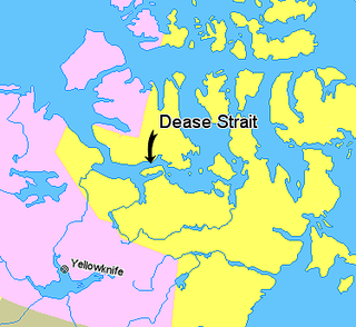
The Kent Peninsula is a large peninsula, almost totally surrounded by water, in Nunavut's northern Canadian Arctic mainland. Were it not for a 5-mile isthmus at the southeast corner it would be a long island parallel to the coast. From the isthmus it extends 105 mi (169 km) westward into the Coronation Gulf. To the south, Melville Sound separates it from the mainland. To the north is Dease Strait and then Victoria Island. To the west is Coronation Gulf and to the east, Queen Maud Gulf. Cape Flinders marks the western tip of the peninsula, Cape Franklin is at the northwestern point, and Cape Alexander marks the northeastern point.
Hoppner may refer to:
Hoppner Inlet is an arm of Foxe Basin's Lyon Inlet on southern Melville Peninsula in Qikiqtaaluk Region of Nunavut, Canada.
The Hoppner River flows northward from Wollaston Peninsula into Dolphin and Union Strait at the juncture with the Amundsen Gulf in Nunavut, Canada. Long-tailed duck frequent the area.
Hoppner Island is an island in Ontario's Georgian Bay.
Hoppner Strait is a narrow arm of Foxe Basin east of Lyon Inlet in the Qikiqtaaluk Region of Nunavut, Canada. It is situated between Winter Island and the Melville Peninsula.
Liddon Island is one of several irregularly shaped islands located in the Fury and Hecla Strait of Nunavut's Qikiqtaaluk Region within the northern Canadian Arctic. It is north of the mainland's Melville Peninsula, south of Baffin Island's Sikosak Bay, west of Ormonde Island, and east of Amherst Island.
Skene Bay is an Arctic waterway in Qikiqtaaluk Region, Nunavut, Canada. Located off southern Melville Island, the bay is an arm of Viscount Melville Sound.
Fort Collinson was a Hudson's Bay Company trading post located on Victoria Island in the Northwest Territories, Canada. It is situated on the Prince Albert Peninsula on the north side of Walker Bay, just north of Minto Inlet.
Cape Parry is a headland in Canada's Northwest Territories. Located at the northern tip of the Parry Peninsula, it projects into Amundsen Gulf. The nearest settlement is Paulatuk, 100 km (62 mi) to the south, and Fiji Island is located 9 km (5.6 mi) to the west. Cape Parry was formerly accessible through Cape Parry Airport that was located at the Distant Early Warning Line. The airport was listed as abandoned after the closure of the DEW line site.
Coordinates: 74°59′2″N112°52′8″W / 74.98389°N 112.86889°W

A geographic coordinate system is a coordinate system that enables every location on Earth to be specified by a set of numbers, letters or symbols. The coordinates are often chosen such that one of the numbers represents a vertical position and two or three of the numbers represent a horizontal position; alternatively, a geographic position may be expressed in a combined three-dimensional Cartesian vector. A common choice of coordinates is latitude, longitude and elevation. To specify a location on a plane requires a map projection.
| This Canadian Northwest Territories location article is a stub. You can help Wikipedia by expanding it. |