Related Research Articles

Mawson Station, commonly called Mawson, is one of three permanent bases and research outposts in Antarctica managed by the Australian Antarctic Division (AAD). Mawson lies in Holme Bay in Mac. Robertson Land, East Antarctica in the Australian Antarctic Territory, a territory claimed by Australia. Established in 1954, Mawson is Australia's oldest Antarctic station and the oldest continuously inhabited Antarctic station south of the Antarctic Circle. It houses approximately 20 personnel over winter and up to 53 in summer.
Martin Glacier is a glacier, 3 nautical miles (6 km) wide and 9 nautical miles (17 km) long, which flows west and then northwest from the south side of Mount Lupa to the southeast corner of Rymill Bay where it joins Bertrand Ice Piedmont, on the west coast of Graham Land, Antarctica. It was first surveyed in 1936 by the British Graham Land Expedition (BGLE) under John Riddoch Rymill, and was resurveyed in 1948–1949 by the Falkland Islands Dependencies Survey. The glacier was named for James Hamilton Martin, a member of the British Australian and New Zealand Antarctic Research Expedition (1929–1931) under Sir Douglas Mawson, and first mate of the Penola during the BGLE.

Mac. Robertson Land is the portion of Antarctica lying southward of the coast between William Scoresby Bay and Cape Darnley. It is located at 70°00′S65°00′E. In the east, Mac. Robertson Land includes the Prince Charles Mountains. It was named by the British Australian and New Zealand Antarctic Research Expedition (BANZARE) (1929–1931), under Sir Douglas Mawson, after Sir Macpherson Robertson of Melbourne, a patron of the expedition.
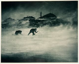
Cape Denison is a rocky point at the head of Commonwealth Bay in George V Land, Antarctica. It was discovered in 1912 by the Australasian Antarctic Expedition (1911–14) under Douglas Mawson, who named it for Sir Hugh Denison of Sydney, a patron of the expedition. The cape was the site of the expedition's main base. Called by Mawson "the windiest place on Earth", the site experiences fierce katabatic winds.
Mawson Peninsula is a high, narrow, ice-covered peninsula on the George V Coast, on the west side of the Slava Ice Shelf, Antarctica, terminating in Cape Hudson. It extends for over 30 nautical miles (56 km) in a northwesterly direction. The peninsula was photographed from the air by U.S. Navy Operation Highjump, 1946–47, and was sketched and photographed by Phillip Law of the Australian National Antarctic Research Expeditions who flew along it to its northern end in February 1959. It was named by the Antarctic Names Committee of Australia for Sir Douglas Mawson.
The Mawson Coast is that portion of the coast of Mac. Robertson Land, Antarctica, lying between William Scoresby Bay, at 59°34′E, and Murray Monolith, at 66°54′E. The coast was sighted during the British Australian New Zealand Antarctic Research Expedition (BANZARE), 1929–30, under Sir Douglas Mawson. Further exploration and landings at Cape Bruce and Scullin Monolith were made during BANZARE, 1930–31. Mawson Coast was named by the Antarctic Names Committee of Australia after Mawson in recognition of his great contribution to Antarctic exploration.
The Scott Mountains are a large number of isolated peaks lying south of Amundsen Bay in Enderby Land of East Antarctica, Antarctica. Discovered on 13 January 1930 by the British Australian New Zealand Antarctic Research Expedition (BANZARE) under Sir Douglas Mawson. He named the feature Scott Range after Captain Robert Falcon Scott, Royal Navy. The term mountains is considered more appropriate because of the isolation of its individual features.
Wilkins Coast is that portion of the east coast of the Antarctic Peninsula between Cape Agassiz and Cape Boggs. It was named by the Advisory Committee on Antarctic Names (US-ACAN) for Sir Hubert Wilkins, who in a pioneer Antarctic exploratory flight on December 20, 1928, flew southward from Deception Island and crossed the Antarctic Peninsula to its east side. He continued southward to Stefansson Strait and Hearst Island, which lie midway along Wilkins Coast.
Mount Martin is a mountain, 1,360 metres (4,460 ft) high, with conspicuous rock exposures on its southeast side, standing immediately north of the head of Anthony Glacier on the east coast of Palmer Land, Antarctica. The mountain lies on the fringe of the area explored by the British Graham Land Expedition in 1936 and was photographed from the air by the United States Antarctic Service in 1940. In 1947 it was photographed from the air by members of the Ronne Antarctic Research Expedition, under Finn Ronne, who in conjunction with the Falkland Islands Dependencies Survey charted it from the ground. The mountain was named by Ronne for electronics engineer Orville Martin, who was of assistance in planning and obtaining radio equipment necessary for Ronne's expedition.

Cape Batterbee is a small, rocky point on the coast, the most northerly cape of Enderby Land. It is located 92 km north of Mount Elkins.
Fold Island, also known as Foldøya is an offshore island north of Ives Tongue, 11 kilometres (6 nmi) long and 6 kilometres (3 nmi) wide, which, with smaller islands south, separate Stefansson Bay to the west from William Scoresby Bay to the east. This feature was seen by Discovery Investigations (DI) personnel on the RSS William Scoresby in February 1936, who mapped it as part of the mainland. It was determined to be an island and named Foldøya by Norwegian cartographers who charted this area from aerial photographs taken by the Lars Christensen Expedition (LCE) in January–February 1937.
The Black Nunataks are a group of about nine nunataks located 10 nautical miles (19 km) west-southwest of Mount Harding in the Grove Mountains, Antarctica. They were mapped by Australian National Antarctic Research Expeditions from air photos, 1956–60, and named by the Antarctic Names Committee of Australia after I. Black, a geophysicist at Mawson Station, 1963.

The Cape-Pigeon Rocks are twin rocky promontories on the western side of Watt Bay, 6 kilometres (3 nmi) south of Garnet Point. They were discovered by the Australasian Antarctic Expedition (1911–14) under Douglas Mawson, who gave the name because of the large rookery of Cape petrels here. The Advisory Committee on Antarctic Names added a hyphen between the first and second words in the specific part of the name to reduce ambiguity and emphasize the generic term "Rocks".
Vukovich Peaks are two well-defined peaks surmounting the northernmost rock outcrop in the Grove Mountains. Mapped from air photos, 1956–60, by ANARE. Named by Antarctic Names Committee of Australia (ANCA) for J.N. Vukovich, weather observer at Mawson Station, 1963.
Grimley Glacier is a tributary glacier, 15 nautical miles (28 km) long and 3 nautical miles (6 km) wide, lying 3 nautical miles north of Sunfix Glacier and flowing east-northeast into Casey Glacier in northern Palmer Land, Antarctica. The glacier was photographed from the air by the United States Antarctic Service on September 28, 1940, and by the Ronne Antarctic Research Expedition on December 22, 1947. It was surveyed by the Falkland Islands Dependencies Survey (FIDS) in December 1960 and was named by the UK Antarctic Place-Names Committee for Peter H. Grimley of FIDS, a geologist at Horseshoe Island and Stonington Island in 1960.
The Douglas Islands are two small islands 22 kilometres (12 nmi) northwest of Cape Daly, and 6 kilometres (3 nmi) north of Andersen Island, as well as 7 kilometres (4 nmi) north-east of Child Rocks, which are both part of the Robinson Group. The islands lie off the coast of Mac. Robertson Land in Antarctica.
The Havre Mountains are a large group of mountains forming the northwestern extremity of Alexander Island, Antarctica, extending 20 nautical miles (37 km) in an east–west direction between Cape Vostok and the Russian Gap. They were first seen in 1821 by a Russian expedition under Fabian Gottlieb von Bellingshausen and re-sighted by the Belgian Antarctic Expedition, 1897–99. They were roughly charted by the French Antarctic Expedition, 1908–10, under Jean-Baptiste Charcot, who named them for Le Havre, the French port from which the Pourquol Pas? sailed in 1908. The mountains were mapped in detail from air photos taken by the Ronne Antarctic Research Expedition, 1947–48, by D. Searle of the Falkland Islands Dependencies Survey in 1960.
Marr Ice Piedmont is a large ice piedmont which covers the northwestern half of Anvers Island, in the Palmer Archipelago, Antarctica. This feature was presumably first seen by a German expedition under Eduard Dallmann, 1873–74, and was first roughly surveyed by the French Antarctic Expedition, 1903–05, and French Antarctic Expedition, 1908–10, both under Jean-Baptiste Charcot. It was named by the UK Antarctic Place-Names Committee for British marine biologist James W.S. Marr, first commander of the Falkland Islands Dependencies Survey, 1943–45, and leader of the base at nearby Port Lockroy. Marr was also a member of the British Australian New Zealand Antarctic Research Expedition under Mawson, 1929–31, and of Shackleton's expedition of 1921–22.
Scripps Heights is a rugged heights which are largely ice-covered, surmounting the peninsula between Casey Glacier and Lurabee Glacier on the east coast of Palmer Land, Antarctica. Deeply scarred by glaciers, the heights terminate on the east in Cape Walcott. Discovered by Sir Hubert Wilkins in his pioneer flight on December 20, 1928. Thinking the feature to be a large island lying between two great transverse channels which completely severed Antarctic Peninsula, he named it Scripps Island for William Scripps of Detroit, Michigan. Correlation of aerial photographs taken by Lincoln Ellsworth in 1935 and preliminary reports of the findings of the British Graham Land Expedition (BGLE) under Rymill, 1934–37, led W.L.G. Joerg to interpret this to be a peninsula. In published reports, members of the BGLE have concurred in this interpretation which was also borne out by the results of subsequent flights and a sledge trip from East Base by members of the United States Antarctic Service (USAS) in 1940.

Cape Robinson is a cape marking the east end of Cole Peninsula, between Cabinet and Mill Inlets on Foyn Coast, Graham Land. Sir Hubert Wilkins, while on his flight of December 20, 1928 along this coast, named an island for W.S. Robinson of London and Australia, which he reported to lie in about 67°20′S61°40′W. Absence of photographs of this island by Wilkins has prevented its positive reidentification. For this reason, and for the sake of historical continuity, it is recommended that the east end of the peninsula here described be given the name Cape Robinson. This cape was charted by the Falkland Islands Dependencies Survey (FIDS) and photographed from the air by the Ronne Antarctic Research Expedition (RARE) in 1947.
References
- ↑ "Cape Mawson". Geographic Names Information System . United States Geological Survey, United States Department of the Interior . Retrieved 2013-08-30.
![]() This article incorporates public domain material from "Cape Mawson". Geographic Names Information System . United States Geological Survey.
This article incorporates public domain material from "Cape Mawson". Geographic Names Information System . United States Geological Survey.
| | This Palmer Land location article is a stub. You can help Wikipedia by expanding it. |