Cape Morton

Last updated
Cape Morton
Kap Morton
Operational Navigation Chart A-5, 3rd edition.jpg
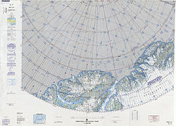
Map of the Nares Strait area.
Greenland edcp location map.svg
Red pog.svg
Cape Morton
Location in Greenland
Coordinates: 81°12′N62°48′W / 81.200°N 62.800°W / 81.200; -62.800
Location Avannaata, Greenland
Offshore water bodies Nares Strait
Elevation600

Cape Morton (Danish : Kap Morton) is a headland in North Greenland in Avannaata municipality. The cape is named after Arctic explorer William Morton, who surveyed the Nares Strait area together with Hans Hendrik in June 1854 during the Second Grinnell Expedition.

Contents

Fossils dating back to the Homerian have been found in the area of the cape. They belong to the Kap Morton Formation of the Peary Land Group. [1]

Geography

Cape Morton is located west of Cape Lucie Marie, off the mouth of the Petermann Fjord opposite Cape Tyson at the northern end of the Petermann Peninsula. Mushroom-shaped Joe Island lies 3.2 km from the shore west-north-west of the cape. [2]

Together with Cape Baird on the eastern coast of Ellesmere Island this cape marks the northern limit of the Kennedy Channel and the entrance of the Hall Basin, both part of the Nares Strait. [3]

See also

Related Research Articles

<span class="mw-page-title-main">Ellesmere Island</span> Island of the Arctic Archipelago in Nunavut, Canada

Ellesmere Island is Canada's northernmost and third largest island, and the tenth largest in the world. It comprises an area of 196,236 km2 (75,767 sq mi), slightly smaller than Great Britain, and the total length of the island is 830 km (520 mi).

<span class="mw-page-title-main">Hans Island</span> Island shared by Canada and Greenland, Denmark

Hans Island is an island in the centre of the Kennedy Channel of Nares Strait in the high Arctic region, split between the Canadian territory of Nunavut and the Danish autonomous territory of Greenland. The island itself is barren and uninhabited with an area of 130 hectares, measuring 1,290 by 1,199 metres, and a maximum elevation of 168.17 m (551.7 ft). Its location in the strait that separates Ellesmere Island of Canada from northern Greenland was for years a border dispute, the so-called Whisky War between the two countries of Canada and Denmark. Hans Island is the smallest of three islands in Kennedy Channel off the Washington Land coast; the others are Franklin Island and Crozier Island. The strait at this point is 35 km (22 mi) wide, placing the island within the territorial waters of both Canada and Denmark (Greenland). A 1,280-metre-long (4,200 ft) border traverses the island.

<span class="mw-page-title-main">Cape Morris Jesup</span> Headland in northern Greenland

Cape Morris Jesup is a headland in Peary Land, Greenland.

<span class="mw-page-title-main">Franklin Island (Greenland)</span> Island in Greenland, in the Kennedy Channel

Franklin Island is one of three islands located in Kennedy Channel of Nares Strait in the high Arctic and is part of Avannaata municipality, Greenland.

<span class="mw-page-title-main">Smith Sound</span> Arctic sea passage between Greenland and Canada

Smith Sound is an Arctic sea passage between Greenland and Nunavut's northernmost island, Ellesmere Island. It links Baffin Bay with Kane Basin and forms part of the Nares Strait. On the Canadian side it extends from Cape Sabine in the north to Cape Isabella in the south.

Jørgen Brønlund Fjord or Bronlund Fjord is a fjord in southern Peary Land, northern Greenland.

<span class="mw-page-title-main">Peary Land</span> Peninsula in northern Greenland

Peary Land is a peninsula in northern Greenland, extending into the Arctic Ocean. It reaches from Victoria Fjord in the west to Independence Fjord in the south and southeast, and to the Arctic Ocean in the north, with Cape Morris Jesup, the northernmost point of Greenland's mainland, and Cape Bridgman in the northeast.

<span class="mw-page-title-main">Hall Basin</span> Arctic sea passage between Greenland and Canada

Hall Basin is an Arctic waterway between Hall Land in Greenland to the east and Canada's northernmost island, Ellesmere Island, to the west.

<span class="mw-page-title-main">Etah, Greenland</span> Place in Greenland, Kingdom of Denmark

Etah is an abandoned settlement in the Avannaata municipality in northern Greenland. It was a starting point of discovery expeditions to the North Pole and the landing site of the last migration of the Inuit from the Canadian Arctic.

Brønlundhus, on some maps also Brønlundfjord, is a former research station and radio station located on the western shore of Jørgen Brønlund Fjord in southern Peary Land, in northern Greenland. It is named after Greenlandic Arctic researcher Jørgen Brønlund, or after the namesake fjord on which it is located. It is close to the mouth of Jørgen Brønlund Fjord where it opens into Independence Fjord.

<span class="mw-page-title-main">Petermann Glacier</span> Glacier in Greenland

Petermann Glacier is a large glacier located in North-West Greenland to the east of Nares Strait. It connects the Greenland ice sheet to the Arctic Ocean at 81°10' north latitude, near Hans Island.

Hall Land is a peninsula in far northwestern Greenland. It is a part of the Northeast Greenland National Park. Hall Land is one of the coldest places in Greenland.

<span class="mw-page-title-main">Cape Bridgman</span> Headland in northeast Greenland

Cape Bridgman is a headland in the Wandel Sea, Arctic Ocean, northeast Greenland.

Joe Island is an island of the Nares Strait, Greenland. Administratively it belongs to the Avannaata municipality.

<span class="mw-page-title-main">Cape Washington, Greenland</span> Headland in North Greenland

Cape Washington is a headland in North Greenland. Administratively it belongs to the Northeast Greenland National Park.

<span class="mw-page-title-main">Cape Cannon</span>

Cape Cannon is a headland in the Lincoln Sea, Arctic Ocean, North Greenland. Administratively it is part of the Northeast Greenland National Park.

Cape Bismarck is a headland in King Frederick VIII Land, Northeast Greenland. Administratively it is part of the Northeast Greenland National Park.

<span class="mw-page-title-main">Herluf Trolle Land</span>

Herluf Trolle Land is an area in Peary Land, North Greenland. Administratively it is part of the Northeast Greenland National Park.

References

  1. Kap Morton Formation - Peary Land Group
  2. "Kap Morton". Mapcarta. Retrieved 8 April 2016.
  3. Prostar Sailing Directions 2005 Greenland and Iceland Enroute, p. 93