Related Research Articles

Nakhodka is a port city in Primorsky Krai, Russia, located on the Trudny Peninsula jutting into the Nakhodka Bay of the Sea of Japan, about 85 kilometers (53 mi) east of Vladivostok, the administrative center of the krai. Population: 159,719 (2010 Census); 148,826 (2002 Census); 160,056 (1989 Census).

Magdalena Bay is a 50 km (31 mi) long bay in Comondú Municipality along the western coast of the Mexican state of Baja California Sur. It is protected from the Pacific Ocean by the unpopulated sandy barrier islands of Isla Magdalena and Isla Santa Margarita.
Sakhalin Gulf is a gulf in the Sea of Okhotsk between continental Russia and the northern tip of Sakhalin Island. The width of the gulf reaches up to 160 km (99 mi). It is covered with ice from mid-November until late April, but north winds can leave the bay blocked with ice until July.

Ayan is a rural locality and the administrative center of Ayano-Maysky District of Khabarovsk Krai, Russia, located on the shore of a well-protected bay of the Sea of Okhotsk, 1,447 kilometers (899 mi) from Khabarovsk and 631 kilometers (392 mi) by sea from Nikolayevsk-on-Amur. Population: 967 (2010 Census); 1,325 (2002 Census); 2,039 (1989 Census).

Iony Island, or Jonas' Island, formerly Ostrov Svyatogo Iony, is a small island in the Sea of Okhotsk.

Taui Bay is a body of water in the Sea of Okhotsk off the coast of the Magadan Oblast in Russia. The bay opens to the south.

Ulban Bay is a bay in the northwestern Sea of Okhotsk, just south of the Shantar Islands. It is a southern branch of Academy Bay to the north. The Syran and Ulban rivers flow into its head.
Nikolaya Bay, formerly Usalginsky Bay, is a small, narrow bay in the northwestern Sea of Okhotsk, just south of the Shantar Islands. It is a southeastern branch of the larger Academy Bay to the north. Its northern and southern points, Lamsdorf Point and Cape Grote, are separated by only 8 km (5 mi), while the bay itself is about 59.5 km (37 mi) deep in a southerly direction. The Tokara Peninsula separates it from Ulban Bay to the west. The Usalgin River runs into its head. Spring tides rise 5.5 m (18 ft), while neaps rise 2.4–3 m (8–10 ft). There is ice in the bay from mid-November to mid-July.
Tugur Bay or Tugursky Bay is a large bay in the Tuguro-Chumikansky District of Khabarovsk Krai, Russian Federation.
The Shantar Sea is a small coastal sea in the northwestern Sea of Okhotsk.
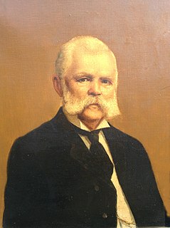
Otto Wilhelm Lindholm was a Finnish businessman and whaleman who served under the Russian flag.
Mamga Bay is a bay in the Tuguro-Chumikansky District of Khabarovsk Krai, Russian Federation.

Uda Gulf or Uda Bay is a bay or gulf in Khabarovsk Krai, Russian Federation.
Academy Bay is a large bay in the Tuguro-Chumikansky District of Khabarovsk Krai, Russian Federation.
Lebyazhya Bay is a small bay that indents the south side of Feklistova Island, one of the Shantar Islands, in the western Sea of Okhotsk. Its entrance is 11.3 kilometers (7.0 mi) wide and it is 5.6 kilometers (3.5 mi) deep. There are three small bays at its head: Enegelma Road to the west, Soboleva to the north, and Rosseta to the east. A small island, Sukhotina, lies to its southeast. In the spring and summer it is host to a small nesting colony of thick-billed murre. A number of streams of fresh water flow down the hills into the bay. Spring tides rise 6.5 meters (21 ft) while neaps rise 2.4 meters.
Severo-Vostochnaya Gavan' is a small bay on the north side of Uda Gulf, in the western Sea of Okhotsk. It lies 2.4 km (1.5 mi) west of Cape Nosorog. It offers shelter from northeast gales.
Cape Bol'shoy Dugandzha is a headland in Khabarovsk Krai, Russia.
Aldoma Bay is a small bay in the western Sea of Okhotsk. It is 8 km east to west and 14.5 km north to south. The Aldoma River flows into it from the west; to its east lies the Nurki Peninsula. It is considered the best anchorage in the northwestern part of the sea as it offers shelter from northeast winds.
Commercial open-boat whaling by American and European ships occurred in the Sea of Okhotsk from the 1830s to the early 1900s. They primarily caught right and bowhead whales. Both populations of these species declined drastically, with the latter once thought to be extinct by western historians. Peak catches were made in the 1840s and 1850s. It is estimated that as many as 15,200 bowheads and 2,400 rights were taken in the sea.
Cape Manorsky is a cape in the western Sea of Okhotsk. It lies ten miles southwest of Cape Nosorog. A small reef extends to the south of the cape.
References
- ↑ National Geospatial-Intelligence Agency. (2014). Sailing Directions (Enroute): East Coast of Russia. U.S. Government, Springfield, Virginia.
- ↑ Lexington, of Nantucket, Sep. 14, 1854, Nantucket Historical Association; Cicero, of New Bedford, Sep. 19, 1862, Kendall Whaling Museum (KWM).
- ↑ Storfursten Constantin, of Helsinki, October 1858 and summer 1859. In Lindholm, O. V., Haes, T. A., & Tyrtoff, D. N. (2008). Beyond the frontiers of imperial Russia: From the memoirs of Otto W. Lindholm. Javea, Spain: A. de Haes OWL Publishing.
- ↑ Storfursten Constantin, of Helsinki, October 1859 and October 1860. In Lindholm, O. V., Haes, T. A., & Tyrtoff, D. N. (2008). Beyond the frontiers of imperial Russia: From the memoirs of Otto W. Lindholm. Javea, Spain: A. de Haes OWL Publishing.
- ↑ Josephine, of New Bedford, June 27–29, 1864, KWM; Java, of New Bedford, June 6–8, 1865, KWM.
Coordinates: 55°38′N136°46′E / 55.633°N 136.767°E
| | This Khabarovsk Krai location article is a stub. You can help Wikipedia by expanding it. |