
Giovanni Ambrogio Figino was an Italian Renaissance painter from Milan.

Buccino is a town and comune in Campania in Italy, in the province of Salerno, located about 700 m above sea level.

Montjovet is a town and comune in the Aosta Valley region of north-western Italy. Montjovet lies in the lower Aosta Valley, between France and Switzerland. Though it only has an area of 18.7 square kilometers, the commune has 50 villages and hamlets, and a number of hills, the highest of which is Mont Lyan, at 2174 metres. Historically, the parish was under the control of the Bishop of Aosta. The current main parish church, Parrocchia della Natività della Vergine Maria, opened in 1837.

The Royal Academy of Italy was a short-lived Italian academy of the Fascist period. It was created on 7 January 1926 by royal decree, but was not inaugurated until 28 October 1929. It was effectively dissolved in 1943 with the fall of Mussolini, and was finally suppressed on 28 September 1944. All of its functions and assets, including the Villa Farnesina, were passed to the Accademia Nazionale dei Lincei. Until 25 April 1945 it continued some activity in the Villa Carlotta on Lake Como near Tremezzo in Lombardy.

Francesco Mancini was an Italian painter whose works are known between 1719 and 1756. He was the pupil of Carlo Cignani.

San Lio is a church located on the campo of the same name in the sestiere of Castello.

Rodolfo Gambini was an Italian painter, active mainly in Milan, Lombardy, Piedmont, and Liguria. He painted both history and sacred subjects. He was born in Arluno and died in Alessandria, Piedmont. He studied at the Accademia di Belle Arti di Brera in Milan. Piero Vignoli and Giovanni Ferraboschi were two of his pupils.
The following is a timeline of the history of the city of Forlì in the Emilia-Romagna region of Italy.

Claudio Maniago is an Italian prelate of the Catholic Church who was named archbishop of Catanzaro-Squillace in 2021, after serving as the bishop of Castellaneta since 2014. He was previously an auxiliary bishop of Florence. He has led the liturgy programs of the Italian Episcopal Conference since 2015.

Anna Maria Brizio (1902-1982) was professor of art history at the University of Milan, a member of the Commissione Vinciana and an authority on the work of Leonardo da Vinci.
The National Library Service of Italy is a Ministry of Cultural Heritage and Activities promoted network of Italian libraries, in collaboration with Regions and Universities, and coordinated by the Central Institute for the Union Catalogue of Italian Libraries and Bibliographic Information.

Tymon Tytus Chmielecki Burgaud(born 29 November 1965) is a Polish prelate of the Catholic Church and a diplomat in the service of the Holy See.

Michela Ramadori is an Italian art historian, author and academic.
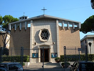
Santa Maria Immacolata di Lourdes a Boccea is a 20th-century parochial church and titular church in Rome, dedicated to Our Lady of Lourdes.

Colle di Compito is a frazione of Capannori in the province of Lucca region of Tuscany in Italy.
The Concattedrale Gran Madre di Dio is a Roman Catholic co-cathedral in Taranto, Italy. Built between 1967 and 1970, it is notable for its modern architectural style.
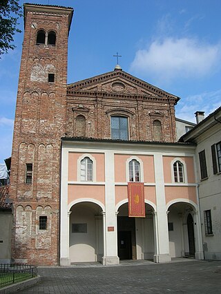
The Church of Santi Gervasio e Protasio is a church in Pavia, in Lombardy.

San Giuseppe is a Roman Catholic church in the city of Grosseto, Tuscany. Located in the western part of the city on Via Sauro, in the Barbanella neighborhood, it is the first parish church built in Grosseto outside the historic center.

San Giuseppe Benedetto Cottolengo is a Roman Catholic church in Grosseto, Tuscany. It is dedicated to St. Joseph Benedict Cottolengo, the founder of the Little House of Divine Providence. The church is situated in the eastern part of the city's urban area, on Via Scansanese, in the Alberino neighborhood.

Santa Famiglia is a Roman Catholic church in Grosseto, Tuscany. The church, along with the entire parish complex, is located on Via Unione Sovietica in the northeastern neighborhood of Sugherella, within the "167 Nord" public housing development. The church has also attracted interest due to its unusual appearance, which evokes the look of a mosque with a minaret.


