A ZIP Code is a postal code used by the United States Postal Service (USPS) in a system it introduced in 1963. The term ZIP is an acronym for Zone Improvement Plan; it was chosen to suggest that the mail travels more efficiently and quickly when senders use the code in the postal address. The basic format consists of five digits. An extended ZIP+4 code was introduced in 1983 which includes the five digits of the ZIP Code, followed by a hyphen and four additional digits that reference a more specific location.

Afton is an unincorporated community in Albemarle and Nelson counties in the U.S. state of Virginia. It is located in the foothills of the Blue Ridge Mountains about 20 miles (32 km) west of Charlottesville.
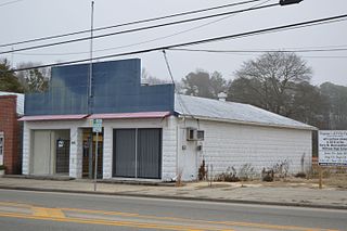
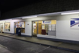
Hudgins is an unincorporated community in northern Mathews County, Virginia, United States. It lies north of the community of Mathews, the county seat of Mathews County. Its elevation is 10 feet (3 m). Although Hudgins is unincorporated, it has a post office, with the ZIP code of 23076.

Frankford is an unincorporated community in Greenbrier County, West Virginia, United States. Frankford is located on U.S. Route 219 south of Falling Spring and north of Maxwelton. Frankford has a post office with ZIP code 24938.
Glen Daniel is an unincorporated community in Raleigh County, West Virginia, United States. Glen Daniel is located at the junction of West Virginia Route 3 and West Virginia Route 99 8.5 miles (13.7 km) west of Beckley. Glen Daniel has a post office with ZIP code 25844.
Danese is an unincorporated community in Fayette County, West Virginia, United States. Danese is located on West Virginia Route 41 5.5 miles (8.9 km) northwest of Meadow Bridge. Danese has a post office with ZIP code 25831.

Layland is an unincorporated community in Fayette County, West Virginia, United States. Layland is located on West Virginia Route 41 6.5 miles (10.5 km) west-northwest of Meadow Bridge. Layland has a post office with ZIP code 25864.
Dorothy is an unincorporated community in Raleigh County, West Virginia, United States. Dorothy is 4.5 miles (7.2 km) east-southeast of Whitesville. Dorothy has a post office with ZIP code 25060. At one time, it was also called Lawson
Mount Olive is an unincorporated community in Fayette County, West Virginia, United States. Mount Olive is 5.5 miles (8.9 km) north-northwest of Gauley Bridge. The town itself has no ZIP code; however, Mount Olive Correctional Complex, West Virginia's maximum-security state prison, is located near the town and has a post office with ZIP code 25185.
Pecks Mill is an unincorporated community in Logan County, West Virginia, United States. Pecks Mill is located on the Guyandotte River and West Virginia Route 10 1.5 miles (2.4 km) north of Mitchell Heights. Pecks Mill has a post office with ZIP code 25547.

Grimstead is an unincorporated community in Mathews County, Virginia, United States. Grimstead is located on Gwynn's Island 4.5 miles (7.2 km) north-northeast of Mathews. Grimstead has a post office with ZIP code 23064.

Gwynn is a census-designated place (CDP) in Mathews County, Virginia, United States. The population as of the 2010 Census was 602. Gwynn is located on Gwynn's Island 5 miles (8.0 km) north-northeast of Mathews. Gwynn has a post office with ZIP code 23066.

Bohannon is an unincorporated community in Mathews County, Virginia, United States. Bohannon is 3.5 miles (5.6 km) southwest of Mathews. Bohannon has a post office with ZIP code 23064.
Cobbs Creek is an unincorporated community in Mathews County, Virginia, United States. Cobbs Creek is located on Virginia Route 198 6.5 miles (10.5 km) northwest of Mathews. Cobbs Creek has a post office with ZIP code 23035.
Foster is an unincorporated community in Mathews County, Virginia, United States. Foster is located on Virginia Route 14 3.5 miles (5.6 km) west-northwest of Mathews. Foster has a post office with ZIP code 23056.
Hallieford is an unincorporated community in Mathews County, Virginia, United States. Hallieford is 4 miles (6.4 km) north-northwest of Mathews. Hallieford has a post office with ZIP code 23068.
Moon is an unincorporated community in Mathews County, Virginia, United States. Moon is 1.5 miles (2.4 km) east-northeast of Mathews. Moon has a post office with ZIP code 23119.
Miles is an unincorporated community in Mathews County, Virginia, United States. Miles is located on Whites Neck 3 miles (4.8 km) southwest of Mathews. Miles had a post office, which closed on July 4, 1992.
North is an unincorporated community in Mathews County, Virginia, United States. North is located on Virginia State Route 14 4.75 miles (7.64 km) west of Mathews. North has a post office with ZIP code 23128.

Mathews is an unincorporated community in Montgomery County, Alabama, United States, located 18.7 miles (30.1 km) east-southeast of Montgomery. Mathews had a post office until it closed on November 19, 2011; it still has its own ZIP code, 36052. It was named for Revolutionary War hero and Georgia Governor George Mathews.


