Carey School

Last updated
Carey School (K-12)
Address
Carey School
20 Panther Lane

,
Idaho 83320

United States
Information
Type Public
Established1965
School district Blaine County School District
PrincipalKayla Janelle Burton
Faculty21.09 (FTE) [1]
GradesK-12
Number of students245 (2018-19) [1]
Student to teacher ratio11.62 [1]
Color(s)  
MascotPanther
YearbookPanther
IHSAA Division1A
Website Carey School
Sign for the school and the city government Carey, Idaho.jpeg
Sign for the school and the city government

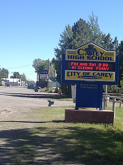
Carey School is a K-12 school in the Blaine County School District and serves the rural farming community of Carey, Idaho. The high school is located on the same campus that includes an elementary and junior high school, encompassing Carey School.

Contents

The school's boundary includes Carey and Picabo. [2]

History

In 1987 the school board decided to have an addition built and to renovate the existing portion. 11 companies put forth bids to do the work, and the board selected Brennan Construction because its bid was the lowest. [3]

Construction on the current high school facility began in 2003. The facility was to have 43,000 square feet (4,000 m2) and have a walkway connection to the remainder of the school. The school district initially proposed 37,000 square feet (3,400 m2). The estimated cost was $4,750,000. [4]

Athletics

The Carey High School football team was the 2006 and 2008 state champion in 1A Division II eight-man football in Idaho, their fourth state championship title. The Carey girls basketball have gone to state three years in a row. They have gotten consolation, 3rd and 2nd. In 2018, they won state championship in 1A Division II. Some of the most intense rivalries Carey has in sports have been with Richfield, Dietrich and in the past Shoshone High School.[ citation needed ]

43°18′59″N113°56′37″W / 43.31639°N 113.94361°W / 43.31639; -113.94361

Related Research Articles

<span class="mw-page-title-main">Twin Falls County, Idaho</span> County in Idaho, United States

Twin Falls County is a county in the south central part of the U.S. state of Idaho. As of the 2020 census, the population was 90,046, making it the fifth-most populous county in Idaho. The county seat and largest city is Twin Falls. Twin Falls County is part of the Twin Falls, ID Twin Falls Metropolitan Statistical Area.

<span class="mw-page-title-main">Cassia County, Idaho</span> County in Idaho, United States

Cassia County is a county in the U.S. state of Idaho. As of the 2020 Census the county had a population of 24,655. The county seat and largest city is Burley. Cassia County is included in the Burley, ID Micropolitan Statistical Area.

<span class="mw-page-title-main">Butte County, Idaho</span> County in Idaho, United States

Butte County is a rural county located in the U.S. state of Idaho. As of the 2020 census, the population was 2,574, making it the third-least populous county in Idaho. Its county seat and largest city is Arco. The county was established in 1917 from parts of Bingham, Blaine, and Jefferson counties. The county gained territory in the Clyde area from Custer County in 1937 to reach its present boundary.

<span class="mw-page-title-main">Blaine County, Idaho</span> County in Idaho, United States

Blaine County is a county in the U.S. state of Idaho. As of the 2020 United States Census, the population was 24,272. The county seat and largest city is Hailey. It is also home to the Sun Valley ski resort, adjacent to Ketchum.

<span class="mw-page-title-main">Post Falls, Idaho</span> City in Idaho, United States

Post Falls is a city in Kootenai County, Idaho, United States. It is the gateway city to North Idaho on I-90 just west of Coeur d'Alene and east of Spokane, Washington. The population was 38,485 at the 2020 census, making it Idaho's ninth-largest city and the second largest city in North Idaho behind Coeur d’Alene.

<span class="mw-page-title-main">Carey, Idaho</span> City in Idaho, United States

Carey is a city in Blaine County, Idaho, United States. The population was 604 at the 2010 census. Carey is primarily an agricultural city and is the location of the Blaine County Fairgrounds. Nearby recreational destinations include the Craters of the Moon National Monument, Carey Lake, Silver Creek and the Little Wood River. Further west is the Big Wood River Valley, leading to the Sun Valley resort.

<span class="mw-page-title-main">Hailey, Idaho</span> City in and county seat of Blaine County, Idaho, United States

Hailey is a city in and the county seat of Blaine County, in the Wood River Valley of the central part of the U.S. state of Idaho. The population was 7,960 at the 2010 census, up from 6,200 in 2000. Hailey is the site of Friedman Memorial Airport (SUN), the airport for the resort area of Sun Valley/Ketchum, 12 miles (19 km) north. The town of Bellevue is a few miles south. From 1882 to 1895, Hailey was the county seat of now-defunct Alturas County.

<span class="mw-page-title-main">Ketchum, Idaho</span> City in Idaho, United States

Ketchum is a city in Blaine County, Idaho, United States. Located in the central part of the state, the population was 3,555 at the 2020 census, up from 2,689 in 2010. Located in the Wood River Valley, Ketchum is adjacent to Sun Valley and the communities share many resources: both sit in the same valley beneath Bald Mountain, with its skiing. The city also draws tourists to its fishing, hiking, trail riding, tennis, shopping, art galleries, and more. The airport for Ketchum, Friedman Memorial Airport, is approximately 15 miles (24 km) south in Hailey.

<span class="mw-page-title-main">Sun Valley, Idaho</span> City in Idaho, United States

Sun Valley is a resort city in the western United States, in Blaine County, Idaho, adjacent to the city of Ketchum in the Wood River valley. The population was 1,783 at the 2020 census. The elevation of Sun Valley is 5,920 feet (1,805 m) above sea level.

<span class="mw-page-title-main">Shoshone, Idaho</span> City in Idaho, United States

Shoshone is the county seat and largest city of Lincoln County, Idaho, United States. The population was 1,461 at the 2010 census. In contrast to the Shoshone Native American tribe for which it is named, the city's name is correctly pronounced "Show-shown", with a silent "e".

<span class="mw-page-title-main">Twin Falls, Idaho</span> City in Idaho, United States

Twin Falls is the county seat and largest city of Twin Falls County, Idaho, United States. The city had a population of 51,807 as of the 2020 census. In the Magic Valley region, Twin Falls is the largest city in a 100-mile (160 km) radius, and is the regional commercial center for south-central Idaho and northeastern Nevada. It is the principal city of the Twin Falls metropolitan statistical area, which officially includes the entirety of Twin Falls and Jerome Counties. The border town resort community of Jackpot, Nevada, 50 mi (80 km) south at the state line, is unofficially considered part of the greater Twin Falls area. Located on a broad plain at the south rim of the Snake River Canyon, Twin Falls, is where daredevil Evel Knievel attempted to jump across the canyon in 1974 on a steam-powered rocket. The jump site is northeast of central Twin Falls, midway between Shoshone Falls and the Perrine Bridge.

<span class="mw-page-title-main">Blaine, Minnesota</span> City in Minnesota, United States

Blaine is a suburban city in Anoka and Ramsey counties in Minnesota, United States. Once a rural town, Blaine's population has increased significantly in the last 60 years. For several years, Blaine led the Twin Cities metro region in new home construction. The population was 70,222 at the 2020 census. The city is mainly in Anoka County, and is part of the Minneapolis–Saint Paul metropolitan area.

<span class="mw-page-title-main">Magic Valley</span> Region in Idaho, United States

The Magic Valley, also known as South Central Idaho, is a region in south-central Idaho constituting Blaine, Camas, Cassia, Gooding, Jerome, Lincoln, Minidoka, and Twin Falls counties. It is particularly associated with the agricultural region in the Snake River Plain located in the area. The northern Magic Valley region — particularly Blaine and Camas Counties — is also known as the Wood River Valley after the Big Wood River.

<span class="mw-page-title-main">Bald Mountain (Idaho)</span> Ski area in Idaho, United States

Bald Mountain is a mountain in the western United States in south central Idaho, adjacent to the city of Ketchum in Blaine County. The mountain has one of the higher summits of the Smoky Mountains of Idaho, located in the Sawtooth National Forest. The forested Smoky Mountains were named for their propensity for summer forest fires.

Wood River High School is a public secondary school in Hailey, Idaho, one of two traditional high schools operated by the Blaine County School District #61. Wood River High School serves the communities of Bellevue, Hailey, Ketchum, and Sun Valley, all in the valley of the Big Wood River, Wood River Middle School, and Wood River High School. and the current campus opened in August 2003. The school colors are green and white and the mascot is a wolverine.

<span class="mw-page-title-main">Central Idaho</span> Region in Idaho, United States

Central Idaho is a geographical term for the region located northeast of Boise and southeast of Lewiston in the U.S. state of Idaho. It is dominated by federal lands administered by the United States Forest Service and the Bureau of Land Management. Idaho's tallest mountain, Borah Peak, is located in this region. A large part of the Sawtooth National Recreation Area is within Central Idaho.

The State of Idaho has been without an official governor's residence since 2013.

Blaine County School District 61 (BCSD) is a school district headquartered in Hailey, Idaho.

Minico High School, also known as Minidoka County High School, is a four-year public secondary school in unincorporated Minidoka County, Idaho, with a Rupert postal address, operated by the Minidoka County Joint School District #331. The school colors are red and gold and the mascot is a Spartan.

<span class="mw-page-title-main">U.S. Route 20 in Idaho</span> Section of U.S. Highway in Idaho, United States

U.S. Highway 20 (US 20) is the portion of an east–west United States Numbered Highway in the state of Idaho. It begins northwest of Parma at the Oregon state line and enters Montana 9.6 miles (15.4 km) away from the Yellowstone National Park west entrance.

References

  1. 1 2 3 "CAREY PUBLIC SCHOOL". National Center for Education Statistics. Retrieved February 20, 2021.
  2. "Blaine County School District : Neighborhood School Boundaries". Blaineschools.org. Archived from the original on September 29, 2011. Retrieved November 13, 2011. Areas East of ½ mile[...]Students who reside in the Carey Area[...] - Picabo is more than one half mile east of the intersection of Highway 20 and Gannett Road.
  3. Zilly, John (1987-03-12). "Blaine OKs renovation of Carey school". Times-News . Twin Falls, Idaho. pp.  B-1, B-4 via Newspapers.com.
  4. Neiwert, Barb (2003-04-08). "Carey starts work on new school Crowd gathers for groundbreaking ceremony". Times-News . Twin Falls, Idaho. p.  B1 via Newspapers.com.