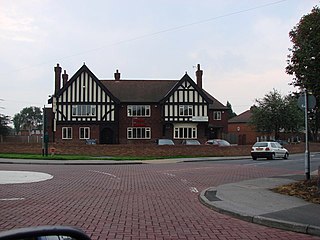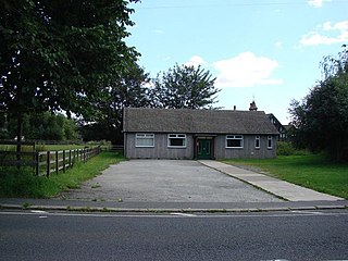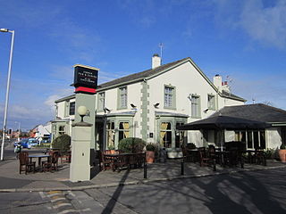
Pontefract is a historic market town in the City of Wakefield, a metropolitan district in West Yorkshire, England. It lies to the east of Wakefield and south of Castleford. Historically part of the West Riding of Yorkshire, it is one of the towns in the City of Wakefield district and had a population of 30,881 at the 2011 Census. Pontefract's motto is Post mortem patris pro filio, Latin for "After the death of the father, support the son", a reference to the town's Royalist sympathies in the English Civil War. Small villages and settlements in the immediate area include Stapleton.

Kexbrough is a village in the Barnsley district, in the county of South Yorkshire, England, on the border with West Yorkshire. The village falls within the Darton West ward of Barnsley MBC. It is located west of the M1 motorway, just south of Junction 38 at an elevation of around 351 feet (107 m) above sea level. Historically the village was known as Kexborough, and includes the hamlets of Haigh and Swithin. Until 1974 it was in the West Riding of Yorkshire.

Carlton is a village in the Metropolitan Borough of Barnsley in South Yorkshire, England. It is situated between the villages of Athersley and Royston. The village is split into two parts, one half in the Monk Bretton ward and the rest in the Royston ward of the Barnsley MBC. It was built up on coking and coal mining industries and now has one of the largest industrial estates within the surrounding area. In the industrial estate lies a glass recycling plant, called Rexam. To its east stands the Mr Kipling cake factory, owned by Premier Foods. Until 1974 it was in the West Riding of Yorkshire.

Ardsley is a small village approximately 3 miles (5 km) east from Barnsley and forms part of the Metropolitan Borough of Barnsley of South Yorkshire, England. The village is in the Stairfoot ward of Barnsley Metropolitan Council. It is historically part of the West Riding of Yorkshire. The A635 divides the village into two parts.

Ackton is a hamlet in the parish of Featherstone, in the Wakefield district of West Yorkshire, England. It is near Pontefract. In 1931 the parish had a population of 961.

Warley Town is a settlement near Halifax, in the Calderdale district, in the county of West Yorkshire, England. Warley is a ward of Calderdale. The population of this ward as taken at the 2011 Census was 12,215.

Altofts is a village in the civil parish of Normanton and Altofts, in the City of Wakefield, West Yorkshire, England. It lies 5 miles (8 km) north-east from the centre of Wakefield and less than 1 mile (1.6 km) north-west of Normanton. The M62 runs close to the village to the north-east, and the Aire and Calder Navigation to the north-west.

Lepton is a village near Huddersfield in the parish of Kirkburton, in the Kirklees district of West Yorkshire, England. It is 4.25 miles (7 km) to the east of Huddersfield on the A642 road, 120 metres (390 ft) above the town centre directly north of Lepton Great Wood. In 1931 the parish had a population of 3,323.

Hemlington is an area of Middlesbrough, North Yorkshire, England. It is centred around a lake and is in the Borough of Middlesbrough's south-western outskirts.

Thurstonland is a village in the civil parish of Kirkburton, in Kirklees, West Yorkshire, England. It has a population of almost 400.

Upton is a village in the civil parish of Upton and North Elmsall, in the City of Wakefield, West Yorkshire, England. The parish had a population of 3,541 in the 2001 census.

Butterwick is a village and former civil parish, now in the parish of Foxholes (1.75 miles to the east, near the village of Weaverthorpe, in North Yorkshire, England. The village lies in the Great Wold Valley and the course of the winterbourne stream the Gypsey Race passes through it. Until 1974 the village lay in the historic county boundaries of the East Riding of Yorkshire. From 1974 to 2023 it was part of the Ryedale district.

Fockerby is a village in the civil parish of Garthorpe and Fockerby, in the North Lincolnshire district, in the ceremonial county of Lincolnshire, England. It is situated approximately 8 miles (13 km) south-east from Goole and 1 mile (1.6 km) west from the River Trent.

East Hardwick is a village and civil parish in the City of Wakefield in West Yorkshire, England. It has a population of 191, reducing to 173 at the 2011 Census. Until 1974 it was part of Osgoldcross Rural District.

North Elmsall is a village in the civil parish of Upton and North Elmsall, in the City of Wakefield district in West Yorkshire, England. The parish had a population of 4,093 in 2001 and 3,873 in 2011. Until 1974 it was part of Hemsworth Rural District. The parish is seven miles from Pontefract, nine miles from Barnsley and Doncaster, and eleven miles from Wakefield.

Wintersett is a hamlet in the Wakefield district, in West Yorkshire, England. At the 2001 census the population of the parish was 50. Until 1974 it formed part of Wakefield Rural District in the West Riding of Yorkshire. It gives its name to the nearby Wintersett Reservoir.

Whitley Lower is a village near Thornhill in Kirklees, West Yorkshire England. The parish church, dedicated to St Mary and St Michael, is part of the united benefice of Thornhill and Whitley which also includes Briestfield. The church was Grade II listed in 1985. In 1891 the civil parish had a population of 879.

Carleton is a village on the coastal plain of the Fylde in the Borough of Wyre in Lancashire, England. It consists of Great Carleton, Little Carleton, Norcross and Whiteholme and is situated close to Poulton-le-Fylde. Other nearby settlements include Thornton, Bispham and Blackpool. Historically, Carleton was in the parish of Poulton-le-Fylde. It borders the Borough of Blackpool immediately to the west.

Rishworth is a village in the civil parish of Ripponden, in Calderdale, West Yorkshire, England. Historically in the West Riding of Yorkshire, it has a small church, farms and schools, including Rishworth School. In 1931 the parish had a population of 838.

Sitlington, historically Shitlington, was a township in the ancient ecclesiastical parish of Thornhill in the wapentake of Agbrigg and Morley in the West Riding of Yorkshire comprising the villages and hamlets of Middlestown, Netherton, Overton and Midgley. The h was dropped from Shitlington and Sitlington was adopted in 1929 with the approval of the county council. The population of the civil parish at the 2011 census was 5,963.


