
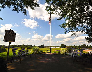
Sutter's Fort was a 19th-century agricultural and trade colony in the Mexican Alta California province. The site of the fort was established in 1839 and originally called New Helvetia by its builder John Sutter, though construction of the fort proper wouldn't begin until 1841. The fort was the first non-Indigenous community in the California Central Valley. The fort is famous for its association with the Donner Party, the California Gold Rush, and the formation of Sacramento. It is notable for its proximity to the end of the California Trail and Siskiyou Trails, which it served as a waystation.

The Sacramento River is the principal river of Northern California in the United States, and is the largest river in California. Rising in the Klamath Mountains, the river flows south for 400 miles (640 km) before reaching the Sacramento–San Joaquin River Delta and San Francisco Bay. The river drains about 26,500 square miles (69,000 km2) in 19 California counties, mostly within the fertile agricultural region bounded by the Coast Ranges and Sierra Nevada known as the Sacramento Valley, but also extending as far as the volcanic plateaus of Northeastern California. Historically, its watershed has reached as far north as south-central Oregon where the now, primarily, endorheic (closed) Goose Lake rarely experiences southerly outflow into the Pit River, the most northerly tributary of the Sacramento.

San Jacinto Peak is the highest peak of the San Jacinto Mountains, and of Riverside County, California. It lies within Mount San Jacinto State Park. Naturalist John Muir wrote of San Jacinto Peak, "The view from San Jacinto is the most sublime spectacle to be found anywhere on this earth!"

Britton Hill is the highest natural point in the state of Florida, United States, with a summit elevation of 345 feet (105 m) above mean sea level. Britton Hill is the lowest state highpoint in the United States, 103 feet (31 m) lower than the next lowest highpoint, Ebright Azimuth in Delaware.

Palomar Mountain is a mountain ridge in the Peninsular Ranges in northern San Diego County. It is famous as the location of the Palomar Observatory and Hale Telescope, and known for the Palomar Mountain State Park.

Taum Sauk Mountain in the Saint Francois Mountains is the highest natural point in the U.S. state of Missouri at 1,772 feet . The topography of Taum Sauk is that of an elongated ridge with a NNW-SSE orientation rather than a peak.
Campbell Hill is, at 1,550 feet (470 m), the highest point in elevation in the U.S. state of Ohio. Campbell Hill is located within the city of Bellefontaine, 2 miles (3.2 km) northeast of downtown.

Eagle Mountain is the highest natural point in Minnesota, United States, at 2,301 feet (701 m). It is in northern Cook County, in the Boundary Waters Canoe Area Wilderness and Superior National Forest in the Misquah Hills, northwest of Grand Marais. It is a Minnesota State Historic Site.

The Chemehuevi Mountains are found at the southeast border of San Bernardino County in southeastern California adjacent the Colorado River. Located south of Needles, California and northwest of the Whipple Mountains, the mountains lie in a north-south direction in general, and are approximately 15 miles in length.
Mill Creek is a large stream in northern California. It is an eastside tributary of the Sacramento River, draining an area of 134 square miles (350 km2) and flowing for 56.5 miles (90.9 km). The creek begins in Shasta County, California, but almost immediately flows into Tehama County, California. The creek's source is a thermal spring at an elevation of 8,200 feet (2,500 m) in Lassen Volcanic National Park. At first, the creek flows roughly south while meandering to the east and west, but the lower two-thirds of the creek flow roughly southwest until it reaches the Sacramento River at an elevation of only 200 feet (61 m), just north of Los Molinos, California.

The Montezuma Hills comprise a small range of low-elevation hills at the northern banks of the Sacramento–San Joaquin River Delta and southwestern Sacramento Valley in California in the United States.
Cobb Mountain is the tallest mountain in the Mayacamas Mountains of California. Its 4720+ feet, (1439+ m) main summit is located in Lake County, west of the town of Cobb. Like nearby Mount Saint Helena, Cobb Mountain is tall enough to receive winter snowfall. The mountain also has a sub-peak named Cobb Mountain – Southwest Peak with an elevation of about 4483+ feet, (1367+ m) NAVD 88; Southwest Peak lies on the Sonoma-Lake county line and is the highest point in Sonoma County. Nearby tall peaks like Mount Saint Helena and Snow Mountain can be seen from this summit.

Blue Angels Peak is a mountain located in the Sierra Juárez mountains less than 300 yards (270 m) north of the United States-Mexico border in California. The mountain rises to an elevation of 4,552 feet (1,387 m) near the San Diego-Imperial county border and Interstate 8. Despite its relatively low elevation, the summit of Blue Angels Peak is the highest point in Imperial County. A 500 kV power line, an extension of Path 46 into San Diego, traverses the northern foothills of this mountain.
Little Blue Peak is highest point on Little Blue Ridge in the Northern Coast Ranges, located on the boundary of Yolo and Lake counties in northern California.
Long Ridge is a hill located in the Santa Cruz Mountains in the San Francisco Bay Area, California. The hill rises to an elevation of about 2,600 feet (792 m) on private property near Highway 35 and the Santa Clara-San Mateo county line. The hill is the highest point in San Mateo County. A hill to the northeast of Long Ridge rises to 2,566 feet (782 m). Some snow falls on the mountain during the winter.

Caliente Mountain is a mountain located in the Southern Coast Ranges of California. The summit, at 5,106 feet (1,556 m), is the highest point in San Luis Obispo County and the Caliente Range. The mountain receives a little snowfall during the winter months.
Corral Ridge or Corral Hollow Hill, a minor summit in the Sierra Nevada, is the highest point in Calaveras County. It stands nearly 4,000 feet (1,200 m) above the North Fork of the Mokelumne River. Located near the Alpine county line, it is east of the Salt Springs Reservoir and west of the town of Bear Valley. Due to its high elevation much of the precipitation that the summit receives is in the form of snow.

Brace Mountain is the peak of a ridge in the southern Taconic Mountains, near the tripoint of the U.S. states of New York, Connecticut and Massachusetts. Its 2,311-foot (704 m) main summit is located in New York; it is the highest point in that state's Dutchess County.

The Mohave Mountains are a small 18-mi (29 km) long mountain range of northwest Arizona. The range is a northwest trending range in southwest Mohave County that parallels a southeast-flowing stretch of the Colorado River, the Arizona-California border. The range also forms the southwest border of a flatland region to its east and north, namely, Dutch Flat which lies east, at the south end of Sacramento Valley. Lake Havasu City, AZ on the Colorado, lays opposite the southwest flank of the range, where the London Bridge was reconstructed at Lake Havasu.


