Lanarkshire, also called the County of Lanark is a historic county in the central Lowlands of Scotland.
Clydesdale is an archaic name for Lanarkshire, a county in Scotland. From 1975 to 1996 it was also the name given to one of the nineteen districts of the Strathclyde region.
Carluke Rovers Football Club are a Scottish football club based in Carluke, South Lanarkshire. Nicknamed The Rovers, they were formed in 1887 and are based in the John Cumming Stadium. The club compete in the West Region of the Scottish Junior Football Association. The team have been managed on a caretaker basis by Derek Wilson since February 2018.
Forth Wanderers Football Club are a Scottish football club based in the village of Forth, South Lanarkshire. Formed in 1904 they compete in the West Region of the Scottish Junior Football Association and play in red strips (uniforms) with a white trim.Although now more often play in a black kit. The black kit is sponsored by the Scottish band G.U.N. and the red kit by local firm Gardiner accountants, and the white kit is sponsored by engineering company Well Machined.
Lanark United Football Club are a Scottish football club based in the town of Lanark, South Lanarkshire. Nicknamed the Yowes, they were formed in 1920, and play at Moor Park. They currently compete in the West Region of the Scottish Junior Football Association and play in blue strips (uniforms) with a white trim.

Rutherglen and Hamilton West is a burgh constituency of the House of Commons of the Parliament of the United Kingdom, which was created for the 2005 general election. It covers almost all of the former constituency of Glasgow Rutherglen and most of the former constituency of Hamilton South, and it elects one Member of Parliament (MP) by the first-past-the-post system of election. The current MP is Gerard Killen of the Labour Co-op party, who was first elected at the 2017 snap general election.

East Kilbride, Strathaven and Lesmahagow is a county constituency of the House of Commons of the Parliament of the United Kingdom, which was first used in the general election of 2005. It replaced East Kilbride and some of Clydesdale, and it elects one Member of Parliament (MP) by the first past the post system of election.
Lanarkshire was a Scottish county constituency of the House of Commons of the Parliament of the United Kingdom (Westminster) from 1708 to 1868. It elected one Member of Parliament (MP) by the first past the post voting system.
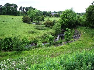
The North Calder Water is a river in North Lanarkshire, Scotland. It flows for 12 miles (19 km) from the Black Loch via the Hillend Reservoir, Caldercruix, Airdrie and Calderbank to the River Clyde at Daldowie, south-east of Glasgow. For the last 2 miles (3.2 km) of its course, it forms part of the boundary between North Lanarkshire and Glasgow.
South Medwin is a river in the Lanarkshire region of Scotland. Along with the confluence of the North Medwin River it forms the Medwin water basin. The South Medwin flows westward to join the River Clyde a mile (1.5 km) south of Carnwath at a point called "The Meeting".

Thankerton is a small village in South Lanarkshire, Scotland, United Kingdom. It is located between Biggar and Lanark. It is situated between Quothquan Law and Tinto.
Newbigging is a village in South Lanarkshire, Scotland. It is near Dunsyre at the southern end of the Pentland Hills. It is on the A72 Carnwath to Peebles road.
Symington is a small village in South Lanarkshire, Scotland, 3 miles (5 km) southwest of Biggar, 10 miles (16 km) east of Douglas and 13 miles (21 km) southeast of Carluke. Geographical features near Symington include Tinto Hill, the Coulter Hills and the River Clyde. A map by Pont in 1596 showed two St John's Kirks in a small settlement, and another map by Roy in 1754 showed a mill to the east.
Kirkfieldbank is a small village and parish in Scotland, on the banks of the Clyde Water. It is close to the town of Lanark and is part of the current South Lanarkshire local authority. The village of New Lanark is also close by, some ten minutes drive upstream.
Ravenstruther is a small village in South Lanarkshire, Scotland, near the town of Lanark. In 1517 the lands of Carstairs and Ravenstruther were granted to William Sommerville. Ravenstruther was then known as Ronstruther. The village is home to a caravan and camping park.

North Medwyn is a river in the Lanarkshire region of Scotland. Along with the confluence of the South Medwyn River it forms the Medwyn water basin. The North Medwyn is a tributary of the River Clyde.
Crossford is a village in South Lanarkshire, Scotland.

Pettinain is a hamlet and civil parish in South Lanarkshire, Scotland, 7 miles (11 km) east of Lanark. Bartholomew's Gazetteer of the British Isles described Pettinain in 1887 as "par. and vil., Lanarkshire, on river Clyde - par., 3900 ac., pop. 360; vil., 3 miles S. of Carstairs Junction; P.O".

Duneaton Water is a river in South Lanarkshire, Scotland. It joins the River Clyde at Abington.
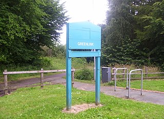
The Greenlink Cycle Path is a cycle path in North Lanarkshire that is a direct route running from Strathclyde Country Park to Motherwell Town Centre. The path is 7 kilometres in length. The Greenlink project was established in 2005, and is part of a 3-year partnership between many organisations, such as North Lanarkshire Council, Scottish National Heritage and Forestry Commission Scotland.


