
The Snake River is a major river of the greater Pacific Northwest region in the United States. At 1,078 miles (1,735 km) long, it is the largest tributary of the Columbia River, in turn, the largest North American river that empties into the Pacific Ocean. The Snake River rises in western Wyoming, then flows through the Snake River Plain of southern Idaho, the rugged Hells Canyon on the Oregon–Idaho border and the rolling Palouse Hills of Washington, emptying into the Columbia River at the Tri-Cities in the Columbia Basin of Eastern Washington.
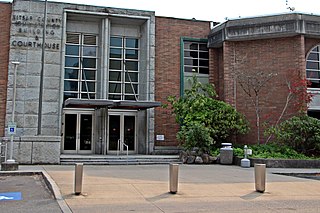
Kitsap County is located in the U.S. state of Washington. As of the 2020 census, its population was 275,611. Its county seat is Port Orchard; its largest city is Bremerton. The county, formed out of King County and Jefferson County on January 16, 1857, is named for Chief Kitsap of the Suquamish Tribe. Originally named Slaughter County, it was soon renamed.

The Tuolumne River flows for 149 miles (240 km) through Central California, from the high Sierra Nevada to join the San Joaquin River in the Central Valley. Originating at over 8,000 feet (2,400 m) above sea level in Yosemite National Park, the Tuolumne drains a rugged watershed of 1,958 square miles (5,070 km2), carving a series of canyons through the western slope of the Sierra. While the upper Tuolumne is a fast-flowing mountain stream, the lower river crosses a broad, fertile and extensively cultivated alluvial plain. Like most other central California rivers, the Tuolumne is dammed multiple times for irrigation and the generation of hydroelectricity.

The Cedar River is a river in the U.S. state of Washington. About 45 miles (72 km) long, it originates in the Cascade Range and flows generally west and northwest, emptying into the southern end of Lake Washington. Its upper watershed is a protected area called the Cedar River Watershed, which provides drinking water for the greater Seattle area.
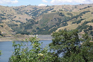
Calaveras Reservoir is located primarily in Santa Clara County, California, with a small portion and its dam in Alameda County, California. In Spanish, Calaveras means "skulls".

Coyote Creek is a river that flows through the Santa Clara Valley in Northern California. Its source is on Mount Sizer, in the mountains east of Morgan Hill. It eventually flows into Anderson Lake in Morgan Hill and then northwards through Coyote Valley to San Jose, where it empties into San Francisco Bay.

The Mokelumne River is a 95-mile (153 km)-long river in northern California in the United States. The river flows west from a rugged portion of the central Sierra Nevada into the Central Valley and ultimately the Sacramento–San Joaquin River Delta, where it empties into the San Joaquin River-Stockton Deepwater Shipping Channel. Together with its main tributary, the Cosumnes River, the Mokelumne drains 2,143 square miles (5,550 km2) in parts of five California counties. Measured to its farthest source at the head of the North Fork, the river stretches for 157 miles (253 km).

The Bull Run River is a 21.9-mile (35.2 km) tributary of the Sandy River in the U.S. state of Oregon. Beginning at the lower end of Bull Run Lake in the Cascade Range, it flows generally west through the Bull Run Watershed Management Unit (BRWMU), a restricted area meant to protect the river and its tributaries from contamination. The river, impounded by two artificial storage reservoirs as well as the lake, is the primary source of drinking water for the city of Portland, Oregon.

Lagunitas Creek is a 24 miles (39 km)-long northward-flowing stream in Marin County, California. It is critically important to the largest spawning runs of endangered coho salmon in the Central California Coast Coho salmon Evolutionary Significant Unit.

Alameda Creek is a large perennial stream in the San Francisco Bay Area. The creek runs for 45 miles (72 km) from a lake northeast of Packard Ridge to the eastern shore of San Francisco Bay by way of Niles Canyon and a flood control channel. Along its course, Alameda Creek provides wildlife habitat, water supply, a conduit for flood waters, opportunities for recreation, and a host of aesthetic and environmental values. The creek and three major reservoirs in the watershed are used as water supply by the San Francisco Public Utilities Commission, Alameda County Water District and Zone 7 Water Agency. Within the watershed can be found some of the highest peaks and tallest waterfall in the East Bay, over a dozen regional parks, and notable natural landmarks such as the cascades at Little Yosemite and the wildflower-strewn grasslands and oak savannahs of the Sunol Regional Wilderness. After an absence of half a century, ocean-run steelhead trout are able to return to Alameda Creek to mingle with remnant rainbow trout populations. Completion of a series of dam removal and fish passage projects, along with improved stream flows for cold-water fish and planned habitat restoration, enable steelhead trout and Chinook salmon to access up to 20 miles (32 km) of spawning and rearing habitat in Alameda Creek and its tributaries. The first juvenile trout migrating downstream from the upper watershed through lower Alameda Creek toward San Francisco Bay was detected and documented in April 2023.
The Baker River is an approximately 30-mile (48 km), southward-flowing tributary of the Skagit River in northwestern Washington in the United States. It drains an area of the high North Cascades in the watershed of Puget Sound north of Seattle, and east of Mount Baker. With a watershed of approximately 270 square miles (700 km2) in a complex of deep valleys partially inside North Cascades National Park, it is the last major tributary of the Skagit before the larger river reaches its mouth on Skagit Bay. The river flows through Concrete, Washington, near its mouth and has two hydroelectric dams owned by Puget Sound Energy.

The American River is a 30-mile (50 km)-long river in California that runs from the Sierra Nevada mountain range to its confluence with the Sacramento River in downtown Sacramento. Via the Sacramento River, it is part of the San Francisco Bay watershed. This river is fed by the melting snowpack of the Sierra Nevada and its many headwaters and tributaries, including the North Fork American River, the Middle Fork American River, and the South Fork American River.

The Union River is a stream in the U.S. state of Washington. It originates in central Kitsap Peninsula and flows south, emptying into the end of Hood Canal. The Union River Reservoir provides drinking water for the nearby city of Bremerton.

The Mokelumne Aqueduct is a 95-mile (153 km) water conveyance system in central California, United States. The aqueduct is supplied by the Mokelumne River and provides water to 35 municipalities in the East Bay in the San Francisco Bay Area. The aqueduct and the associated dams, pipelines, treatment plants and hydroelectric system are owned and operated by the East Bay Municipal Utility District (EBMUD) and provide over 90 percent of the water used by the agency.

Salmon Falls Creek is a tributary of the Snake River, flowing from northern Nevada into Idaho in the United States. Formed in high mountains at the northern edge of the Great Basin, Salmon Falls Creek flows northwards 121 miles (195 km), draining an arid and mountainous basin of 2,103 square miles (5,450 km2). The Salmon Falls Creek valley served as a trade route between the Native American groups of the Snake River Plain and Great Basin. Today, most of its water is used for irrigation.

Gold Mountain is a 1,761-foot (537 m) summit in the Blue Hills on the Kitsap Peninsula of Washington state, in the United States' Pacific Northwest. It is the highest point on the Kitsap Peninsula and the highest point in Kitsap County, Washington, and nearby 1,639-foot (500 m) Green Mountain is the second-highest point.
The Blue Hills just west of Bremerton, Washington, also called the Bremerton Hills, Bald Hills, and Wildcat Hills, consist of Gold Mountain, Green Mountain, and several informally named hills. Reaching an elevation of 1761 feet, a thousand feet above the glacial till that fills the Puget Lowland, they form a prominent landmark visible around the region. They are formed of uplifted blocks of marine basalts, the steep-walled canyons between the various summits being the fissures between the blocks. In addition to Gold Mountain and Green Mountain are several other prominent peaks unofficially named according to their elevation :

The Chehalis Gap is a gap in the Coast Range of Washington state between the southernmost foothills of the Olympic Mountains called the Satsop Hills, and the Willapa Hills.
The following outline is provided as an overview of and topical guide to infrastructure of the U.S. state of Washington.

