Related Research Articles

Mount Bachelor, formerly named Bachelor Butte, is a dormant stratovolcano atop a shield volcano in the Cascade Volcanic Arc and the Cascade Range of central Oregon. Named Mount Bachelor because it stands apart from the nearby Three Sisters, it lies in the eastern segment of the central portion of the High Cascades, the eastern segment of the Cascade Range. The volcano lies at the northern end of the 15-mile (24 km) long Mount Bachelor Volcanic Chain, which underwent four major eruptive episodes during the Pleistocene and the Holocene. The United States Geological Survey considers Mount Bachelor a moderate threat, but Bachelor poses little threat of becoming an active volcano in the near future. It remains unclear whether the volcano is extinct or just inactive.

The Deschutes River in central Oregon is a major tributary of the Columbia River. The river provides much of the drainage on the eastern side of the Cascade Range in Oregon, gathering many of the tributaries that descend from the drier, eastern flank of the mountains. The Deschutes provided an important route to and from the Columbia for Native Americans for thousands of years, and then in the 19th century for pioneers on the Oregon Trail. The river flows mostly through rugged and arid country, and its valley provides a cultural heart for central Oregon. Today the river supplies water for irrigation and is popular in the summer for whitewater rafting and fishing.

The Cascades Lakes Scenic Byway is a National Scenic Byway in central Oregon in the United States. It runs for 66 miles (106 km) in the rugged country of Deschutes and Klamath counties on the east side of the Cascade Range. It offers particularly good views of Mount Bachelor, Broken Top, and the Three Sisters (Oregon) mountains and provides access to many recreational facilities in central Oregon. The route is so named because it weaves past a number of small natural lakes along the Cascades as well as several reservoirs on the upper Deschutes River.

Broken Top is a glacially eroded complex stratovolcano. It lies in the Cascade Volcanic Arc, part of the extensive Cascade Range in the U.S. state of Oregon. Located southeast of the Three Sisters peaks, the volcano, residing within the Three Sisters Wilderness, is 20 miles (32 km) west of Bend, Oregon in Deschutes County. Eruptive activity stopped roughly 100,000 years ago, and erosion by glaciers has since reduced the volcano's cone to where its contents are exposed. There are two named glaciers on the peak, Bend and Crook Glacier.

Central Oregon is a geographic region in the U.S. state of Oregon and is traditionally considered to be made up of Deschutes, Jefferson, and Crook counties. Other definitions include larger areas, often encompassing areas to the north towards the Columbia River, eastward towards Burns, or south towards Klamath Falls. These three counties have a combined population of 200,431 as of the 2010 census, with Deschutes the largest of the three counties, having approximately four times the population of the other two counties combined. As of 2015, the most populous city in the region is Bend, with an estimated 87,014 residents. As defined by the three county definition, Central Oregon covers 7,833 square miles (20,290 km2) of land. Central Oregon has had 3 record tourism years beginning in 2012. Over 2.2 million people visited Central Oregon in 2012 and again in 2013.

The Deschutes National Forest is a United States national forest (NF) located in Central Oregon, in parts of Deschutes, Klamath, Lake, and Jefferson counties. It was established in 1908, with border changes following in 1911 and 1915. The forest now encompasses almost 1.6 million acres (6,500 km2) along the east side of the Cascade Range. The forest is bordered to the south by the Fremont–Winema NF, to the southwest by the Umpqua NF, and to the west by the Willamette NF.

The Mount Washington Wilderness is a wilderness area located on and around Mount Washington in the central Cascade Range of Oregon in the United States. The wilderness was established in 1964 and comprises 54,278 acres (219.66 km2) of the Willamette National Forest and Deschutes National Forest. It is administered by the U.S. Forest Service.

The Mount Jefferson Wilderness is a wilderness area located on and around Mount Jefferson in the central Cascade Range of Oregon in the United States. The wilderness lies within the Willamette National Forest and Deschutes National Forest. The wilderness area covers 111,177 acres (449.92 km2), with more than 150 lakes. It also has 190 miles (310 km) of trails, including 40 miles (64 km) of the Pacific Crest National Scenic Trail. Three Fingered Jack and Mount Jefferson are both prominent features of the wilderness area. Mount Jefferson Wilderness is the second most visited Oregon wilderness area after the Three Sisters Wilderness.

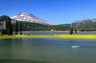
Sparks Lake is a natural body of water near the crest of the central Cascade Range in Deschutes County in the U.S. state of Oregon. The lake is about 26 miles (42 km) west-southwest of Bend along the Cascade Lakes Scenic Byway in Deschutes National Forest. Named for a 19th-century rancher, "Lige" Sparks, the water body is a remnant of a bigger lake that has partly filled with sediment and vegetation.

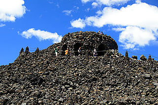
Dee Wright Observatory is an observation structure at the summit of McKenzie Pass in the Cascade Mountains of Oregon. The structure is an open shelter constructed with lava stone. It is located in the midst of a large lava flow, and offers an exceptional view of numerous Cascade peaks.

Little Lava Lake lies in the Cascade Range about 26 miles (42 km) west-southwest of Bend in the U.S. state of Oregon. A close neighbor of Lava Lake, from which it is separated by solidified lava, Little Lava Lake is at an elevation of 4,744 feet (1,446 m) in the Deschutes National Forest. Generally considered the source of the Deschutes River, the lake covers 138 acres (56 ha) to an average depth of 8 feet (2.4 m).

The Ochoco Mountains are a mountain range in central Oregon in the United States, located at the western end of the Blue Mountains. They were formed when Permian, Triassic, and Jurassic rocks were slowly uplifted by volcanic eruptions to form the Clarno Formation. Today, the highest point in the range is Lookout Mountain. The dominant vegetation on the west side of the range is old-growth ponderosa pine; on the east side, western juniper is common. The western area of the mountains is administered by the Ochoco National Forest, while the southeastern section is part of the Malheur National Forest. The Ochoco Mountains are used for hiking, camping, bird watching, rockhounding, and hunting, as well as cross-country skiing in the winter.

Wickiup Reservoir is the second-largest reservoir in the U.S. state of Oregon. It is located 60 miles (97 km) southwest of Bend, and is the largest of the Cascade Lakes. Wickiup Reservoir is close to the Twin Lakes, Davis Lake, Crane Prairie Reservoir, Cultus Lake, and Little Cultus Lake. The reservoir is located within the Deschutes National Forest and the Fort Rock Ranger District, near the Cascade Lakes Scenic Byway.

Little Cultus Lake is a natural lake in Deschutes County, Oregon, United States. Near its larger and more popular twin Cultus Lake to the north on the other side of Cultus Mountain, it is located in the Deschutes National Forest in the Cascade Range. Like Cultus Lake, it is named after the Chinook Jargon word "cultus", meaning "in vain" or "worthless".

Elk Lake is a natural body of water in the central Cascade Range in the U.S. state of Oregon. Nearly 4,900 feet (1,500 m) above sea level, the lake is part of a volcanic landscape about 25 miles (40 km) west-southwest of Bend along the Cascade Lakes Scenic Byway.

Lava Lake lies in the Cascade Range about 25 miles (40 km) west-southwest of Bend in the U.S. state of Oregon. It is a close neighbor of Little Lava Lake, from which it is separated by solidified lava. Lava Lake is at an elevation of 4,740 feet (1,440 m) in the Deschutes National Forest. The lake covers 368 acres (149 ha) to an average depth of 20 feet (6.1 m).

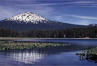
Hosmer Lake is a natural body of water in the central Cascade Range in the U.S. state of Oregon. Nearly 5,000 feet (1,500 m) above sea level, the lake is part of a volcanic landscape about 20 miles (32 km) west-southwest of Bend along the Cascade Lakes Scenic Byway. In 1962, the United States Board on Geographic Names changed the name from Mud Lake to Hosmer Lake in honor of Paul Hosmer, a naturalist from Bend.
Doris Lake is a natural body of water in the Three Sisters Wilderness of the central Cascade Range in the U.S. state of Oregon. At 5,300 feet (1,600 m) above sea level, the lake is part of a volcanic landscape 27 miles (43 km) southwest of Bend and about 3 miles (5 km) by trail west of the Cascade Lakes Scenic Byway.

Todd Lake is a natural lake near the crest of the Cascade Range in central Oregon in the United States. The lake covers 45 acres (18 ha). It is named in honor of John Y. Todd, an early settler in Central Oregon. Today, the lake and surrounding forest is managed by the U.S. Forest Service as part of the Deschutes National Forest. The Oregon Department of Fish and Wildlife regularly stocks the lake with brook trout. There is a day-use area and a rustic campground located on the west shore. In the summer, the lake is a popular outdoor recreation site for picnicking, fishing, hiking, and nature viewing. In the winter, trails in the area are used for cross-country skiing and snowshoeing.

The Nash Fire is a wildfire that occurred in the Deschutes National Forest and Willamette National Forest, on the southwest slope of the South Sister Mountain in Oregon in the United States. The fire, which was started by lightning, started on August 10, 2017. The Nash Fire was part of the Horse Creek Complex but for reporting purposes was removed from the complex by authorities. The fire threatened the campgrounds and structures at Elk Lake, Hosmer Lake, Lava Lake, and Little Lava Lake.
References
- ↑ "The Cascade Lakes", Cascade Lakes National Scenic Byway Tour of Interpretive Sites, Deschutes National Forest, United States Forest Service, United States Department of Agriculture, Washington, District of Columbia, 2010.
- ↑ Gyorgyfalvy, Robin Lee, "Description", Cascade Lakes National Scenic Byway Corridor Management and Interpretive Plan 2011, Deschutes National Forest, United States Department of Agriculture, Bend, Oregon, 2011, p. 6.