The Hill of Tara is a hill and ancient ceremonial and burial site near Skryne in County Meath, Ireland. According to tradition, it was the inauguration place and seat of the High Kings of Ireland, and it also appears in Irish mythology. Tara consists of numerous monuments and earthworks—from the Neolithic to the Iron Age—including a passage tomb, burial mounds, round enclosures, a standing stone, and a ceremonial avenue. There is also a church and graveyard on the hill. Tara is part of a larger ancient landscape and Tara itself is a protected national monument under the care of The Office of Public Works, an agency of the Irish Government.

Rathcroghan is a complex of archaeological sites near Tulsk in County Roscommon, Ireland. It is identified as the site of Cruachan, the traditional capital of the Connachta, the prehistoric and early historic rulers of the western territory. The Rathcroghan Complex is a unique archaeological landscape with many references found in early Irish medieval manuscripts.

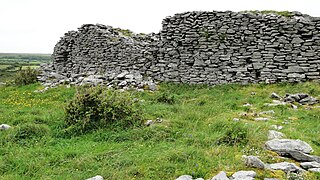
Cahercommaun, sometimes Cahercommane, is a triple stone ringfort on the south-east edge of the Burren area, in Kilnaboy, near the rural village of Carran, in County Clare, Ireland. It was built in the 9th century.

Monasteraden is a village in County Sligo, Ireland. The village is located on the shores of Lough Gara. St Aiden's church is the village's church. Other sights include Lough Gara Lodge, Slí na Croí's Roundhouse Ecolodge, Drury's pub and the general store.

The Grianan of Aileach is a hillfort atop the 244 metres (801 ft) high Greenan Mountain at Inishowen in County Donegal, Ireland. The main structure is a stone ringfort, thought to have been built by the Northern Uí Néill, in the sixth or seventh century CE; although there is evidence that the site had been in use before the fort was built. It has been identified as the seat of the Kingdom of Ailech and one of the royal sites of Gaelic Ireland. The wall is about 4.5 metres (15 ft) thick and 5 metres (16 ft) high. Inside it has three terraces, which are linked by steps, and two long passages within it. Originally, there would have been buildings inside the ringfort. Just outside it are the remains of a well and a tumulus.

Caherconnell is an exceptionally well-preserved medieval stone ringfort in region known as the Burren, County Clare, Ireland. It lies about 1 km south of the Poulnabrone dolmen.

Carrowkeel is a passage tomb cluster in south County Sligo, Ireland, located on four ridges in the Bricklieve Hills, overlooking Lough Arrow. The monuments were built in the 4th millennium BC, during the Neolithic era. They are named after the townland of Carrowkeel in which most of the sites are located. Nearby are the Caves of Kesh and Heapstown Cairn. The Carrowkeel monuments are protected as National Monuments and are considered one of the "big four" passage tomb cemeteries in Ireland, along with Carrowmore, Brú na Bóinne and Loughcrew.

Aghanaglack or Aghnaglack, is a townland in County Fermanagh, Northern Ireland. It is situated in the civil parish of Boho, as well as Fermanagh and Omagh district.

Cashelore, also called Cashel Bir or Bawnboy, is a stone ringfort (cashel) and National Monument located in County Sligo, Ireland.

Barnacahoge Cashel, is a stone ringfort (cashel) and National Monument located in County Mayo, Ireland.

Kilcashel Stone Fort is a double court cairn and National Monument located in County Mayo, Ireland.

Loher Cashel is a stone ringfort (cashel) and National Monument located on the Iveragh Peninsula, Ireland.

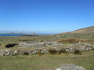
Leacanabuaile is a stone ringfort (cashel) and National Monument in County Kerry, Ireland. Leacanabuaile is immediately northwest of Cahergal, 3 km (1.9 mi) northwest of Cahirciveen.

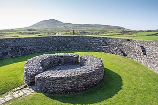
Cahergall is a stone ringfort (cashel) and National Monument located in County Kerry, Ireland.

Glanfahan is a townland on the Dingle Peninsula, Ireland, notable for its large collection of clocháns, which form a National Monument.

Caherdorgan North is a National Monument located in County Kerry, Ireland.

Ballynavenooragh is a stone fort and National Monument located in County Kerry, Ireland.

Creggankeel Fort is a stone fort and National Monument located on the island of Inisheer, Ireland. It also contains a later Christian site, the Grave of the Seven Daughters.


