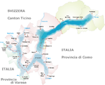
The river Ticino is the most important perennial left-bank tributary of the Po. It has given its name to the Swiss canton through which its upper portion flows.

Lugano is a city and municipality within the Lugano District in the canton of Ticino, Switzerland. It is the largest city in both Ticino and the Italian-speaking region of southern Switzerland. Lugano has a population of 62,315, and an urban agglomeration of over 150,000. It is the ninth largest Swiss city.
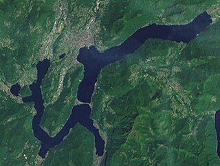
Lake Lugano is a glacial lake which is situated on the border between southern Switzerland and northern Italy. The lake, named after the city of Lugano, is situated between Lake Como and Lago Maggiore. It was cited for the first time by Gregory of Tours in 590 with the name Ceresio, a name which is said to have derived from the Latin word cerasus, meaning cherry, and refers to the abundance of cherry trees which at one time adorned the shores of the lake. The lake appears in documents in 804 under the name Laco Luanasco.

The Vorderrhein, or Anterior Rhine, is the left of the two initial tributaries of the Rhine. It is longer than the Hinterrhein, but has a lower discharge than the latter at their confluence, which marks the beginning of the Alpine Rhine section.

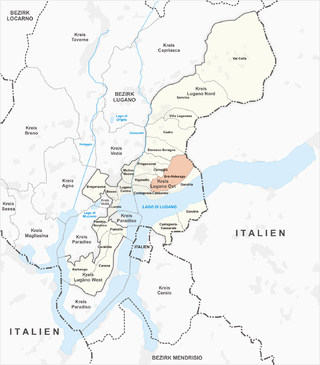
Bogno is a former municipality in the district of Lugano in the canton of Ticino in Switzerland. On 14 April 2013 the former municipalities of Bogno, Cadro, Carona, Certara, Cimadera, Valcolla and Sonvico merged into the municipality of Lugano.
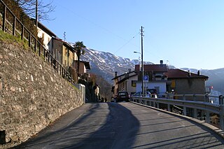
Valcolla is a quarter of the city of Lugano and former municipality in the district of Lugano in the canton of Ticino in Switzerland. On 14 April 2013 the former municipalities of Bogno, Cadro, Carona, Certara, Cimadera, Sonvico and Valcolla merged into the municipality of Lugano.
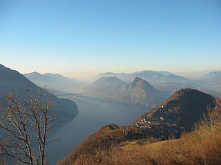
Monte Brè is a small mountain east of Lugano on the flank of Monte Boglia with a view of the bay of Lugano and the Pennine Alps and the Bernese Alps. It is considered one of the sunniest points in Switzerland.
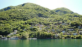
Brè-Aldesago is a quarter of the city of Lugano, in the Swiss canton of Ticino.

Castagnola is a village on the northern shore of Lake Lugano, below the mountain of Monte Brè, in the Swiss canton of Ticino. Politically the village forms part of the Castagnola-Cassarate quarter of the city of Lugano, although until 1972 Castagnola-Cassarate was an independent municipality under the name Castagnola.
Caprino is a village on the southern shore of Lake Lugano in the Swiss canton of Ticino, to the east of the Italian exclave of Campione d'Italia and below the summit of Sighignola. Some 0.5 kilometres (0.31 mi) east of Caprino village is Cantine di Caprino, a smaller settlement. Politically both form part of the Castagnola-Cassarate quarter of the city of Lugano, although until 1972 Castagnola-Cassarate was an independent municipality under the name Castagnola.
Cassarate is a village on the northern shore of Lake Lugano, to the east of the outfall of the Cassarate River, in the Swiss canton of Ticino. Politically the village forms part of the Castagnola-Cassarate quarter of the city of Lugano, although until 1972 Castagnola-Cassarate was an independent municipality under the name Castagnola.

The Monte Brè funicular, or Funicolare Cassarate - Monte Brè, is a funicular railway in the city of Lugano in the Swiss canton of Ticino. The line links a lower station in the Lugano suburb of Cassarate with an upper station at 883 m near the summit of the Monte Brè. The top yields views of the city and Lake Lugano.

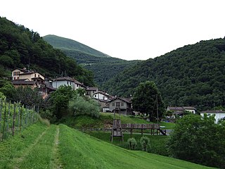
The Val Colla is a valley and a quarter of the city of Lugano in the Swiss canton of Ticino, to the north-east of the city of Lugano. It includes the localities of Bogno, Valcolla, Certara, Cimadera, Sonvico, which are all part of the city of Lugano, and the municipality of Capriasca.

The Società Navigazione del Lago di Lugano or Lake Lugano Navigation Company (SNL) is a Swiss company operating passenger services on Lake Lugano. The company also operates bus routes in the same area, and is based at Cassarate in the city of Lugano. It was formerly known as the Società di Navigazione e Ferrovie per lago di Lugano and at one time also operated railways in the area.

Aldesago is a village on the western slopes of the mountain of Monte Brè, in the Swiss canton of Ticino. Politically the village forms part of the Brè-Aldesago quarter of the city of Lugano, although until 1972 Brè-Aldesago was an independent municipality.
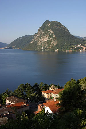
Castagnola-Cassarate is a quarter of the city of Lugano, in the Swiss canton of Ticino.
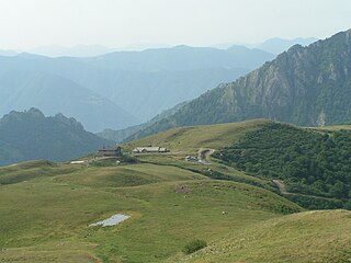
The San Lucio Pass, located in the Lugano Prealps at an altitude of 1,541 metres (5,056 ft) above sea level, connects the Val Cavargna in the Italian province of Como with the Val Colla in the Swiss canton of Ticino. The pass is shared by the municipalities of Cavargna (Italy) and Bogno (Switzerland).

The Cima di Fojorina is a mountain of the Lugano Prealps, located on the border between Switzerland and Italy. It lies on the range separating the Val Colla from Lake Lugano.
Monte Bar is a mountain of the Lugano Prealps, located north of Lugano in the canton of Ticino, Switzerland. It lies on the range west of the Gazzirola, between the Val d'Isone and the Val Colla.

The border between the modern states of Switzerland and Italy extends for 744 kilometres (462 mi), from the French-Swiss-Italian tripoint at Mont Dolent in the west to the Austrian-Swiss-Italian tripoint near Piz Lad in the east. Much of the border runs across the High Alps, rising above 4,600 metres (15,100 ft) as it passes east of Dufourspitze, but it also descends to the lowest point in Switzerland as it passes Lago Maggiore at below 200 metres (660 ft).


