Related Research Articles

A grid reference system, also known as grid reference or grid system, is a geographic coordinate system that defines locations in maps using Cartesian coordinates based on a particular map projection. Grid lines on maps illustrate the underlying coordinate system. Such coordinate lines are numbered to provide a unique reference to each location on the map. Grid coordinates are normally eastings and northings.

The Public Land Survey System (PLSS) is the surveying method developed and used in the United States to plat, or divide, real property for sale and settling. Also known as the Rectangular Survey System, it was created by the Land Ordinance of 1785 to survey land ceded to the United States by the Treaty of Paris in 1783, following the end of the American Revolution. Beginning with the Seven Ranges in present-day Ohio, the PLSS has been used as the primary survey method in the United States. Following the passage of the Northwest Ordinance in 1787, the Surveyor General of the Northwest Territory platted lands in the Northwest Territory. The Surveyor General was later merged with the General Land Office, which later became a part of the U.S. Bureau of Land Management (BLM). Today, the BLM controls the survey, sale, and settling of lands acquired by the United States.

The Ordnance Survey National Grid reference system is a system of geographic grid references used in Great Britain, distinct from latitude and longitude.
The Maidenhead Locator System is a geocode system used by amateur radio operators to succinctly describe their geographic coordinates, which replaced the deprecated QRA locator, that was limited to European contacts. Its purpose is to be concise, accurate, and robust in the face of interference and other adverse transmission conditions. The Maidenhead Locator System can describe locations anywhere in the world.

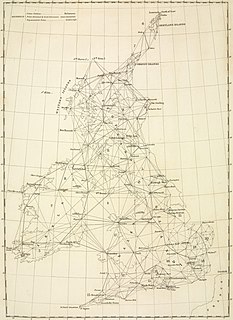
Dunnet Head is a peninsula in Caithness, on the north coast of Scotland. Dunnet Head includes the most northerly point of both mainland Scotland and the island of Great Britain.
The Irish grid reference system is a system of geographic grid references used for paper mapping in Ireland. The Irish grid partially overlaps the British grid, and uses a similar co-ordinate system but with a meridian more suited to its westerly location.
The Military Grid Reference System (MGRS) is the geocoordinate standard used by NATO militaries for locating points on Earth. The MGRS is derived from the Universal Transverse Mercator (UTM) grid system and the Universal Polar Stereographic (UPS) grid system, but uses a different labeling convention. The MGRS is used as geocode for the entire Earth.
The Principal Triangulation of Britain was the first high-precision triangulation survey of the whole of Great Britain, carried out between 1791 and 1853 under the auspices of the Board of Ordnance. The aim of the survey was to establish precise geographical coordinates of almost 300 significant landmarks which could be used as the fixed points of local topographic surveys from which maps could be drawn. In addition there was a purely scientific aim in providing precise data for geodetic calculations such as the determination of the length of meridian arcs and the figure of the Earth. Such a survey had been proposed by William Roy (1726–1790) on his completion of the Anglo-French Survey but it was only after his death that the Board of Ordnance initiated the trigonometric survey, motivated by military considerations in a time of a threatened French invasion. Most of the work was carried out under the direction of Isaac Dalby, William Mudge and Thomas Frederick Colby, but the final synthesis and report (1858) was the work of Alexander Ross Clarke. The survey stood the test of time for a century, until the Retriangulation of Great Britain between 1935 and 1962.

The scale of a map is the ratio of a distance on the map to the corresponding distance on the ground. This simple concept is complicated by the curvature of the Earth's surface, which forces scale to vary across a map. Because of this variation, the concept of scale becomes meaningful in two distinct ways.
The Swiss coordinate system is a geographic coordinate system used in Switzerland and Liechtenstein for maps and surveying by the Swiss Federal Office of Topography (Swisstopo).
The Universal Transverse Mercator (UTM) is a map projection system for assigning coordinates to locations on the surface of the Earth. Like the traditional method of latitude and longitude, it is a horizontal position representation, which means it ignores altitude and treats the earth as a perfect ellipsoid. However, it differs from global latitude/longitude in that it divides earth into 60 zones and projects each to the plane as a basis for its coordinates. Specifying a location means specifying the zone and the x, y coordinate in that plane. The projection from spheroid to a UTM zone is some parameterization of the transverse Mercator projection. The parameters vary by nation or region or mapping system.
A spatial reference system (SRS) or coordinate reference system (CRS) is a coordinate-based local, regional or global system used to locate geographical entities. A SRS commonly defines a specific map projection, as well as transformations between different SRS.
The World Geographic Reference System (GEOREF) is a geocode, a grid-based method of specifying locations on the surface of the Earth. GEOREF is essentially based on the geographic system of latitude and longitude, but using a simpler and more flexible notation. GEOREF was used primarily in aeronautical charts for air navigation, particularly in military or inter-service applications, but it is rarely seen today. However, GEOREF can be used with any map or chart that has latitude and longitude printed on it.
The United States National Grid (USNG) is a multi-purpose location system of grid references used in the United States. It provides a nationally consistent "language of location", optimized for local applications, in a compact, user friendly format. It is similar in design to the national grid reference systems used in other countries. The USNG was adopted as a national standard by the Federal Geographic Data Committee (FGDC) of the US Government in 2001.

The Royal Australian Survey Corps was a Corps of the Australian Army, formed on 1 July 1915 and disbanded on 1 July 1996. As one of the principal military survey units in Australia, the role of the Royal Australian Survey Corps was to provide the maps, aeronautical charts, hydrographical charts and geodetic and control survey data required for land combat operations.
The Land Utilisation Survey of Britain was a comprehensive survey of land use in Great Britain in the 1930s. The survey was the first such comprehensive survey in Britain since the Domesday Book survey in the 11th Century. A Second Land Use Survey was carried out in the 1960s. Subsequent work has mainly been based on satellite imagery, with sample field survey work for quality checking.

Ordnance Survey (OS) is the national mapping agency for Great Britain. The agency's name indicates its original military purpose, which was to map Scotland in the wake of the Jacobite rising of 1745. There was also a more general and nationwide need in light of the potential threat of invasion during the Napoleonic Wars. Since 1 April 2015 Ordnance Survey has operated as Ordnance Survey Ltd, a government-owned company, 100% in public ownership. The Ordnance Survey Board remains accountable to the Secretary of State for Business, Energy and Industrial Strategy. It was also a member of the Public Data Group.
A Discrete Global Grid (DGG) is a mosaic which covers the entire Earth's surface. Mathematically it is a space partitioning: it consists of a set of non-empty regions that form a partition of the Earth's surface. In a usual grid-modeling strategy, to simplify position calculations, each region is represented by a point, abstracting the grid as a set of region-points. Each region or region-point in the grid is called a cell.

The Palestine grid was the geographic coordinate system used by the Survey Department of Palestine.
The Ordnance Survey Great Britain County Series maps were produced from the 1840s to the 1890s by the Ordnance Survey, with revisions published until the 1940s. The series mapped the counties of Great Britain at both a six inch and twenty-five inch scale with accompanying acreage and land use information. Following the introduction of the Ordnance Survey National Grid in the 1930s the County Series maps were replaced by a new series of maps at each scale.
References
- 1 2 3 4 5 6 7 The Defence of East Sussex Project, Military Maps Archived 2015-09-27 at WebCite , accessed and archived 27 September 2015.
- ↑ R. Böhme, R. W. Anson, Eastern Europe, Asia, Oceania and Antarctica, p. 138, Elsevier, 2013 ISBN 1483292657.
- ↑ F. J. Monkhouse, "The new Ordnance Survey map series: Scale 1:25,000", Town Planning Review, vol. 21, iss. 1, pp. 70–81, 1950.
- ↑ Chris Davies, Almost Forgotten: The Search for Aviation Accidents in Northumberland, "Defiant N3364: October 2010", Amberley Publishing Limited, 2013 ISBN 1445626519.