Castle Street, Liverpool

Last updated

Castle Street, Liverpool
Castle Street, Liverpool pedestrianised 2.jpg
Castle Street, Liverpool
Liverpool Centre map.png
Red pog.svg
Location Liverpool city centre
Postal codeL2
Coordinates 53°24′23″N2°59′28″W / 53.4064°N 2.9911°W / 53.4064; -2.9911
Other
Known for
  • Offices, restaurants, bars

Castle Street is a road in Liverpool, England. Situated in the city centre, it runs between Water Street and Derby Square, where Liverpool Castle once stood. [1]

Contents

History

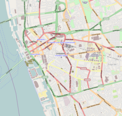
The street was one of the original seven streets that made up the medieval borough founded by King John in 1207, together with Water Street, Old Hall Street, Chapel Street, High Street, Tithebarn Street and Dale Street. [2]

Of the original seven streets, Castle Street was one of the most important due to it running from the river to the castle and the market. [3] Its course was marked out at the creation of the Borough by a representative of King John. The boundary of the market was marked out by three Sactuary Stones, one of which still remains on Castle Street. [4]

The original street was very narrow, with barely enough room for two carts to pass each other. [3] During the 18th and 19th centuries the road was widened.

Whilst once home to several banks, Castle Street is now home to many restaurants and bars and considered part of Liverpool's Food Quarter. [5] [6]

Listed buildings

Castle Street contains seventeen Grade II listed and buildings as well a Grade I listed building, these include: [7]

Related Research Articles

<span class="mw-page-title-main">Liverpool</span> City in England

Liverpool is a city and metropolitan borough in Merseyside, northwest England. It had a population of 496,770 in 2022. The city is located on the eastern side of the Mersey Estuary, adjacent to the Irish Sea, and is approximately 178 miles (286 km) from London. Liverpool is the fifth largest city in the United Kingdom, the largest settlement in Merseyside and part of the Liverpool City Region, a combined authority with a population of over 1.5 million.

<span class="mw-page-title-main">Caernarfon</span> Town in Gwynedd, Wales

Caernarfon is a royal town, community and port in Gwynedd, Wales. It has a population of 9,852. It lies along the A487 road, on the eastern shore of the Menai Strait, opposite the island of Anglesey. The city of Bangor is 8.6 miles (13.8 km) to the north-east, while Snowdonia (Eryri) fringes Caernarfon to the east and south-east.

<span class="mw-page-title-main">Northampton</span> Town in Northamptonshire, England

Northampton is a town and civil parish in Northamptonshire, England. It is the county town of Northamptonshire and the administrative centre of the unitary authority of West Northamptonshire. The town is situated on the River Nene, 60 miles (97 km) north-west of London and 50 miles (80 km) south-east of Birmingham. Northampton is one of the largest towns in England; the population of its overall urban area was recorded as 249,093 in the 2021 census.

<span class="mw-page-title-main">Christchurch, Dorset</span> Town and civil parish in England

Christchurch is a town and civil parish on the south coast of Dorset, England. The parish had a population of 31,372 in 2021. It adjoins Bournemouth to the west, with the New Forest to the east. Part of the historic county of Hampshire, Christchurch was a borough within the administrative county of Dorset from 1974 until 2019, when it became part of the new Bournemouth, Christchurch and Poole unitary authority.

<span class="mw-page-title-main">Yarm</span> Town and civil parish in North Yorkshire, England

Yarm, also referred to as Yarm-on-Tees, is a market town and civil parish in the Borough of Stockton-on-Tees, North Yorkshire, England. It is in Teesdale with a town centre on a small meander of the River Tees. To the south-east, it extends to the River Leven, to the south it extends into the Kirklevington.

<span class="mw-page-title-main">Royal Liver Building</span> Commercial offices in England

The Royal Liver Building is a Grade I listed building in Liverpool, England. It is located at the Pier Head and along with the neighbouring Cunard Building and Port of Liverpool Building is one of Liverpool's Three Graces, which line the city's waterfront. It was also part of Liverpool's formerly UNESCO-designated World Heritage Maritime Mercantile City.

<span class="mw-page-title-main">New Ferry</span> Urban area in Merseyside, England

New Ferry is an urban area on the Metropolitan Borough of Wirral, Merseyside, England. It is located on the Wirral Peninsula, with the River Mersey to the east and the town of Bebington to the west. Within the boundaries of the historic county of Cheshire, the area was developed from the early nineteenth century.

<span class="mw-page-title-main">Bank of England Building, Liverpool</span> Historic building in Liverpool, England

The Bank of England Building is a Grade I listed building located on Castle Street, Liverpool, England.

<span class="mw-page-title-main">Liver bird</span> Mythical bird which is the symbol of Liverpool

The liver bird is a mythical creature which is the symbol of the English city of Liverpool. It is normally represented as a cormorant, and appears as such on the city's arms, in which it bears a branch of laver seaweed in its beak as a further pun on the name "Liverpool".

<span class="mw-page-title-main">Municipal Buildings, Liverpool</span> Grade II listed building in Liverpool, England

Municipal Buildings is a former council office building that has been converted into a hotel. It is located on Dale Street in the centre of Liverpool, England. It is a Grade II* listed building.

<span class="mw-page-title-main">Raglan, Monmouthshire</span> Village in Monmouthshire, Wales

Raglan (; is a village and community in Monmouthshire, south-east Wales, United Kingdom. It is located some 9 miles south-west of Monmouth, midway between Monmouth and Abergavenny on the A40 road very near to the junction with the A449 road. The fame of the village derives from Raglan Castle, built for William ap Thomas and now maintained by Cadw. The community includes the villages of Llandenny and Pen-y-clawdd. Raglan itself has a population of 1,183.

<span class="mw-page-title-main">Dale Street</span> Street in Liverpool, England

Dale Street is a thoroughfare in Liverpool city centre, England.

<span class="mw-page-title-main">Lord Street, Liverpool</span> Street in Liverpool, England

Lord Street is a street in central Liverpool, England that forms part of the city's main shopping district. The street is less than 300 metres in length. It joins Church Street to the east and James Street alongside Derby Square and the Queen Elizabeth II Law Courts to the west. The majority of land to the south of Lord Street is occupied by the Liverpool One complex, whilst the likes of Cavern Walks are located on the north side of the street.

<span class="mw-page-title-main">Baltic Triangle</span> Creative, leisure and nightlife district of Liverpool UK

The Baltic Triangle is an area of Liverpool city centre defined by Liverpool City Council as the triangular portion of the city bounded by Liver Street, Park Lane, St James Street, Hill Street, Sefton Street and Wapping.

<span class="mw-page-title-main">Liverpool city centre</span> Commercial, cultural, financial and historical heart of Liverpool, England

Liverpool city centre is the commercial, cultural, financial and historical centre of Liverpool and the Liverpool City Region, England. Different definitions of the city centre exist for urban planning and local government, however, the border of Liverpool city centre is broadly marked by the inner city districts of Vauxhall, Everton, Edge Hill, Kensington and Toxteth.

<span class="mw-page-title-main">Water Street, Liverpool</span> Road in Liverpool, England

Water Street is a road in Liverpool, England. Situated in the city centre, it runs from Dale Street to the Pier Head at the River Mersey.

<span class="mw-page-title-main">Old Hall Street</span> Road in Liverpool, England

Old Hall Street is a road in Liverpool, England. Situated in the city centre, it runs between Leeds Street and Chapel Street and is part of Liverpool business district.

<span class="mw-page-title-main">Chapel Street, Liverpool</span> Road in Liverpool, England

Chapel Street is a road in Liverpool, England. Situated in the city centre, it runs between Tithebarn Street and the Dock Road.

<span class="mw-page-title-main">High Street, Liverpool</span> Road in Liverpool, England

High Street is a road in Liverpool, England. Situated in the city centre, it runs between Exchange Flags and Dale Street and is part of Liverpool's business district.

<span class="mw-page-title-main">Tithebarn Street</span> Road in Liverpool, England

Tithebarn Street is a road in Liverpool, England. Situated in the city centre, it runs between Chapel Street and the junction of Great Crosshall Street and Vauxhall Road is part of Liverpool's Knowledge Quarter.

References

  1. "Monument to Queen Victoria". Liverpool World Heritage. City of Liverpool. Archived from the original on February 29, 2012. Retrieved May 4, 2024.
  2. Bona, Emilia (3 November 2019). "How Liverpool went from seven streets to global superpower". Liverpool Echo. Archived from the original on 28 December 2023. Retrieved 28 December 2023.
  3. 1 2 "BBC - Liverpool Local History -". www.bbc.co.uk. Retrieved 4 May 2024.
  4. Greaney, Martin (19 October 2015). "Historic Liverpool - Sanctuary Stone, Castle Street". Historic Liverpool. Retrieved 4 May 2024.
  5. Hadfield, Charlotte (30 October 2022). "'Renaissance' of one of the city's oldest streets". Liverpool Echo. Retrieved 4 May 2024.
  6. McCoid, Sophie; Rice, Elle May (28 December 2017). "Check out our guide to Castle Street's bustling food quarter". Liverpool Echo. Retrieved 4 May 2024.
  7. Echo, Liverpool (28 September 2009). "History of famous Liverpool Castle Street". Liverpool Echo. Retrieved 4 May 2024.