Tithebarn Street

Last updated

Tithebarn Street, Liverpool
Tithebarn Street 2019.jpg
Tithebarn Street in 2019, the old Exchange Station can be seen on the left
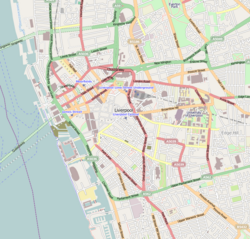
Liverpool Centre map.png
Red pog.svg
Location Liverpool city centre
Postal codeL2
Coordinates 53°24′33″N2°59′25″W / 53.4092°N 2.9904°W / 53.4092; -2.9904
Other
Known forOffices, shops, pubs

Tithebarn Street is a road in Liverpool, England. Situated in the city centre, it runs between Chapel Street and the junction of Great Crosshall Street and Vauxhall Road is part of Liverpool's Knowledge Quarter.

Contents

History

The street was one of the original seven streets that made up the medieval borough founded by King John in 1207, together with Water Street, Castle Street, Chapel Street, Old Hall Street, High Street and Dale Street. [1] Originally, the street was known as Moor (or Moore) Street before its name was changed to the present day name. [2] Records show a barn being built in 1523 by Sir William Molyneux on the corner of the street where it meets Cheapside. [3] The barn was used to store tithes. Parts of the barn survived into the early 1900s.

May 1850 saw the opening of a railway station, which would come to be known as Liverpool Exchange. [4] Jointly owned by the Lancashire and Yorkshire Railway and the East Lancashire Railway, the station had ten platforms at its peak. However, the Beeching cuts proved to be the death knell of the station and, with mainline services moved to Liverpool Lime Street, it closed in April 1977. [5] Local services were moved to the nearby Moorfields railway station with the creation of Merseyrail. The frontage of the station was preserved and turned into office space, known as Mercury Court.

The street was the scene of a brutal murder in 1874, known as the 'Tithebarn Street Outrage' when Robert Morgan, a dock worker, was kicked to death in front of his wife and brother. [6] Morgan was killed by members of Liverpool's notorious Cornermen gang when he refused to hand over ale money to 17 year old gang member, John McCrave. [7]

During World War 2, Tithebarn Street and the area around it suffered extensive damage from the Blitz and required considerable rebuilding. [8] The rail route to Exchange railway station was damaged by the bombing and parts of the roof of the station had to be demolished. [9]

In 1970, the Churchill Way Flyovers were opened, linking Tithebarn Street and Dale Street to Lime Street. [10] Built as part of an inner-city ring road project that was never fully completed, the flyovers were demolished in 2019 having been deemed unsafe.

In April 2005, popular Liverpool sculpture Superlambanana was moved to the street. [11]

Knowledge Quarter

Tithebarn Street is home to several university buildings and along with the surrounding streets is a popular site for student accommodation. [12] Liverpool John Moores University (LJMU), has facilities on the road dating back from when it was Liverpool Polytechnic. [13] LJMU's library, Avril Robarts Library, is situated on the street.

Related Research Articles

<span class="mw-page-title-main">Liverpool John Moores University</span> University in Liverpool, England

Liverpool John Moores University is a public research university in the city of Liverpool, England. The university can trace its origins to the Liverpool Mechanics' School of Arts, established in 1823. This later merged to become Liverpool Polytechnic. In 1992, following an Act of Parliament, the Liverpool Polytechnic became what is now Liverpool John Moores University. It is named after Sir John Moores, a local businessman and philanthropist, who donated to the university's precursor institutions.

<span class="mw-page-title-main">Liverpool Exchange railway station</span> Former railway station in Liverpool, England

Liverpool Exchange railway station was a railway station located in the city centre of Liverpool, England. Of the four terminal stations in Liverpool's city centre, Exchange station was the only station not accessed via a tunnel.

<span class="mw-page-title-main">Moorfields railway station</span> Railway station in Liverpool

Moorfields railway station is an underground railway station in the city centre of Liverpool, England. The station is situated on both the Northern and Wirral Lines of the Merseyrail network. It is the third-busiest station on the Merseyrail network, and the largest underground station. It is also the only station on the network having services to all other Merseyrail stations.

Exchange Station is a large office building on Tithebarn Street in the business district in Liverpool City Centre, Liverpool.

<span class="mw-page-title-main">Kirkham and Wesham railway station</span> Station in Lancashire, England

Kirkham and Wesham railway station serves the Lancashire towns of Kirkham and Wesham, in England. It is managed by Northern Trains, who operate most of the passenger services that call there.

<span class="mw-page-title-main">Lime Street, Liverpool</span> Major thoroughfare in Merseyside

Lime Street in Liverpool, England, was created as a street in 1790. Its most famous feature is Lime Street railway station. It is part of the William Brown Street conservation area.

<span class="mw-page-title-main">Aintree railway station</span> Railway station on the Ormskirk Branch of the Northern Line in Liverpool, England

Aintree railway station is a railway station that serves the village of Aintree, Merseyside, England. It is on the Ormskirk branch of the Merseyrail network's Northern Line. Until 1968 it was known as Aintree Sefton Arms after a nearby public house. The station's design reflects that it is the closest station to Aintree Racecourse, where the annual Grand National horse race takes place.

<span class="mw-page-title-main">Birkenhead Woodside railway station</span> Former GWR & LNWR railway station in Birkenhead, Wirral, England

Birkenhead Woodside was a railway station located at Woodside, in Birkenhead, on the Wirral Peninsula, Cheshire. It served both local services within Cheshire and long-distance services to southern England, including London.

<span class="mw-page-title-main">Manchester Exchange railway station</span> Former railway station in Salford, England

Manchester Exchange was a railway station immediately north of Manchester city centre, England, which served it between 1884 and 1969. The main approach road ran from the end of Deansgate, near Manchester Cathedral, passing over the River Irwell, the Manchester-Salford boundary, and Chapel Street; a second approach road led up from Blackfriars Road. Most of the station was in Salford, with only the 1929 extension to platform 3 east of the Irwell in Manchester.

<span class="mw-page-title-main">Mossbridge railway station</span> Former railway station in England

Mossbridge railway station was located on Downholland Moss at Moss Lane, Haskayne, Lancashire, England. The Southport & Cheshire Lines Extension Railway (SCLER) opened Mossbridge on 5 April 1886 as "Barton & Halsall".

Gladstone Dock was a station on the Liverpool Overhead Railway, between Alexandra Dock and Seaforth Sands. It was opened on 16 June 1930, the final station to open on the network.

Spellow railway station was located on County Road, Walton in Liverpool, England.

<span class="mw-page-title-main">Liverpool Central High Level railway station</span> Former railway station in Liverpool, England

Liverpool Central High Level was a terminus railway station in central Liverpool, England. It opened on 1 March 1874, at the western end of the Cheshire Lines Committee (CLC) line to Manchester Central. It replaced Brunswick as the CLC's Liverpool passenger terminus, becoming the headquarters of the committee.

<span class="mw-page-title-main">Dale Street</span> Street in Liverpool, England

Dale Street is a thoroughfare in Liverpool city centre, England.

<span class="mw-page-title-main">Avril Robarts Library</span> Library of Liverpool John Moores University

The Avril Robarts Library (formerly the Avril Robarts Learning Resource Centre (LRC)) is one of the two designated libraries belonging to Liverpool John Moores University (LJMU) in Liverpool, England. It stands at 79 Tithebarn Street and serves the City Campus located mostly on Byrom Street.

<span class="mw-page-title-main">Knowledge Quarter, Liverpool</span> Science and education district of Liverpool UK

The "Knowledge Quarter" is an area of Liverpool city centre covering 450 acres, incorporating the vicinity around London Road, Islington, the so called 'Fabric District', Paddington Village and part of Canning.

The following is a timeline of the history of the city of Liverpool, England.

The history of Merseyrail dates back to the 19th century, with the original formation of the Mersey Railway, however, Merseyrail dates back to the 20th century, namely being set up by British Rail in 1969, it did not become a single network until 1977.

<span class="mw-page-title-main">Old Hall Street</span> Road in Liverpool, England

Old Hall Street is a road in Liverpool, England. Situated in the city centre, it runs between Leeds Street and Chapel Street and is part of Liverpool business district.

<span class="mw-page-title-main">High Street, Liverpool</span> Road in Liverpool, England

High Street is a road in Liverpool, England. Situated in the city centre, it runs between Exchange Flags and Dale Street and is part of Liverpool's business district.

References

  1. Bona, Emilia (3 November 2019). "How Liverpool went from seven streets to global superpower". Liverpool Echo. Archived from the original on 28 December 2023. Retrieved 28 December 2023.
  2. Grimsditch, Lee (7 August 2021). "12 original Liverpool street names and reasons why they changed". Liverpool Echo. Retrieved 24 May 2024.
  3. "BBC - Liverpool Local History -". www.bbc.co.uk. Retrieved 24 May 2024.
  4. Welbourn 2003 , p. 79
  5. Butt 1995 , p. 144
  6. Koncienzcy, Rebecca; Clements, Max; Grimsditch, Lee (4 July 2020). "The historic gangs that terrorised Liverpool's streets". Liverpool Echo. Retrieved 24 May 2024.
  7. Williams, Olivia (3 December 2023). "Liverpool's notorious gangs who reigned terror on the city". Liverpool Echo. Retrieved 24 May 2024.
  8. Hadfield, Charlotte (8 November 2020). "Liverpool's hidden history that will change how you see the city". Liverpool Echo. Retrieved 24 May 2024.
  9. "Disused Stations: Liverpool Exchange Station". www.disused-stations.org.uk. Retrieved 24 May 2024.
  10. Thorp, Liam (27 June 2021). "After the flyovers: What next for Churchill Way demolition site". Liverpool Echo. Retrieved 27 May 2024.
  11. "Superlambanana moves to new home". 13 April 2005. Retrieved 24 May 2024.
  12. "Liverpool City Council - Local Plan 2013-2033" (PDF). Retrieved 24 May 2024.
  13. "The growth in vocational education". www.ljmu.ac.uk. Retrieved 24 May 2024.

Bibliography